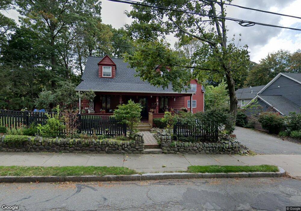
490 Auburn St Auburndale, MA 02466
Auburndale NeighborhoodEstimated Value: $1,208,000 - $1,391,000
4
Beds
3
Baths
3,308
Sq Ft
$401/Sq Ft
Est. Value
About This Home
This home is located at 490 Auburn St, Auburndale, MA 02466 and is currently estimated at $1,327,635, approximately $401 per square foot. 490 Auburn St is a home located in Middlesex County with nearby schools including Williams Elementary School, Charles E Brown Middle School, and Newton South High School.
Ownership History
Date
Name
Owned For
Owner Type
Purchase Details
Closed on
Feb 25, 2015
Sold by
Hogan Robert V and Hogan Jill P
Bought by
Hogan Ft and Hogan Robert V
Current Estimated Value
Purchase Details
Closed on
Apr 20, 2012
Sold by
White Marilyn P
Bought by
Hogan Jill P
Create a Home Valuation Report for This Property
The Home Valuation Report is an in-depth analysis detailing your home's value as well as a comparison with similar homes in the area
Home Values in the Area
Average Home Value in this Area
Purchase History
| Date | Buyer | Sale Price | Title Company |
|---|---|---|---|
| Hogan Ft | -- | -- | |
| Hogan Jill P | -- | -- |
Source: Public Records
Tax History Compared to Growth
Tax History
| Year | Tax Paid | Tax Assessment Tax Assessment Total Assessment is a certain percentage of the fair market value that is determined by local assessors to be the total taxable value of land and additions on the property. | Land | Improvement |
|---|---|---|---|---|
| 2025 | $8,829 | $900,900 | $693,100 | $207,800 |
| 2024 | $8,537 | $874,700 | $672,900 | $201,800 |
| 2023 | $8,123 | $797,900 | $546,500 | $251,400 |
| 2022 | $7,772 | $738,800 | $506,000 | $232,800 |
| 2021 | $7,293 | $677,800 | $464,200 | $213,600 |
| 2020 | $7,076 | $677,800 | $464,200 | $213,600 |
| 2019 | $6,620 | $633,500 | $433,800 | $199,700 |
| 2018 | $4,961 | $618,100 | $410,800 | $207,300 |
| 2017 | $5,053 | $567,100 | $376,900 | $190,200 |
| 2016 | $5,921 | $520,300 | $345,800 | $174,500 |
| 2015 | $5,646 | $486,300 | $323,200 | $163,100 |
Source: Public Records
Map
Nearby Homes
- 2202 Commonwealth Ave Unit 2
- 2202 Commonwealth Ave Unit 1
- 283 Melrose St
- 17 Lasell St
- 27 Oakwood Rd
- 224 Auburn St Unit 224
- 224 Auburn St Unit A
- 226 Auburn St Unit 226
- 62-64 Rowe St Unit B
- 49 Staniford St
- 13 Weir St
- 283 Woodland Rd
- 160 Pine St Unit 12
- 1754 Washington St
- 1639 Washington St
- 17 Crescent St
- 51 Bourne St
- 17 Deforest Rd
- 17 Gilbert St
- 103 Loring Rd
- 496 Auburn St
- 496 Auburn St Unit 496
- 496 Auburn St Unit 498
- 498 Auburn St Unit 498
- 483 Auburn St
- 493 Auburn St Unit B
- 493 Auburn St Unit A
- 493 Auburn St Unit 493B
- 493 Auburn St
- 2 Rockwood Terrace Unit 2
- 2 Rockwood Terrace Unit 18
- 4 Rockwood Terrace
- 2 Rockwood Terrace
- 504 Auburn St
- 504 Auburn St Unit 1
- 497 Auburn St
- 40 Woodbine Terrace
- 12 Johnson Place
- 6 Johnson Place
- 41 Woodbine Terrace