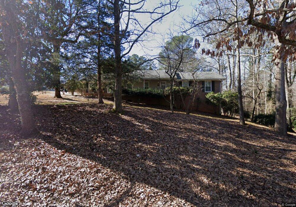
490 Cherokee Ridge Athens, GA 30606
Estimated Value: $301,000 - $335,000
3
Beds
2
Baths
1,626
Sq Ft
$192/Sq Ft
Est. Value
About This Home
This home is located at 490 Cherokee Ridge, Athens, GA 30606 and is currently estimated at $312,720, approximately $192 per square foot. 490 Cherokee Ridge is a home located in Clarke County with nearby schools including Cleveland Road Elementary School, Burney-Harris-Lyons Middle School, and Clarke Central High School.
Ownership History
Date
Name
Owned For
Owner Type
Purchase Details
Closed on
Jan 11, 2013
Sold by
Dixon William Samuel
Bought by
Dixon Joseph Mark
Current Estimated Value
Purchase Details
Closed on
Jun 8, 2007
Sold by
Not Provided
Bought by
Dixon W S and Mark Dixon J
Home Financials for this Owner
Home Financials are based on the most recent Mortgage that was taken out on this home.
Original Mortgage
$104,852
Interest Rate
6.1%
Mortgage Type
New Conventional
Create a Home Valuation Report for This Property
The Home Valuation Report is an in-depth analysis detailing your home's value as well as a comparison with similar homes in the area
Purchase History
| Date | Buyer | Sale Price | Title Company |
|---|---|---|---|
| Dixon Joseph Mark | -- | -- | |
| Dixon W S | $130,000 | -- |
Source: Public Records
Mortgage History
| Date | Status | Borrower | Loan Amount |
|---|---|---|---|
| Previous Owner | Dixon W S | $104,852 |
Source: Public Records
Tax History
| Year | Tax Paid | Tax Assessment Tax Assessment Total Assessment is a certain percentage of the fair market value that is determined by local assessors to be the total taxable value of land and additions on the property. | Land | Improvement |
|---|---|---|---|---|
| 2025 | $1,472 | $99,266 | $12,000 | $87,266 |
| 2024 | $1,472 | $93,895 | $12,000 | $81,895 |
| 2023 | $263 | $86,976 | $12,000 | $74,976 |
| 2022 | $1,434 | $71,497 | $10,400 | $61,097 |
| 2021 | $1,376 | $61,615 | $10,400 | $51,215 |
| 2020 | $1,331 | $58,361 | $10,400 | $47,961 |
| 2019 | $1,279 | $53,779 | $9,600 | $44,179 |
| 2018 | $1,219 | $49,473 | $9,600 | $39,873 |
| 2017 | $0 | $46,342 | $9,600 | $36,742 |
| 2016 | $1,115 | $42,854 | $9,600 | $33,254 |
| 2015 | $1,130 | $43,275 | $9,600 | $33,675 |
| 2014 | $1,139 | $43,426 | $9,600 | $33,826 |
Source: Public Records
Map
Nearby Homes
- 256 Cherokee Ridge
- 212 Huntington Shoals Dr
- 532 Huntington Rd Unit 7
- 470 Huntington Rd Unit 5
- 460 Huntington Rd
- 637 Huntington Rd Unit C2
- 637 Huntington Rd Unit 2
- 637 Huntington Rd Unit B1
- 116 Laurel Springs Dr
- 201 Chesterfield Rd
- 240 W Huntington Rd
- 284 Meeler Cir
- 175 New Haven Dr
- 157 Kittle Ln
- 241 Meeler Cir
- 651 Chesterfield Rd
- 400 Providence Rd
- 575 Vaughn Rd
- 170 Huntington Ct
- 118 Woodhaven Terrace
- 140 Cherokee Ct
- 489 Cherokee Ridge
- 493 Cherokee Ridge
- 500 Cherokee Ridge
- 155 Cherokee Ct
- 150 Cherokee Ct
- 190 Cherokee Ct
- 480 Cherokee Ridge
- 485 Cherokee Ridge
- 499 Cherokee Ridge
- 499 Cherokee Ridge
- 501 Cherokee Ridge
- 483 Cherokee Ridge
- 506 Cherokee Ridge
- 140 Slick Rock Ct
- 130 Slick Rock Ct
- 135 Slick Rock Ct
- 505 Cherokee Ridge
- 479 Cherokee Ridge
- 305 Cherokee Ridge
Your Personal Tour Guide
Ask me questions while you tour the home.