Estimated Value: $291,920 - $363,000
--
Bed
--
Bath
1,769
Sq Ft
$188/Sq Ft
Est. Value
About This Home
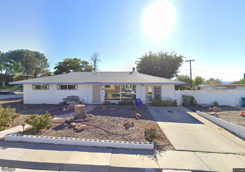
This home is located at 490 Date St, Page, AZ 86040 and is currently estimated at $333,230, approximately $188 per square foot. 490 Date St is a home with nearby schools including Desert View Elementary Intermediate School, Lake View Elementary Primary School, and Page Middle School.
Ownership History
Date
Name
Owned For
Owner Type
Purchase Details
Closed on
Oct 14, 2020
Sold by
Massey Andrea Sauls and Jones Charles Adrian
Bought by
Toohey Leslie and Fullerton Donald
Current Estimated Value
Home Financials for this Owner
Home Financials are based on the most recent Mortgage that was taken out on this home.
Original Mortgage
$238,552
Outstanding Balance
$209,351
Interest Rate
2.8%
Mortgage Type
FHA
Estimated Equity
$123,879
Purchase Details
Closed on
Jan 31, 2008
Sold by
Jones Charles A and Jones Reba S
Bought by
Jones Reba S and Kirby Charles E
Purchase Details
Closed on
Mar 30, 2001
Sold by
Jones Billie
Bought by
Jones Reba S
Create a Home Valuation Report for This Property
The Home Valuation Report is an in-depth analysis detailing your home's value as well as a comparison with similar homes in the area
Home Values in the Area
Average Home Value in this Area
Purchase History
| Date | Buyer | Sale Price | Title Company |
|---|---|---|---|
| Toohey Leslie | -- | Pioneer Title | |
| Jones Reba S | -- | None Available | |
| Jones Reba S | -- | -- |
Source: Public Records
Mortgage History
| Date | Status | Borrower | Loan Amount |
|---|---|---|---|
| Open | Toohey Leslie | $238,552 |
Source: Public Records
Tax History
| Year | Tax Paid | Tax Assessment Tax Assessment Total Assessment is a certain percentage of the fair market value that is determined by local assessors to be the total taxable value of land and additions on the property. | Land | Improvement |
|---|---|---|---|---|
| 2025 | $1,124 | $23,363 | -- | -- |
| 2024 | $1,124 | $25,065 | -- | -- |
| 2023 | $1,525 | $21,767 | $0 | $0 |
| 2022 | $1,003 | $19,753 | $0 | $0 |
| 2021 | $1,171 | $17,115 | $0 | $0 |
| 2020 | $1,171 | $15,942 | $0 | $0 |
| 2019 | $1,246 | $17,423 | $0 | $0 |
| 2018 | $1,237 | $15,908 | $0 | $0 |
| 2017 | $1,178 | $15,214 | $0 | $0 |
| 2016 | $1,107 | $15,743 | $0 | $0 |
| 2015 | $1,198 | $15,826 | $0 | $0 |
Source: Public Records
Map
Nearby Homes
- 425 Cedar St
- 801 Oak St Unit 133
- 801 Oak St Unit 70
- 801 Oak St Unit 62
- 134 Calle Hermosa
- 22 Sunset St Unit 22
- 57 Aero Ave
- 314 Clubhouse Dr Unit 16
- 1531 Rim View Dr
- 8.35 Acres S Parcel Rainbow Dr
- 112 Schoppman Ln Unit 60
- 265 Myrtle Dr
- 451 Ticaboo Canyon Dr Unit 33
- 461 Ticaboo Canyon Dr Unit 34
- 112 Bryce Canyon Dr
- 122 Bryce Canyon Dr
- 132 Bryce Canyon Dr
- 142 Bryce Canyon Dr
- 12 Sumner Cove
- 30 Tek Ct
Your Personal Tour Guide
Ask me questions while you tour the home.