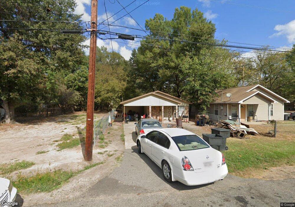
490 E 72nd St Shreveport, LA 71106
Cedar Grove/Lynbrook NeighborhoodEstimated Value: $44,000 - $80,000
3
Beds
1
Bath
1,088
Sq Ft
$52/Sq Ft
Est. Value
About This Home
This home is located at 490 E 72nd St, Shreveport, LA 71106 and is currently estimated at $56,583, approximately $52 per square foot. 490 E 72nd St is a home with nearby schools including Fairfield Magnet School, Atkins Technology Elementary School, and Judson Fundamental Elementary School.
Ownership History
Date
Name
Owned For
Owner Type
Purchase Details
Closed on
Jul 8, 2025
Sold by
Parish Of Caddo
Bought by
Parish Of Caddo
Current Estimated Value
Purchase Details
Closed on
Dec 6, 2012
Sold by
Jemico 1 Llc
Bought by
Ruben Residential Properties Llc
Purchase Details
Closed on
Jun 8, 2007
Sold by
Kingdom Properties Llc
Bought by
Magnolia Grove Rto Tax Sale Properties L
Purchase Details
Closed on
Jun 2, 2006
Sold by
State Of Louisiana
Bought by
Kingdom Properties Llc
Create a Home Valuation Report for This Property
The Home Valuation Report is an in-depth analysis detailing your home's value as well as a comparison with similar homes in the area
Home Values in the Area
Average Home Value in this Area
Purchase History
| Date | Buyer | Sale Price | Title Company |
|---|---|---|---|
| Parish Of Caddo | $619 | None Listed On Document | |
| Ruben Residential Properties Llc | -- | None Available | |
| Magnolia Grove Rto Tax Sale Properties L | $299 | None Available | |
| Kingdom Properties Llc | $301 | None Available |
Source: Public Records
Tax History Compared to Growth
Tax History
| Year | Tax Paid | Tax Assessment Tax Assessment Total Assessment is a certain percentage of the fair market value that is determined by local assessors to be the total taxable value of land and additions on the property. | Land | Improvement |
|---|---|---|---|---|
| 2024 | $288 | $1,845 | $365 | $1,480 |
| 2023 | $291 | $1,828 | $348 | $1,480 |
| 2022 | $291 | $1,828 | $348 | $1,480 |
| 2021 | $287 | $1,828 | $348 | $1,480 |
| 2020 | $287 | $1,828 | $348 | $1,480 |
| 2019 | $295 | $1,827 | $348 | $1,479 |
| 2018 | $235 | $1,827 | $348 | $1,479 |
| 2017 | $300 | $1,827 | $348 | $1,479 |
| 2015 | $211 | $1,630 | $350 | $1,280 |
| 2014 | $213 | $1,630 | $350 | $1,280 |
| 2013 | -- | $1,630 | $350 | $1,280 |
Source: Public Records
Map
Nearby Homes
- 531 E 73rd St
- 567 E 73rd St
- 361 E 70th St
- 636 E 70th St
- 247 E 72nd St
- 7205 Southern Ave
- 6835 Bethany St
- 250 E 68th St
- 913 Bethany St
- 343 Pilatus Dr
- 6446 Birnamwood Rd
- 7000 Creswell Rd Unit 114
- 7000 Creswell Rd Unit 117
- 7000 Creswell Rd Unit 223
- 7000 Creswell Rd Unit 217
- 7000 Creswell Rd Unit 124
- 7000 Creswell Rd Unit 216
- 0 Birnamwood Rd
- 0 Gilbert Place Unit 2 20583892
- 7040 Creswell Rd