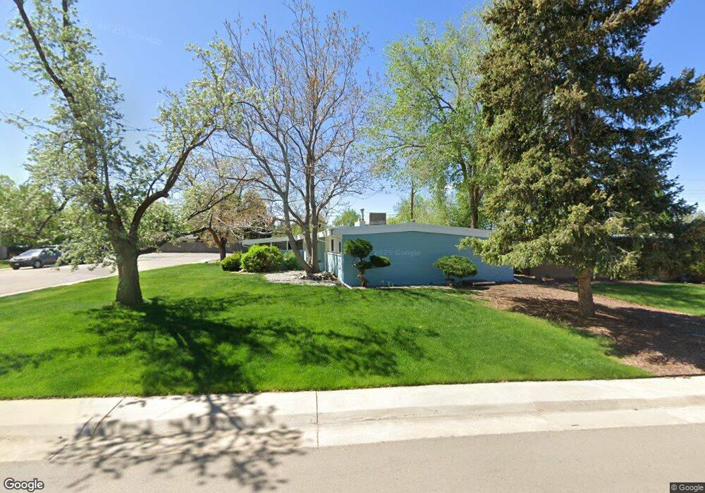
490 E Bellewood Dr Englewood, CO 80113
Bellewood NeighborhoodEstimated Value: $511,579 - $546,000
4
Beds
2
Baths
1,700
Sq Ft
$312/Sq Ft
Est. Value
About This Home
This home is located at 490 E Bellewood Dr, Englewood, CO 80113 and is currently estimated at $530,895, approximately $312 per square foot. 490 E Bellewood Dr is a home located in Arapahoe County with nearby schools including Cherrelyn Elementary School, Englewood Middle School, and Englewood High School.
Ownership History
Date
Name
Owned For
Owner Type
Purchase Details
Closed on
Feb 22, 2016
Sold by
Nguyen Kevin C and Nguyen Ashley M
Bought by
Nguyen Ashley M
Current Estimated Value
Home Financials for this Owner
Home Financials are based on the most recent Mortgage that was taken out on this home.
Original Mortgage
$233,100
Outstanding Balance
$185,642
Interest Rate
3.92%
Mortgage Type
New Conventional
Estimated Equity
$345,253
Purchase Details
Closed on
Nov 15, 2013
Sold by
Donova Mark and Donovan Kimberly
Bought by
Nguyen Kevin C and Taylor Ashley M
Home Financials for this Owner
Home Financials are based on the most recent Mortgage that was taken out on this home.
Original Mortgage
$236,634
Interest Rate
4.75%
Mortgage Type
FHA
Purchase Details
Closed on
Jul 19, 2013
Sold by
Secretary Of Housing & Urban Development
Bought by
Donovan Mark and Donovan Kimberly
Purchase Details
Closed on
Jan 2, 2013
Sold by
Wells Fargo Bank Na
Bought by
Secretary Of Housing & Urban Development
Purchase Details
Closed on
Dec 27, 2012
Sold by
Reyes Louis and Reyes Trina M
Bought by
Wells Fargo Bank Na
Purchase Details
Closed on
Mar 22, 2001
Sold by
Hoff Daniel B and Hoff Kerry M
Bought by
Reyes Louis and Reyes Trina M
Home Financials for this Owner
Home Financials are based on the most recent Mortgage that was taken out on this home.
Original Mortgage
$173,000
Interest Rate
6.98%
Mortgage Type
VA
Purchase Details
Closed on
Jan 29, 1999
Sold by
Derocher David A
Bought by
Hoff Daniel B and Hoff Kerry M
Home Financials for this Owner
Home Financials are based on the most recent Mortgage that was taken out on this home.
Original Mortgage
$134,100
Interest Rate
6.79%
Mortgage Type
FHA
Purchase Details
Closed on
May 31, 1994
Sold by
Sheehan Todd
Bought by
Derocher David A
Purchase Details
Closed on
Jun 1, 1983
Sold by
Conversion Arapco
Bought by
Conversion Arapco
Purchase Details
Closed on
May 1, 1983
Sold by
Conversion Arapco
Bought by
Conversion Arapco
Purchase Details
Closed on
Jun 1, 1981
Sold by
Conversion Arapco
Bought by
Conversion Arapco
Purchase Details
Closed on
Jul 4, 1776
Bought by
Conversion Arapco
Create a Home Valuation Report for This Property
The Home Valuation Report is an in-depth analysis detailing your home's value as well as a comparison with similar homes in the area
Home Values in the Area
Average Home Value in this Area
Purchase History
| Date | Buyer | Sale Price | Title Company |
|---|---|---|---|
| Nguyen Ashley M | -- | Stewart Title Company | |
| Nguyen Kevin C | $241,000 | Homestead Title & Escrow | |
| Donovan Mark | $166,100 | Ats | |
| Secretary Of Housing & Urban Development | -- | None Available | |
| Wells Fargo Bank Na | -- | None Available | |
| Reyes Louis | $173,000 | North American Title Co | |
| Hoff Daniel B | $135,000 | -- | |
| Derocher David A | $90,000 | Security Title Guaranty Co | |
| Conversion Arapco | -- | -- | |
| Conversion Arapco | -- | -- | |
| Conversion Arapco | -- | -- | |
| Conversion Arapco | -- | -- |
Source: Public Records
Mortgage History
| Date | Status | Borrower | Loan Amount |
|---|---|---|---|
| Open | Nguyen Ashley M | $233,100 | |
| Closed | Nguyen Kevin C | $236,634 | |
| Previous Owner | Reyes Louis | $173,000 | |
| Previous Owner | Hoff Daniel B | $134,100 |
Source: Public Records
Tax History Compared to Growth
Tax History
| Year | Tax Paid | Tax Assessment Tax Assessment Total Assessment is a certain percentage of the fair market value that is determined by local assessors to be the total taxable value of land and additions on the property. | Land | Improvement |
|---|---|---|---|---|
| 2024 | $1,979 | $28,133 | -- | -- |
| 2023 | $1,979 | $28,133 | $0 | $0 |
| 2022 | $1,886 | $25,896 | $0 | $0 |
| 2021 | $1,879 | $25,896 | $0 | $0 |
| 2020 | $1,878 | $25,568 | $0 | $0 |
| 2019 | $1,866 | $25,568 | $0 | $0 |
| 2018 | $1,744 | $22,298 | $0 | $0 |
| 2017 | $1,728 | $22,298 | $0 | $0 |
| 2016 | $1,606 | $19,621 | $0 | $0 |
| 2015 | $1,325 | $19,621 | $0 | $0 |
| 2014 | $1,104 | $15,172 | $0 | $0 |
| 2013 | -- | $15,220 | $0 | $0 |
Source: Public Records
Map
Nearby Homes
- 5108 S Pennsylvania St
- 664 S Washington Cir
- 5136 S Pennsylvania St
- 5180 S Logan St
- 5261 S Pennsylvania St
- 5215 S Washington St
- 5145 S Clarkson St
- 5280 S Logan St
- 5291 S Sherman St
- 5370 S Sherman St
- 4822 S Grant St
- 4874 S Lincoln St
- 4794 S Pearl St
- 5471 S Sherman St
- 4720 S Grant St
- 925 E Sunset Ct
- 4703 S Sherman St
- 4680 S Sherman St
- 301 W Lehow Ave Unit 11
- 4728 S Acoma St
- 480 E Bellewood Dr
- 470 E Bellewood Dr
- 590 Pennwood Cir
- 580 Pennwood Cir
- 559 Pennwood Cir
- 5102 S Pennsylvania St
- 570 Pennwood Cir
- 450 E Bellewood Dr
- 5101 S Pearl St
- 485 E Bellewood Dr
- 550 Pennwood Cir
- 475 E Bellewood Dr
- 535 Pennwood Cir
- 5101 S Pennsylvania St
- 675 E Belleview Ave
- 5111 S Pearl St
- 430 E Bellewood Dr
- 536 Pennwood Cir
- 453 E Bellewood Dr
- 5121 S Pennsylvania St