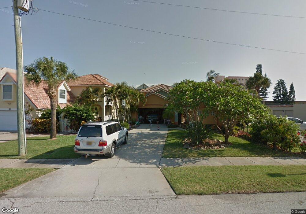
490 Garfield Ave Cocoa Beach, FL 32931
Estimated Value: $826,000 - $1,141,000
4
Beds
4
Baths
3,004
Sq Ft
$341/Sq Ft
Est. Value
About This Home
This home is located at 490 Garfield Ave, Cocoa Beach, FL 32931 and is currently estimated at $1,025,315, approximately $341 per square foot. 490 Garfield Ave is a home located in Brevard County with nearby schools including Cape View Elementary School, Cocoa Beach Junior/Senior High School, and Our Saviour School.
Ownership History
Date
Name
Owned For
Owner Type
Purchase Details
Closed on
Aug 17, 2012
Sold by
Grochowski Brenda D
Bought by
Grochowski Charles S
Current Estimated Value
Purchase Details
Closed on
Jul 21, 2000
Sold by
Hughes John and Hughes Judy
Bought by
Grochowski Charles S and Grochowski Brenda D
Home Financials for this Owner
Home Financials are based on the most recent Mortgage that was taken out on this home.
Original Mortgage
$39,900
Interest Rate
8.3%
Purchase Details
Closed on
Feb 13, 1998
Sold by
Yamasaki Kiyoshi and Yamasaki Camilla
Bought by
Hughes John and Hughes Judy
Create a Home Valuation Report for This Property
The Home Valuation Report is an in-depth analysis detailing your home's value as well as a comparison with similar homes in the area
Home Values in the Area
Average Home Value in this Area
Purchase History
| Date | Buyer | Sale Price | Title Company |
|---|---|---|---|
| Grochowski Charles S | -- | Attorney | |
| Grochowski Charles S | $319,000 | -- | |
| Hughes John | $275,000 | -- |
Source: Public Records
Mortgage History
| Date | Status | Borrower | Loan Amount |
|---|---|---|---|
| Previous Owner | Grochowski Charles S | $39,900 |
Source: Public Records
Tax History Compared to Growth
Tax History
| Year | Tax Paid | Tax Assessment Tax Assessment Total Assessment is a certain percentage of the fair market value that is determined by local assessors to be the total taxable value of land and additions on the property. | Land | Improvement |
|---|---|---|---|---|
| 2025 | $3,629 | $287,200 | -- | -- |
| 2024 | $3,577 | $279,110 | -- | -- |
| 2023 | $3,577 | $270,990 | $0 | $0 |
| 2022 | $3,300 | $259,750 | $0 | $0 |
| 2021 | $3,381 | $252,190 | $0 | $0 |
| 2020 | $3,299 | $248,710 | $0 | $0 |
| 2019 | $3,248 | $243,120 | $0 | $0 |
| 2018 | $3,260 | $238,590 | $0 | $0 |
| 2017 | $3,295 | $233,690 | $0 | $0 |
| 2016 | $3,358 | $228,890 | $138,000 | $90,890 |
| 2015 | $3,460 | $227,300 | $110,000 | $117,300 |
| 2014 | $3,487 | $225,500 | $79,000 | $146,500 |
Source: Public Records
Map
Nearby Homes
- 410 Hayes Ave Unit 203
- 0 E Grant Ave
- 545 Garfield Ave Unit 702
- 223 (Tbd) Johnson Ave
- 314 & 312 Lincoln Ave
- 317 Winslow Cir
- 302 Lincoln Ave Unit 6
- 302 Lincoln Ave Unit 7
- 6409 Ridgewood Ave
- 425 Buchanan Ave Unit 201
- 212 Cleveland Ave Unit 212
- 7101 Ridgewood Ave Unit 102
- 7101 Ridgewood Ave Unit 104
- 110 Lincoln Ave
- 6590 Odyssey St Unit I
- 6500 Falcon Way Unit 19A
- 6500 Falcon Way Unit 19B
- 351 Taylor Ave Unit E5
- 351 Taylor Ave Unit E16
- 504 Fillmore Ave Unit B16
- 470 Garfield Ave
- 450 Garfield Ave
- 407 Hayes Ave
- 405 Hayes Ave
- 403 Hayes Ave
- 409 Hayes Ave
- 411 Hayes Ave Unit 10
- 413 Hayes Ave
- 401 Hayes Ave
- 415 Hayes Ave
- 411 Hayes Ave
- 413 Hayes Ave Unit 413
- 419 Hayes Ave Unit 1
- 430 Garfield Ave
- 550 Garfield Ave Unit 501
- 550 Garfield Ave Unit 202
- 550 Garfield Ave Unit 401
- 550 Garfield Ave Unit 403
- 550 Garfield Ave Unit 204
- 550 Garfield Ave Unit 201