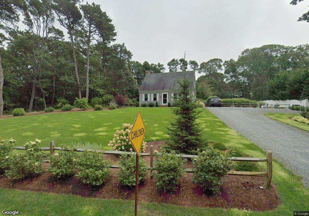
490 Hay Rd Unit 1 Eastham, MA 02642
Estimated Value: $818,000 - $980,000
4
Beds
3
Baths
2,402
Sq Ft
$372/Sq Ft
Est. Value
About This Home
This home is located at 490 Hay Rd Unit 1, Eastham, MA 02642 and is currently estimated at $892,458, approximately $371 per square foot. 490 Hay Rd Unit 1 is a home located in Barnstable County with nearby schools including Eastham Elementary School, Nauset Regional Middle School, and Nauset Regional High School.
Ownership History
Date
Name
Owned For
Owner Type
Purchase Details
Closed on
Oct 19, 2012
Sold by
Vbf Realty Llc
Bought by
Vautrinot Derek and Vautrinot Betty J
Current Estimated Value
Purchase Details
Closed on
Jun 8, 2006
Sold by
Nault Family Nt and Nault
Bought by
Vbf Llc
Home Financials for this Owner
Home Financials are based on the most recent Mortgage that was taken out on this home.
Original Mortgage
$435,000
Interest Rate
6.62%
Mortgage Type
Purchase Money Mortgage
Purchase Details
Closed on
Mar 26, 1991
Sold by
Nault Norman and Nault Denise M
Bought by
Nault Charlottee
Create a Home Valuation Report for This Property
The Home Valuation Report is an in-depth analysis detailing your home's value as well as a comparison with similar homes in the area
Home Values in the Area
Average Home Value in this Area
Purchase History
We collect this data history from publicly available records. To have your information removed, we recommend requesting removal directly through your county’s website.
| Date | Buyer | Sale Price | Title Company |
|---|---|---|---|
| Vautrinot Derek | $350,000 | -- | |
| Vautrinot Derek I | $350,000 | -- | |
| Vautrinot Derek | $350,000 | -- | |
| Vbf Llc | $460,000 | -- | |
| Vbf Llc | $460,000 | -- | |
| Nault Charlottee | $175,000 | -- | |
| Nault Charlottee | $175,000 | -- |
Source: Public Records
Mortgage History
We collect this data history from publicly available records. To have your information removed, we recommend requesting removal directly through your county’s website.
| Date | Status | Borrower | Loan Amount |
|---|---|---|---|
| Previous Owner | Vbf Llc | $435,000 |
Source: Public Records
Tax History
| Year | Tax Paid | Tax Assessment Tax Assessment Total Assessment is a certain percentage of the fair market value that is determined by local assessors to be the total taxable value of land and additions on the property. | Land | Improvement |
|---|---|---|---|---|
| 2025 | $5,486 | $711,500 | $293,800 | $417,700 |
| 2024 | $4,854 | $692,400 | $285,200 | $407,200 |
| 2023 | $4,513 | $623,300 | $264,100 | $359,200 |
| 2022 | $4,307 | $502,000 | $235,800 | $266,200 |
| 2021 | $4,143 | $451,300 | $214,300 | $237,000 |
| 2020 | $3,856 | $442,200 | $218,700 | $223,500 |
| 2019 | $3,255 | $394,500 | $212,400 | $182,100 |
| 2018 | $3,221 | $385,700 | $206,200 | $179,500 |
| 2017 | $3,006 | $380,500 | $202,100 | $178,400 |
| 2016 | $2,826 | $379,800 | $202,100 | $177,700 |
| 2015 | $2,650 | $373,200 | $198,200 | $175,000 |
Source: Public Records
Map
Nearby Homes
- 40 Uncle Nate's Way
- 12 Settlers Trace
- 20 Stone Ct
- 1061 State Hwy Unit 4
- 1061 State Hwy Unit 1061
- 1975 State Hwy Unit 1
- 1975 State Hwy Unit 9
- 60 Smith Heights Way
- 25 Twin Rocks Dr
- 785 State Hwy Unit 9
- 250 Mary Chase Rd
- 2255 State Hwy
- 20 Kittiwake Ln
- 704 State Hwy
- 163 Samoset Rd
- 655 Herring Brook Rd
- 46 Freeman Ln
- 10 Cartway N
- 10 Polly Seabury Way
- 20 Priscilla Cir
- 435 Governor Prence Rd
- 455 Governor Prence Rd
- 475 Governor Prence Rd
- 490 Hay Rd
- 440 Governor Prence Rd
- 395 Governor Prence Rd
- 400 Governor Prence Rd
- 385 Governor Prence Rd
- 540 Hay Rd
- 450 Hay Rd
- 360 Governor Prence Rd
- 225 Hay Rd
- 0 Hay Rd Unit 5 6022182
- 0 Hay Rd Unit C 7028036
- 0 Hay Rd Unit 9
- 350 Governor Prence Rd
- 380 Governor Prence Rd
- 355 Governor Prence Rd
- 440 Hay Rd
- 505 Hay Rd
Your Personal Tour Guide
Ask me questions while you tour the home.