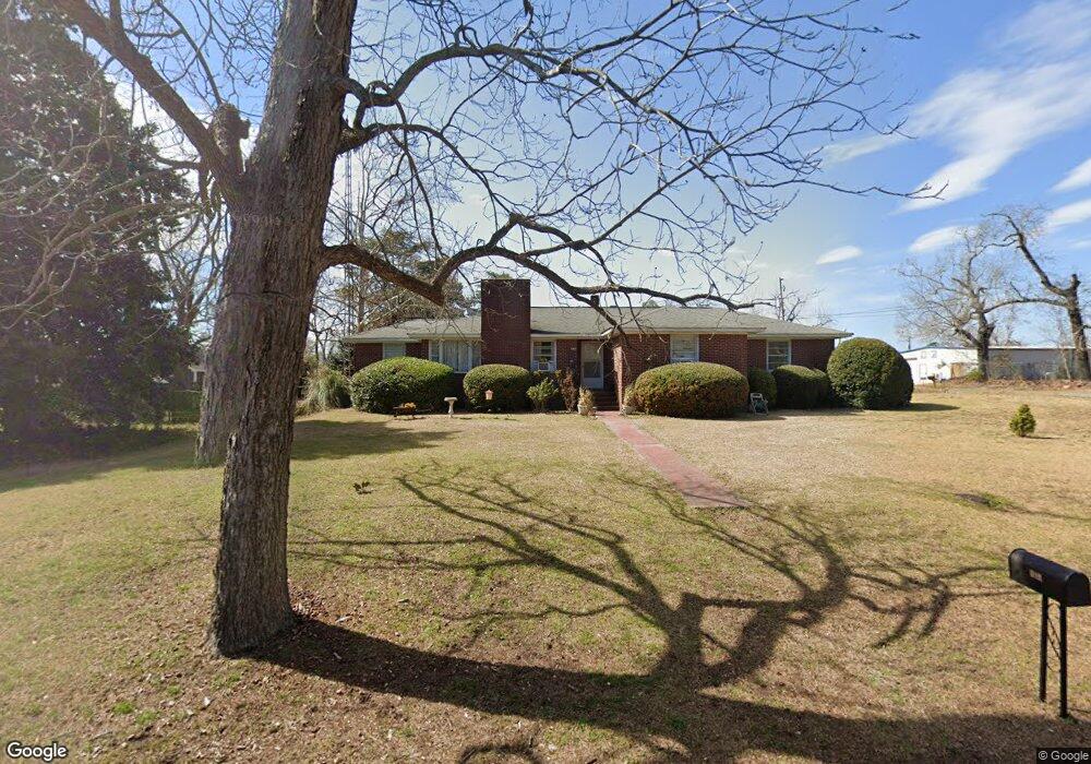
490 N Bartow Ave Swansea, SC 29160
Estimated Value: $205,000 - $259,000
4
Beds
2
Baths
2,120
Sq Ft
$107/Sq Ft
Est. Value
About This Home
This home is located at 490 N Bartow Ave, Swansea, SC 29160 and is currently estimated at $227,578, approximately $107 per square foot. 490 N Bartow Ave is a home located in Lexington County with nearby schools including Sandhills Primary School, Sandhills Elementary School, and Swansea High Freshman Academy.
Ownership History
Date
Name
Owned For
Owner Type
Purchase Details
Closed on
Dec 21, 2018
Sold by
Glazer Ann Marie
Bought by
Leonard Ricky C and Leonard Ginger L
Current Estimated Value
Home Financials for this Owner
Home Financials are based on the most recent Mortgage that was taken out on this home.
Original Mortgage
$108,279
Outstanding Balance
$95,204
Interest Rate
4.7%
Mortgage Type
VA
Estimated Equity
$132,374
Purchase Details
Closed on
Aug 9, 2017
Sold by
Smith Sidney L
Bought by
Glazer Ann Marie
Create a Home Valuation Report for This Property
The Home Valuation Report is an in-depth analysis detailing your home's value as well as a comparison with similar homes in the area
Home Values in the Area
Average Home Value in this Area
Purchase History
| Date | Buyer | Sale Price | Title Company |
|---|---|---|---|
| Leonard Ricky C | $106,000 | None Available | |
| Glazer Ann Marie | -- | None Available |
Source: Public Records
Mortgage History
| Date | Status | Borrower | Loan Amount |
|---|---|---|---|
| Open | Leonard Ricky C | $108,279 |
Source: Public Records
Tax History Compared to Growth
Tax History
| Year | Tax Paid | Tax Assessment Tax Assessment Total Assessment is a certain percentage of the fair market value that is determined by local assessors to be the total taxable value of land and additions on the property. | Land | Improvement |
|---|---|---|---|---|
| 2024 | $843 | $3,960 | $200 | $3,760 |
| 2023 | $843 | $3,960 | $200 | $3,760 |
| 2022 | $867 | $3,960 | $200 | $3,760 |
| 2020 | $810 | $3,960 | $200 | $3,760 |
| 2019 | $879 | $4,240 | $480 | $3,760 |
| 2018 | $1,922 | $3,383 | $720 | $2,663 |
| 2017 | $0 | $2,255 | $480 | $1,775 |
| 2016 | -- | $2,255 | $480 | $1,775 |
| 2014 | -- | $2,637 | $480 | $2,157 |
| 2013 | -- | $2,640 | $480 | $2,160 |
Source: Public Records
Map
Nearby Homes
- 200 N Lawrence Ave
- 0 Faith Church Rd
- 546 Huckabee Mill Rd
- 1934 Southbound Rd
- Tract 4 6th St
- 1740 Southbound Rd
- 128 Graceland Ct
- 1029 Savannah Hwy
- 274 Swansea Rd
- 808 Highway 6 Hwy
- 284 Swansea Rd
- TBD Swansea Rd Unit tract a
- TBD Swansea Rd Unit Tract b
- 219 Woodland Dr
- 1040 Cassidy Rd
- TBD Horses Neck Road Lot 2 Rd
- 518 Whetstone Rd
- 545 Basil Rd
- 165 Indian Valley Ln
- 450 Sweet Pea Ln
- 495 N Church St
- 400 N Bartow Ave
- 495 N Bartow Ave
- 465 N Bartow Ave
- 405 N Church St
- 405 N Bartow Ave
- 190 E Craft St
- 490 N Lawrence Ave
- 490 N Church St
- 395 N Church St
- 409 Huckabee Mill Rd
- 395 N Bartow Ave
- 500 N Church St
- 355 N Bartow Ave
- 390 N Lawrence Ave
- 197 W Street Paul St
- 197 W Saint Paul St
- 190 W Craft St
- 415 N Lawrence Ave
- 411 N Lawrence Ave