
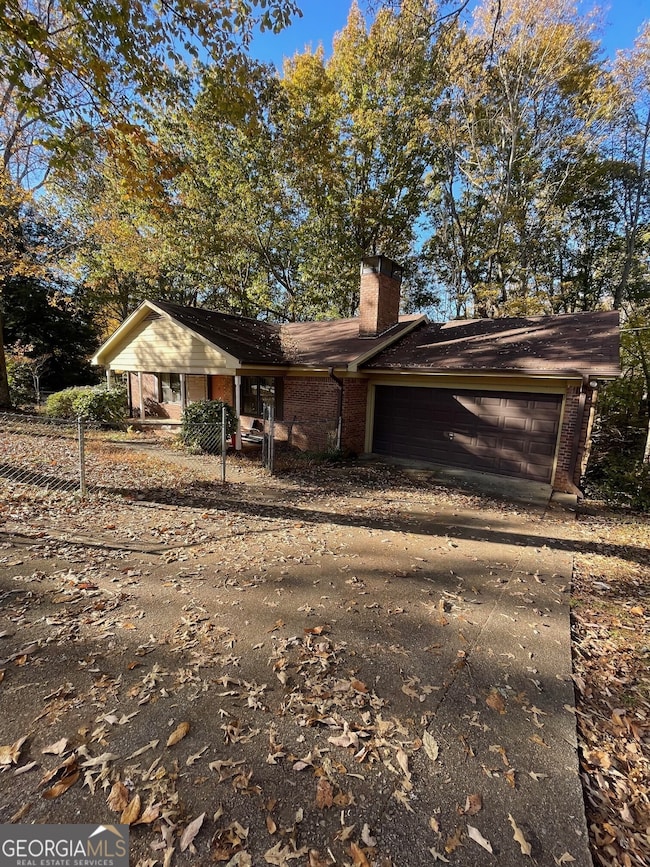
490 N Hall Rd Dahlonega, GA 30533
Estimated payment $2,320/month
Highlights
- Ranch Style House
- Corner Lot
- L-Shaped Dining Room
- Wood Flooring
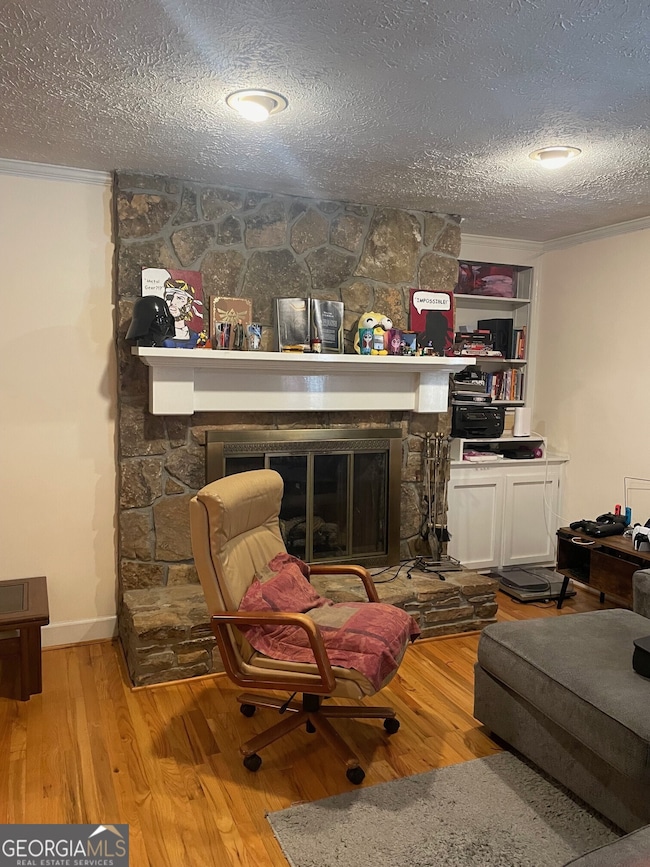
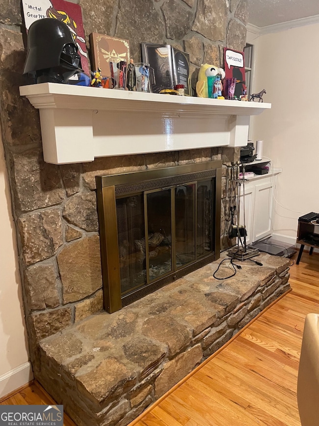
- Great Room
- No HOA
About This Home
Rare opportunity to buy this 4 sided brick Ranch home that is close to downtown Dahlonega. 4 bedroom 3 full bath on a full basement, fireplace, 2 sets of washer/dryer's 2 screened in porches, 2 car garage and also a one car drive under garage. Total electric with central heat and air. This property is being sold "As Is" and would make a great investment property with tenants that are already in place.
Home Details
Home Type
- Single Family
Est. Annual Taxes
- $3,497
Year Built
- Built in 1979
Lot Details
- 0.89 Acre Lot
- Fenced Front Yard
- Chain Link Fence
- Corner Lot
Home Design
- Ranch Style House
- Composition Roof
- Four Sided Brick Exterior Elevation
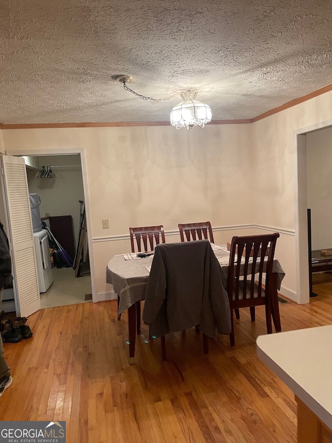
Interior Spaces
- Roommate Plan
- Bookcases
- Factory Built Fireplace
- Gas Log Fireplace
- Family Room with Fireplace
- Great Room
- L-Shaped Dining Room
- Screened Porch
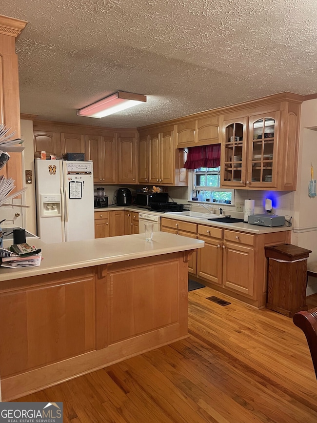
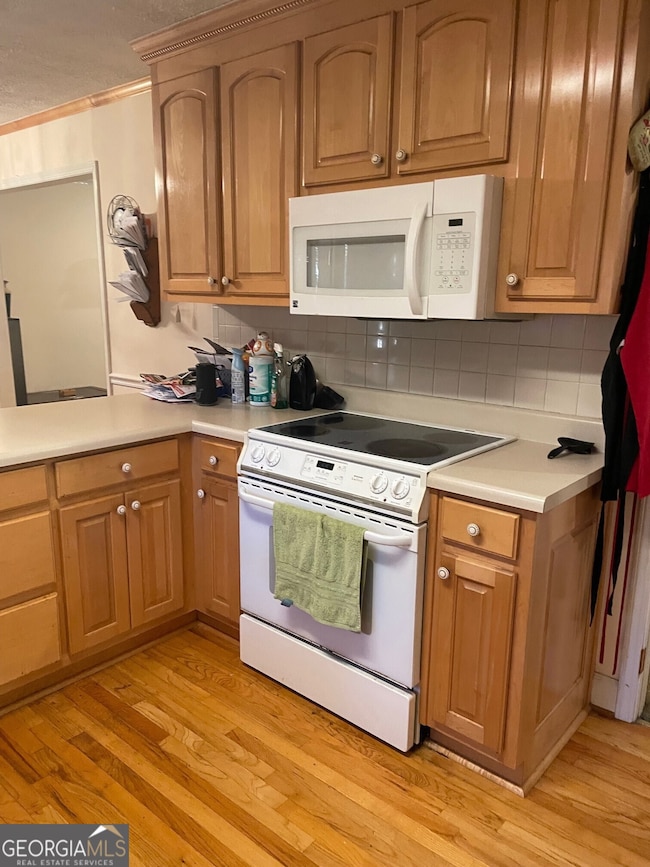
Kitchen
- Oven or Range
- Dishwasher
Flooring
- Wood
- Carpet
- Vinyl
Bedrooms and Bathrooms
- 4 Bedrooms | 3 Main Level Bedrooms
- Walk-In Closet
Laundry
- Laundry in Hall
- Dryer
- Washer
Finished Basement
- Basement Fills Entire Space Under The House
- Exterior Basement Entry
- Finished Basement Bathroom
- Laundry in Basement
- Natural lighting in basement
Parking
- 2 Car Garage
- Parking Pad
Schools
- Cottrell Elementary School
- Lumpkin County Middle School
- New Lumpkin County High School
Utilities
- Central Heating and Cooling System
- Septic Tank
- High Speed Internet
- Phone Available
Community Details
- No Home Owners Association
Listing and Financial Details
- Tax Lot 856
Map
Home Values in the Area
Average Home Value in this Area
Tax History
| Year | Tax Paid | Tax Assessment Tax Assessment Total Assessment is a certain percentage of the fair market value that is determined by local assessors to be the total taxable value of land and additions on the property. | Land | Improvement |
|---|---|---|---|---|
| 2024 | $3,497 | $122,268 | $18,578 | $103,690 |
| 2023 | $3,323 | $115,286 | $18,578 | $96,708 |
| 2022 | $3,147 | $103,030 | $18,578 | $84,452 |
| 2021 | $2,898 | $88,841 | $18,578 | $70,263 |
| 2020 | $2,944 | $86,872 | $18,578 | $68,294 |
| 2019 | $2,959 | $86,872 | $18,578 | $68,294 |
| 2018 | $2,852 | $78,360 | $18,578 | $59,782 |
| 2017 | $2,795 | $75,507 | $18,578 | $56,929 |
| 2016 | $2,667 | $70,502 | $18,578 | $51,924 |
| 2015 | $87 | $70,502 | $18,578 | $51,924 |
| 2014 | $87 | $71,127 | $18,578 | $52,549 |
| 2013 | -- | $71,752 | $18,578 | $53,174 |
Property History
| Date | Event | Price | List to Sale | Price per Sq Ft |
|---|---|---|---|---|
| 11/11/2025 11/11/25 | Pending | -- | -- | -- |
| 11/04/2025 11/04/25 | For Sale | $385,000 | -- | $151 / Sq Ft |
Purchase History
| Date | Type | Sale Price | Title Company |
|---|---|---|---|
| Quit Claim Deed | $324,864 | -- | |
| Deed | -- | -- | |
| Deed | $177,500 | -- | |
| Deed | -- | -- | |
| Deed | -- | -- |
Source: Georgia MLS
MLS Number: 10637596
APN: D02-000-007-000
Disclaimer: Certain information contained herein is derived from information provided by parties other than Homes.com. All information provided is deemed reliable, but is not guaranteed to be accurate and should be independently verified.
![]() The data relating to real estate for sale on this web site comes in part from the Broker Reciprocity Program of Georgia MLS. Real estate listings held by brokerage firms other than Redfin are marked with the Broker Reciprocity logo and detailed information about them includes the name of the listing brokers. Information deemed reliable but not guaranteed. Copyright 2025 Georgia MLS. All rights reserved.
The data relating to real estate for sale on this web site comes in part from the Broker Reciprocity Program of Georgia MLS. Real estate listings held by brokerage firms other than Redfin are marked with the Broker Reciprocity logo and detailed information about them includes the name of the listing brokers. Information deemed reliable but not guaranteed. Copyright 2025 Georgia MLS. All rights reserved.
- 253 Blair Ridge Rd
- 120 Blair Ridge Rd
- 399 N Chestatee St
- 121 Blair Ridge Rd
- 94 Mountain View Dr
- 0 Dawsonville Hwy Unit 10631159
- 00 Dawsonville Hwy
- 10 Rustin Ridge
- 315 Church St
- 95 Jones St
- 549 Ivy Terrace
- 132 J Mountain Dr
- 168 W Main St
- 22 Honeysuckle Ln
- 0 S Chestatee St Unit 10619536
- 97 Beaumont Dr
- 0 Highway 19 N Unit 10594984
- 502 Wimpy Mill Rd
- 1202 Oak Grove Rd
