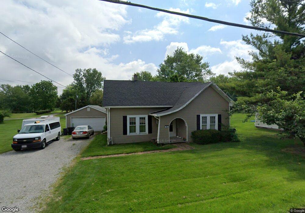
490 N State Route 72 Reesville, OH 45166
Estimated Value: $164,005 - $181,000
2
Beds
1
Bath
1,152
Sq Ft
$152/Sq Ft
Est. Value
About This Home
This home is located at 490 N State Route 72, Reesville, OH 45166 and is currently estimated at $175,002, approximately $151 per square foot. 490 N State Route 72 is a home located in Clinton County with nearby schools including East Clinton High School.
Ownership History
Date
Name
Owned For
Owner Type
Purchase Details
Closed on
Jun 30, 2014
Sold by
Romohr Cody A
Bought by
Hammon Craig A and Hammon Amanda B
Current Estimated Value
Home Financials for this Owner
Home Financials are based on the most recent Mortgage that was taken out on this home.
Original Mortgage
$76,587
Outstanding Balance
$57,696
Interest Rate
3.87%
Mortgage Type
FHA
Estimated Equity
$117,306
Purchase Details
Closed on
Nov 30, 1998
Sold by
Quimby Kipp
Bought by
Quimby Kipp A
Purchase Details
Closed on
Jan 1, 1990
Bought by
Quimby Kipp
Create a Home Valuation Report for This Property
The Home Valuation Report is an in-depth analysis detailing your home's value as well as a comparison with similar homes in the area
Home Values in the Area
Average Home Value in this Area
Purchase History
| Date | Buyer | Sale Price | Title Company |
|---|---|---|---|
| Hammon Craig A | $78,000 | Attorney | |
| Quimby Kipp A | -- | -- | |
| Quimby Kipp | -- | -- |
Source: Public Records
Mortgage History
| Date | Status | Borrower | Loan Amount |
|---|---|---|---|
| Open | Hammon Craig A | $76,587 |
Source: Public Records
Tax History Compared to Growth
Tax History
| Year | Tax Paid | Tax Assessment Tax Assessment Total Assessment is a certain percentage of the fair market value that is determined by local assessors to be the total taxable value of land and additions on the property. | Land | Improvement |
|---|---|---|---|---|
| 2024 | $1,549 | $40,120 | $4,170 | $35,950 |
| 2023 | $1,549 | $40,120 | $4,170 | $35,950 |
| 2022 | $1,274 | $28,050 | $3,340 | $24,710 |
| 2021 | $1,285 | $28,050 | $3,340 | $24,710 |
| 2020 | $1,289 | $28,050 | $3,340 | $24,710 |
| 2019 | $1,052 | $22,270 | $3,340 | $18,930 |
| 2018 | $918 | $22,270 | $3,340 | $18,930 |
| 2017 | $367 | $22,270 | $3,340 | $18,930 |
| 2016 | $823 | $25,140 | $3,510 | $21,630 |
| 2015 | $838 | $25,140 | $3,510 | $21,630 |
| 2013 | $869 | $25,140 | $3,510 | $21,630 |
Source: Public Records
Map
Nearby Homes
- 32 Weller St
- 719 Reed Rd
- 585 Florence Ave
- 1393 S State Route 72
- 400 Grand Ave
- 62 Union St
- 612 Darbyshire Rd
- 323 W Mound St
- 285 S Howard St
- 241 Roshon Ave
- 591 Burnett Rd
- 653 Burnett Rd
- 320 San Mar Gale Dr
- 729 N State Route 729
- 350 Dakin Chapel Rd
- 2762 Reed Rd
- 42 Trahera Ln
- 154 Eden Ave
- 94 Eden Ave
- 3445 St Rt 72