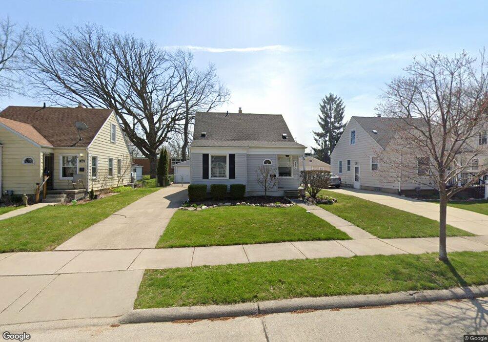
490 Roth Blvd Unit Bldg-Unit Clawson, MI 48017
Estimated Value: $323,000 - $361,000
3
Beds
2
Baths
919
Sq Ft
$373/Sq Ft
Est. Value
About This Home
This home is located at 490 Roth Blvd Unit Bldg-Unit, Clawson, MI 48017 and is currently estimated at $342,504, approximately $372 per square foot. 490 Roth Blvd Unit Bldg-Unit is a home located in Oakland County with nearby schools including Clawson Middle School, Clawson High School, and Guardian Angels School.
Ownership History
Date
Name
Owned For
Owner Type
Purchase Details
Closed on
Feb 5, 2025
Sold by
Stevanovic Sabrina and Simonis Garrett
Bought by
Burke Ryan and Marzetti Stephanie
Current Estimated Value
Home Financials for this Owner
Home Financials are based on the most recent Mortgage that was taken out on this home.
Original Mortgage
$305,100
Outstanding Balance
$302,487
Interest Rate
6.91%
Mortgage Type
New Conventional
Estimated Equity
$40,017
Purchase Details
Closed on
Jun 15, 2018
Sold by
Dorris Brandon J
Bought by
Simonis Garrett and Stevanovic Sabrina
Purchase Details
Closed on
Dec 8, 2011
Sold by
Vesper Randy D and Vesper Mary L
Bought by
Dorris Brandon J
Purchase Details
Closed on
Jul 22, 2002
Sold by
Vesper Randy D
Bought by
Vesper Randy D
Create a Home Valuation Report for This Property
The Home Valuation Report is an in-depth analysis detailing your home's value as well as a comparison with similar homes in the area
Home Values in the Area
Average Home Value in this Area
Purchase History
| Date | Buyer | Sale Price | Title Company |
|---|---|---|---|
| Burke Ryan | $339,000 | None Listed On Document | |
| Burke Ryan | $339,000 | None Listed On Document | |
| Simonis Garrett | $225,000 | Estates Title Agency | |
| Dorris Brandon J | $100,000 | Interstate Title Inc | |
| Vesper Randy D | -- | -- |
Source: Public Records
Mortgage History
| Date | Status | Borrower | Loan Amount |
|---|---|---|---|
| Open | Burke Ryan | $305,100 | |
| Closed | Burke Ryan | $305,100 |
Source: Public Records
Tax History
| Year | Tax Paid | Tax Assessment Tax Assessment Total Assessment is a certain percentage of the fair market value that is determined by local assessors to be the total taxable value of land and additions on the property. | Land | Improvement |
|---|---|---|---|---|
| 2025 | $4,564 | $120,750 | $0 | $0 |
| 2024 | $4,361 | $115,370 | $0 | $0 |
| 2023 | $4,181 | $105,560 | $0 | $0 |
| 2022 | $4,214 | $95,370 | $0 | $0 |
| 2021 | $4,128 | $89,140 | $0 | $0 |
| 2020 | $3,999 | $85,940 | $0 | $0 |
| 2019 | $4,133 | $81,780 | $0 | $0 |
| 2018 | $2,125 | $65,300 | $0 | $0 |
| 2017 | $2,112 | $61,370 | $0 | $0 |
| 2016 | $2,146 | $57,230 | $0 | $0 |
| 2015 | -- | $52,450 | $0 | $0 |
| 2014 | -- | $45,340 | $0 | $0 |
| 2011 | -- | $41,290 | $0 | $0 |
Source: Public Records
Map
Nearby Homes
- 550 Roth Blvd
- 917 Kenwood St
- 911 Kenwood St
- 909 Kenwood St
- 918 Kenwood St
- 45 E Tacoma St
- 101 Jefferson Ave
- 1121 Ottawa Ave
- 1101 Donald Ave
- 625 Whitcomb Ave
- 135 Gerald Ave
- 124 Leroy Ave
- 125 Tecumseh St
- 602 Millard Ave
- 609 John M Ave
- 138 Chopin St
- 1526 Donald Ave
- 1606 Donald Ave
- 1217 Millard Ave
- 0000 Westwood Dr
Your Personal Tour Guide
Ask me questions while you tour the home.