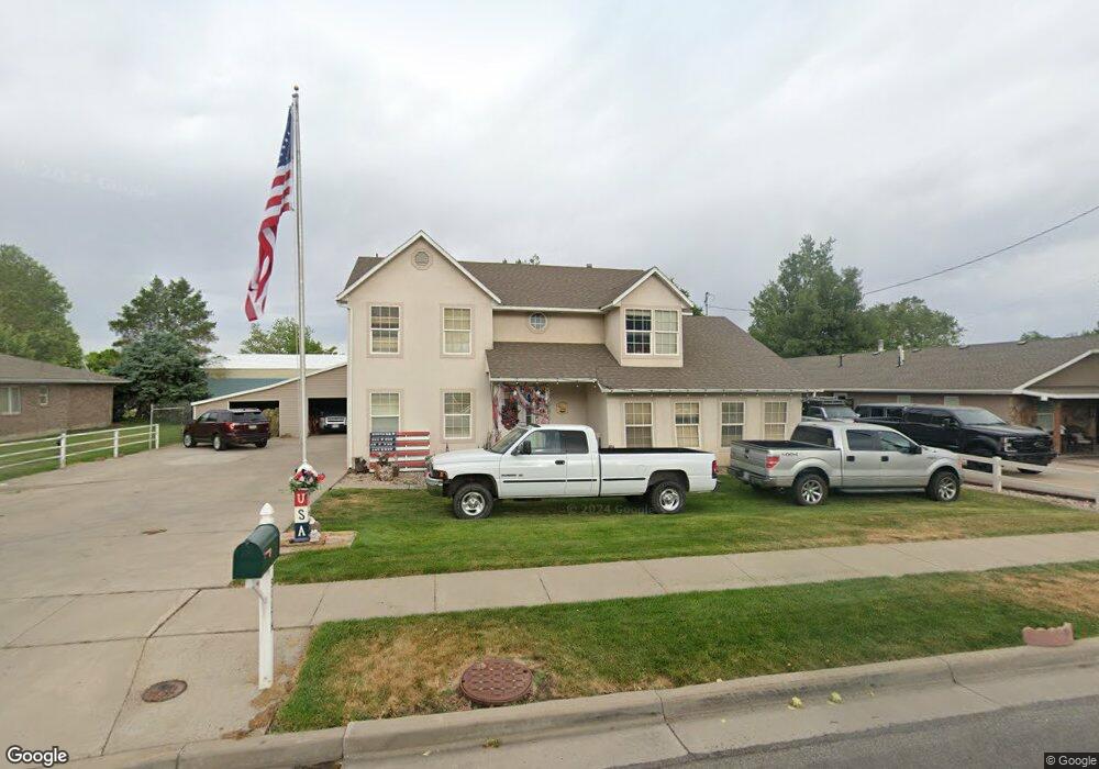
490 S 400 W Centerville, UT 84014
Estimated Value: $695,000 - $813,000
4
Beds
3
Baths
2,900
Sq Ft
$253/Sq Ft
Est. Value
About This Home
This home is located at 490 S 400 W, Centerville, UT 84014 and is currently estimated at $734,782, approximately $253 per square foot. 490 S 400 W is a home located in Davis County with nearby schools including J A Taylor Elementary School, Centerville Jr High, and Viewmont High School.
Ownership History
Date
Name
Owned For
Owner Type
Purchase Details
Closed on
Feb 2, 2021
Sold by
Hooper Valarie J
Bought by
Hooper Valarie J and Hadley Kimberlee
Current Estimated Value
Purchase Details
Closed on
May 18, 1999
Sold by
Powers Valarie
Bought by
Hooper Lynn L and Hooper Valerie
Purchase Details
Closed on
Apr 3, 1997
Sold by
Satterfield Todd A
Bought by
Powers Valarie
Home Financials for this Owner
Home Financials are based on the most recent Mortgage that was taken out on this home.
Original Mortgage
$95,000
Interest Rate
7.56%
Create a Home Valuation Report for This Property
The Home Valuation Report is an in-depth analysis detailing your home's value as well as a comparison with similar homes in the area
Purchase History
| Date | Buyer | Sale Price | Title Company |
|---|---|---|---|
| Hooper Valarie J | -- | Title Guarantee | |
| Hooper Lynn L | -- | Associated Title Company | |
| Powers Valarie | -- | Backman Stewart Title Servic |
Source: Public Records
Mortgage History
| Date | Status | Borrower | Loan Amount |
|---|---|---|---|
| Previous Owner | Powers Valarie | $95,000 |
Source: Public Records
Tax History
| Year | Tax Paid | Tax Assessment Tax Assessment Total Assessment is a certain percentage of the fair market value that is determined by local assessors to be the total taxable value of land and additions on the property. | Land | Improvement |
|---|---|---|---|---|
| 2025 | $459 | $309,100 | $200,455 | $108,645 |
| 2024 | $389 | $299,749 | $190,227 | $109,522 |
| 2023 | $2,987 | $288,750 | $164,323 | $124,426 |
| 2022 | $3,131 | $551,000 | $279,149 | $271,851 |
| 2021 | $2,668 | $441,000 | $249,825 | $191,175 |
| 2020 | $2,607 | $393,000 | $236,062 | $156,938 |
| 2019 | $2,710 | $399,000 | $211,668 | $187,332 |
| 2018 | $2,502 | $364,000 | $195,114 | $168,886 |
| 2016 | $2,236 | $180,785 | $71,288 | $109,497 |
| 2015 | $2,136 | $162,910 | $71,288 | $91,622 |
| 2014 | $2,024 | $157,965 | $71,288 | $86,677 |
| 2013 | -- | $171,258 | $53,597 | $117,661 |
Source: Public Records
Map
Nearby Homes
- 330 W Paradiso Ln
- 324 S 600 W
- 204 Lyman Ln
- 287 S 680 W Unit 9
- 328 W Pages Ln
- 88 W 50 S Unit A4
- 88 W 50 S Unit C-3
- 88 W 50 S Unit B5
- 83 W 850 S
- 951 Centerville Commons Way
- 147 N 360 W Unit 21
- 96 Village Square Rd
- 1767 N 600 W
- 1520 N 550 W
- 967 S Courtyard Ln
- 56 W 200 N
- 235 W 1400 N
- 345 E 600 S
- 1260 N 200 W
- 1420 N Main St
Your Personal Tour Guide
Ask me questions while you tour the home.