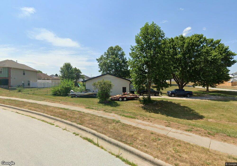
490 S Kansas Ave Republic, MO 65738
Estimated Value: $311,000 - $348,000
4
Beds
2
Baths
2,839
Sq Ft
$117/Sq Ft
Est. Value
About This Home
This home is located at 490 S Kansas Ave, Republic, MO 65738 and is currently estimated at $332,407, approximately $117 per square foot. 490 S Kansas Ave is a home located in Greene County with nearby schools including Lyon Elementary School, Republic Middle School, and Republic High School.
Ownership History
Date
Name
Owned For
Owner Type
Purchase Details
Closed on
Jun 22, 2021
Sold by
Allen & Allen Investments Llc
Bought by
Hagewood Kyle S and Hagewood Ashley D
Current Estimated Value
Home Financials for this Owner
Home Financials are based on the most recent Mortgage that was taken out on this home.
Original Mortgage
$260,000
Outstanding Balance
$235,398
Interest Rate
2.9%
Mortgage Type
VA
Estimated Equity
$97,009
Purchase Details
Closed on
Feb 20, 2007
Sold by
Corner Kevin L and Corner Kerri K
Bought by
Marf Rentals Llc
Home Financials for this Owner
Home Financials are based on the most recent Mortgage that was taken out on this home.
Original Mortgage
$96,300
Interest Rate
6.25%
Mortgage Type
Future Advance Clause Open End Mortgage
Create a Home Valuation Report for This Property
The Home Valuation Report is an in-depth analysis detailing your home's value as well as a comparison with similar homes in the area
Home Values in the Area
Average Home Value in this Area
Purchase History
| Date | Buyer | Sale Price | Title Company |
|---|---|---|---|
| Hagewood Kyle S | -- | None Available | |
| Hagewood Kyle S | -- | None Listed On Document | |
| Marf Rentals Llc | -- | Lincoln Evans Land Title Co |
Source: Public Records
Mortgage History
| Date | Status | Borrower | Loan Amount |
|---|---|---|---|
| Open | Hagewood Kyle S | $260,000 | |
| Closed | Hagewood Kyle S | $260,000 | |
| Previous Owner | Marf Rentals Llc | $96,300 |
Source: Public Records
Tax History Compared to Growth
Tax History
| Year | Tax Paid | Tax Assessment Tax Assessment Total Assessment is a certain percentage of the fair market value that is determined by local assessors to be the total taxable value of land and additions on the property. | Land | Improvement |
|---|---|---|---|---|
| 2025 | $2,488 | $49,550 | $6,650 | $42,900 |
| 2024 | $2,488 | $44,540 | $5,700 | $38,840 |
| 2023 | $2,441 | $44,540 | $5,700 | $38,840 |
| 2022 | $1,113 | $20,220 | $5,700 | $14,520 |
| 2021 | $1,107 | $20,220 | $5,700 | $14,520 |
| 2020 | $1,071 | $19,270 | $5,700 | $13,570 |
| 2019 | $1,068 | $19,270 | $5,700 | $13,570 |
| 2018 | $1,150 | $20,060 | $5,700 | $14,360 |
| 2017 | $1,141 | $19,270 | $5,700 | $13,570 |
| 2016 | $1,108 | $19,270 | $5,700 | $13,570 |
| 2015 | $1,104 | $19,270 | $5,700 | $13,570 |
| 2014 | $1,078 | $18,660 | $5,700 | $12,960 |
Source: Public Records
Map
Nearby Homes
- 573 S Charlotte Ct
- 552 S Michelle Ave
- 1135 W Broad St
- 000 W Crestview Ln
- 1021 W Crestview Ln
- 2450 Highway 60
- 401 Ethan Ave
- .94+/- Ac Highway 60
- 530 Ashley St
- 5751 S Farm Road 67
- 0 Highway 60 Unit 60308100
- 0 Highway 60 Unit 60308095
- 135 N Bonnie Ave
- 347 W Elm St
- 1205 S Kristopher Ave
- 207 W Broad St
- 473 W Melody Ln
- 730 W Apache St
- 1382 S Kristopher Ave
- 113 W Jewell Dr
- 954 W Stanton Dr
- Lot 2 N Charlotte Ct
- 516 W Charlotte Ct
- 516 S Charlotte Ct
- 979 W Stanton Dr
- 510 S Kansas Ave
- Lot 3 N Charlotte Ct
- 945 W Stanton Dr
- 481 S Ashton Ave
- 503 S Ashton Ave
- 414 S Michelle Ave
- 525 S Ashton Ave
- 544 S Charlotte Ct Unit 3 Court
- 931 W Stanton Dr
- 986 W Broad St
- 549 S Charlotte Ct
- 998 W Broad St
- 537 S Ashton Ave
- 0 W Stanton Dr Unit 11103790
- 0 W Stanton Dr Unit 11110522