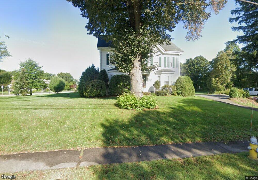
490 South St Wrentham, MA 02093
Estimated Value: $671,000 - $796,000
4
Beds
3
Baths
3,172
Sq Ft
$231/Sq Ft
Est. Value
About This Home
This home is located at 490 South St, Wrentham, MA 02093 and is currently estimated at $733,500, approximately $231 per square foot. 490 South St is a home located in Norfolk County with nearby schools including Delaney Elementary School and Charles E Roderick.
Ownership History
Date
Name
Owned For
Owner Type
Purchase Details
Closed on
Jan 10, 2019
Sold by
Bowmar Rt
Bought by
Montanaro Properties Nt
Current Estimated Value
Purchase Details
Closed on
Oct 29, 2015
Sold by
Bowmar Estates Llc
Bought by
Bowmar Rt
Purchase Details
Closed on
Feb 4, 2005
Sold by
Montanaro M Maya and Montanaro William J
Bought by
Bowmar Ests Llc
Home Financials for this Owner
Home Financials are based on the most recent Mortgage that was taken out on this home.
Original Mortgage
$2,350,000
Interest Rate
5.77%
Mortgage Type
Purchase Money Mortgage
Create a Home Valuation Report for This Property
The Home Valuation Report is an in-depth analysis detailing your home's value as well as a comparison with similar homes in the area
Home Values in the Area
Average Home Value in this Area
Purchase History
| Date | Buyer | Sale Price | Title Company |
|---|---|---|---|
| Montanaro Properties Nt | -- | None Available | |
| Bowmar Rt | -- | -- | |
| Bowmar Ests Llc | -- | -- |
Source: Public Records
Mortgage History
| Date | Status | Borrower | Loan Amount |
|---|---|---|---|
| Previous Owner | Bowmar Ests Llc | $2,350,000 |
Source: Public Records
Tax History Compared to Growth
Tax History
| Year | Tax Paid | Tax Assessment Tax Assessment Total Assessment is a certain percentage of the fair market value that is determined by local assessors to be the total taxable value of land and additions on the property. | Land | Improvement |
|---|---|---|---|---|
| 2025 | $6,944 | $599,100 | $252,700 | $346,400 |
| 2024 | $7,135 | $594,600 | $252,700 | $341,900 |
| 2023 | $7,215 | $571,700 | $229,800 | $341,900 |
| 2022 | $6,782 | $496,100 | $223,600 | $272,500 |
| 2021 | $6,931 | $492,600 | $209,000 | $283,600 |
| 2020 | $5,619 | $394,300 | $159,500 | $234,800 |
| 2019 | $5,568 | $394,300 | $159,500 | $234,800 |
| 2018 | $5,321 | $373,700 | $159,700 | $214,000 |
| 2017 | $5,047 | $354,200 | $156,600 | $197,600 |
| 2016 | $5,022 | $351,700 | $152,100 | $199,600 |
| 2015 | $4,860 | $324,400 | $146,200 | $178,200 |
| 2014 | $4,818 | $314,700 | $140,600 | $174,100 |
Source: Public Records
Map
Nearby Homes
- Lot 1 - Blueberry 2 Car Plan at King Philip Estates
- Lot 8 - Blueberry 2 Car Plan at King Philip Estates
- Lot 5 - Hughes 2 car Plan at King Philip Estates
- Lot 6 - Blueberry 3 Car Plan at King Philip Estates
- Lot 2 - Camden 2 Car Plan at King Philip Estates
- Lot 7 - Cedar Plan at King Philip Estates
- Lot 4 - Hemingway 2 Car Plan at King Philip Estates
- Lot 3 - Blueberry 2 Car Plan at King Philip Estates
- Lot 3 - 14 Earle Stewart Ln
- 11 Earle Stewart Ln
- 131 Creek St Unit 7
- 791 South St Unit 5
- 319 Taunton St
- 10 Nature View Dr
- 15 Nature View Dr
- 570 Franklin St
- 1204 South St
- 1222 South St
- 362 East St
- 50 Green St
- 490 South St Unit 2
- 490 South St Unit 1
- 490 South St Unit 3
- LOT 2 Gibbons Ln
- 2 Gibbons Ln
- 491 South St
- 485 South St
- 499 South St
- 4 Gibbons Ln
- 1 Gibbons Ln
- 483 South St
- 13 Beach St
- 6 Gibbons Ln
- 479 South St
- 3 Gibbons Ln
- 513 South St
- 513 South St Unit 201
- 513 South St Unit 202
- 513 South St Unit 205
- 513 South St Unit 203