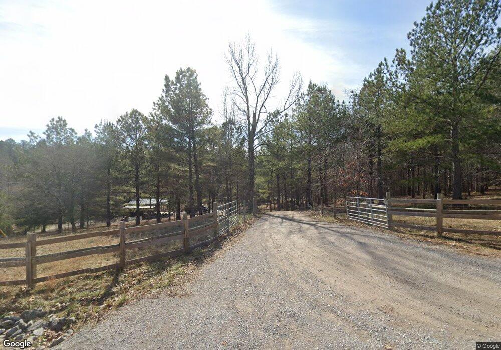
490 Westfork Dr Killen, AL 35645
Estimated Value: $332,000 - $425,902
Studio
--
Bath
1,875
Sq Ft
$202/Sq Ft
Est. Value
About This Home
This home is located at 490 Westfork Dr, Killen, AL 35645 and is currently estimated at $378,951, approximately $202 per square foot. 490 Westfork Dr is a home located in Lauderdale County with nearby schools including Brooks Elementary School and Underwood Elementary School.
Ownership History
Date
Name
Owned For
Owner Type
Purchase Details
Closed on
Apr 19, 2018
Sold by
Borden Mindy and Borden Gilbert D
Bought by
Borden Mindy and Borden Gilbert D
Current Estimated Value
Purchase Details
Closed on
Oct 15, 2013
Sold by
Shapiro Joshua Malachi and Shapiro Amber
Bought by
Borden Mindy
Purchase Details
Closed on
Jan 27, 2012
Sold by
Edwards Steve
Bought by
Shapiro Joshua Malachi
Create a Home Valuation Report for This Property
The Home Valuation Report is an in-depth analysis detailing your home's value as well as a comparison with similar homes in the area
Purchase History
| Date | Buyer | Sale Price | Title Company |
|---|---|---|---|
| Borden Mindy | -- | None Available | |
| Borden Mindy | -- | -- | |
| Shapiro Joshua Malachi | -- | -- |
Source: Public Records
Tax History Compared to Growth
Tax History
| Year | Tax Paid | Tax Assessment Tax Assessment Total Assessment is a certain percentage of the fair market value that is determined by local assessors to be the total taxable value of land and additions on the property. | Land | Improvement |
|---|---|---|---|---|
| 2025 | $1,141 | $34,220 | $0 | $0 |
| 2024 | $1,187 | $35,540 | $2,440 | $33,100 |
| 2023 | $1,237 | $2,260 | $2,260 | $0 |
| 2022 | $947 | $27,280 | $0 | $0 |
| 2021 | $850 | $24,500 | $0 | $0 |
| 2020 | $782 | $22,560 | $0 | $0 |
| 2019 | $747 | $21,560 | $0 | $0 |
| 2018 | $681 | $19,680 | $0 | $0 |
| 2017 | $654 | $18,900 | $0 | $0 |
| 2016 | $9 | $260 | $0 | $0 |
| 2015 | $20 | $580 | $0 | $0 |
| 2014 | $20 | $580 | $0 | $0 |
Source: Public Records
Map
Nearby Homes
- 0 Hwy 72 Unit 523004
- 0 Hwy 72 Unit 524420
- 000 Hwy 72
- .50 Stone Run
- 500 County Road 396
- 3442 Highway 43
- 172 Smith Ln
- Lot 27 Cooper Rd
- 4015 Co Rd 73
- 4137 County Road 73
- 135 Oldenburg Dr
- 235 Oldenburg Dr
- 529 Dartmoor Dr
- 2332 County Road 36
- 168 Bridgewood Dr
- 4370 County Road 34
- 101 Kentwood Dr
- 153 Kentwood Dr
- 7.62 Acres County Road 399
- 167 Blue Sky Way
- 2067 County Road 170
- 462 Westfork Dr
- 520 Westfork Dr
- 485 Westfork Dr
- 436 Westfork Dr
- 626 Westfork Dr
- 2155 County Road 170
- 625 Westfork Dr
- 000 Westfork Dr
- 0 Westfork Dr
- 00 Westfork Dr
- 375 Westfork Dr
- 400 Westfork Dr
- 545 Westfork Dr
- 339 Westfork Dr
- 650 Westfork Dr
- 270 Westfork Dr
- 2143 County Road 170
- 2095 County Road 170
- 1987 County Road 170
