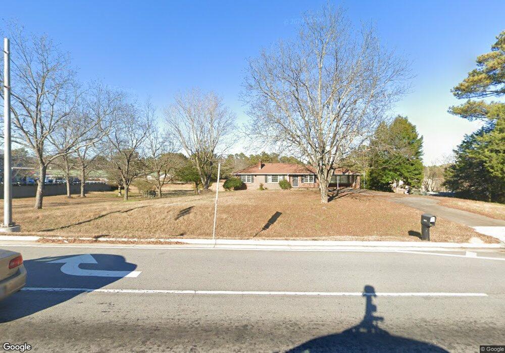
4900 Atlanta Hwy Loganville, GA 30052
Estimated Value: $1,475,500
--
Bed
1
Bath
1,440
Sq Ft
$1,025/Sq Ft
Est. Value
About This Home
This home is located at 4900 Atlanta Hwy, Loganville, GA 30052 and is currently priced at $1,475,500, approximately $1,024 per square foot. 4900 Atlanta Hwy is a home with nearby schools including Bay Creek Elementary School, Loganville Middle School, and Loganville High School.
Ownership History
Date
Name
Owned For
Owner Type
Purchase Details
Closed on
Aug 30, 2023
Sold by
Needham Teresa King
Bought by
Conyers Rd Investments Llcc
Current Estimated Value
Home Financials for this Owner
Home Financials are based on the most recent Mortgage that was taken out on this home.
Original Mortgage
$1,900,000
Outstanding Balance
$1,015,259
Interest Rate
6.9%
Mortgage Type
New Conventional
Purchase Details
Closed on
Feb 4, 2021
Sold by
Needham Danny Eugene
Bought by
Needham Teresa King and Needham Barry Lynn
Create a Home Valuation Report for This Property
The Home Valuation Report is an in-depth analysis detailing your home's value as well as a comparison with similar homes in the area
Home Values in the Area
Average Home Value in this Area
Purchase History
| Date | Buyer | Sale Price | Title Company |
|---|---|---|---|
| Conyers Rd Investments Llcc | $1,950,000 | -- | |
| Needham Teresa King | -- | -- | |
| Needham Danny Eugene | -- | -- | |
| Needham Danny Eugene | -- | -- |
Source: Public Records
Mortgage History
| Date | Status | Borrower | Loan Amount |
|---|---|---|---|
| Open | Conyers Rd Investments Llcc | $1,900,000 |
Source: Public Records
Tax History Compared to Growth
Tax History
| Year | Tax Paid | Tax Assessment Tax Assessment Total Assessment is a certain percentage of the fair market value that is determined by local assessors to be the total taxable value of land and additions on the property. | Land | Improvement |
|---|---|---|---|---|
| 2023 | $11,718 | $386,336 | $344,200 | $42,136 |
| 2022 | $7,339 | $232,096 | $192,160 | $39,936 |
| 2021 | $7,434 | $228,176 | $192,160 | $36,016 |
| 2020 | $9,083 | $271,856 | $236,760 | $35,096 |
| 2019 | $8,971 | $177,496 | $143,200 | $34,296 |
| 2018 | $2,790 | $177,496 | $143,200 | $34,296 |
| 2017 | $6,116 | $177,496 | $143,200 | $34,296 |
| 2016 | $2,847 | $173,096 | $143,200 | $29,896 |
| 2015 | $2,893 | $173,096 | $143,200 | $29,896 |
| 2014 | $5,975 | $312,440 | $0 | $0 |
Source: Public Records
Map
Nearby Homes
- 902 Edgewater Dr
- 6300 Highway 81
- 711 Wilhaven Ct
- 387 Lee Byrd Rd
- 2942 Highway 81
- 638 Granite Ln
- 405 Mallory Cir
- 1840 Pearson St
- 1920 Pearson St
- 2205 Baker Carter Dr
- 501 Lee Byrd Rd
- 1197 Granite Ln
- 0 Old Zion Cemetery Rd Unit 7396101
- 0 Old Zion Cemetery Rd Unit 10310202
- 1168 Granite Ln
- 308 Horizon Trace
- 2221 Baker Carter Dr
- 410 Live Oak Pass
- 290 Lee Byrd Rd
- 0 Lee Byrd Rd Unit 5981923
- 0 Lee Byrd Rd Unit 8345027
- 0 Lee Byrd Rd Unit 2613598
- 0 Lee Byrd Rd Unit 137 & 139 7624055
- 0 Lee Byrd Rd Unit 137&139 8042221
- 0 Lee Byrd Rd Unit 7239645
- 0 Lee Byrd Rd Unit 7384399
- 0 Lee Byrd Rd Unit 7484713
- 0 Lee Byrd Rd Unit 7586984
- 0 Lee Byrd Rd Unit 8174962
- 0 Lee Byrd Rd Unit 5319737
- 0 Lee Byrd Rd Unit 5393917
- 0 Lee Byrd Rd Unit 5645821
- 0 Lee Byrd Rd Unit 137 & 139 5676730
- 0 Lee Byrd Rd Unit 137&139 5725715
- 0 Lee Byrd Rd
- 0 Lee Byrd Rd Unit 8732222
- 0 Lee Byrd Rd Unit 7585656
- 0 Lee Byrd Rd Unit 7533833