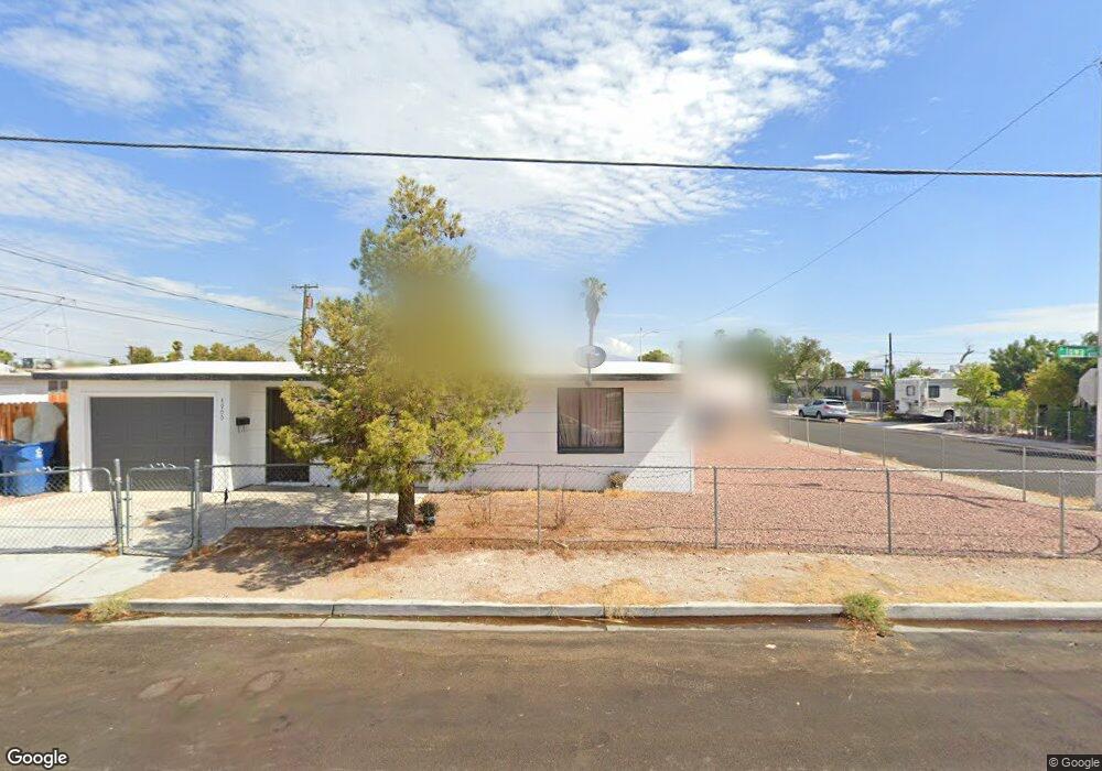
4900 Iowa Ave Las Vegas, NV 89107
Michael Way NeighborhoodEstimated Value: $271,000 - $294,662
2
Beds
1
Bath
718
Sq Ft
$393/Sq Ft
Est. Value
About This Home
This home is located at 4900 Iowa Ave, Las Vegas, NV 89107 and is currently estimated at $282,416, approximately $393 per square foot. 4900 Iowa Ave is a home located in Clark County with nearby schools including J.T. McWlliams Elementary School, Robert O Gibson Middle School, and Western High School.
Ownership History
Date
Name
Owned For
Owner Type
Purchase Details
Closed on
Jan 25, 2017
Sold by
Rmkk Llc
Bought by
Hammack Jeffrey and Msag Legacy Trust
Current Estimated Value
Purchase Details
Closed on
Nov 8, 2010
Sold by
Flatebo Mark E
Bought by
Mrkk Llc
Create a Home Valuation Report for This Property
The Home Valuation Report is an in-depth analysis detailing your home's value as well as a comparison with similar homes in the area
Home Values in the Area
Average Home Value in this Area
Purchase History
| Date | Buyer | Sale Price | Title Company |
|---|---|---|---|
| Hammack Jeffrey | $70,000 | First American Title Ins | |
| Mrkk Llc | $23,280 | Lawyers Title Of Nevada Mid | |
| Flatebo Mark E | -- | Lawyers Title Of Nevada Mid |
Source: Public Records
Tax History Compared to Growth
Tax History
| Year | Tax Paid | Tax Assessment Tax Assessment Total Assessment is a certain percentage of the fair market value that is determined by local assessors to be the total taxable value of land and additions on the property. | Land | Improvement |
|---|---|---|---|---|
| 2025 | $457 | $35,846 | $25,200 | $10,646 |
| 2024 | $444 | $35,846 | $25,200 | $10,646 |
| 2023 | $466 | $35,495 | $25,900 | $9,595 |
| 2022 | $452 | $29,610 | $21,000 | $8,610 |
| 2021 | $419 | $26,192 | $18,200 | $7,992 |
| 2020 | $418 | $22,837 | $15,050 | $7,787 |
| 2019 | $399 | $22,548 | $15,050 | $7,498 |
| 2018 | $381 | $17,543 | $10,500 | $7,043 |
| 2017 | $550 | $16,778 | $9,800 | $6,978 |
| 2016 | $362 | $13,770 | $7,000 | $6,770 |
| 2015 | $360 | $11,816 | $5,250 | $6,566 |
| 2014 | $349 | $10,319 | $3,780 | $6,539 |
Source: Public Records
Map
Nearby Homes
- 421 Harvard St
- 424 Stanford St
- 504 N Minnesota St
- 605 N Yale St
- 605 Stanford St
- 104 Stanford St
- 4901 Nebraska Ave
- 5117 Arbor Way
- 17 Princeton St
- 5124 Bromley Ave
- 617 Mayfield St
- 0 N Decatur Blvd
- 5300 Sugarfoot Ave
- 601 Huntington St
- 600 Sarajane Ln
- 5250 Mission Carmel Ln Unit 102
- 5250 Mission Carmel Ln Unit 204
- 5220 Mission Carmel Ln Unit 103
- 5420 Moonstruck Ave
- 5413 Maddox Ave
- 417 Harvard St
- 4901 Iowa Ave
- 4912 Iowa Ave
- 416 Princeton St
- 4913 Iowa Ave
- 420 N Princeton St
- 401 Harvard St
- 4830 Iowa Ave
- 420 Princeton St
- 416 Harvard St Unit None
- 416 Harvard St
- 425 Harvard St
- 4831 Iowa Ave
- 400 Princeton St
- 420 Harvard St
- 424 Princeton St
- 325 Harvard St
- 400 Harvard St
- 501 Harvard St
- 424 Harvard St