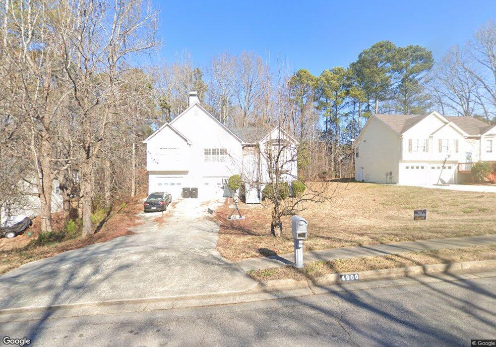
4900 Saint Johns Dr Douglasville, GA 30135
Lithia Springs NeighborhoodEstimated Value: $241,000 - $373,000
3
Beds
2
Baths
1,364
Sq Ft
$202/Sq Ft
Est. Value
About This Home
This home is located at 4900 Saint Johns Dr, Douglasville, GA 30135 and is currently estimated at $275,341, approximately $201 per square foot. 4900 Saint Johns Dr is a home located in Douglas County with nearby schools including Mt. Carmel Elementary School, Chestnut Log Middle School, and New Manchester High School.
Ownership History
Date
Name
Owned For
Owner Type
Purchase Details
Closed on
May 14, 1999
Sold by
K & A Enterprises Inc
Bought by
Desvernine Steven M and Desvernine Pamela
Current Estimated Value
Home Financials for this Owner
Home Financials are based on the most recent Mortgage that was taken out on this home.
Original Mortgage
$118,650
Outstanding Balance
$30,886
Interest Rate
7.13%
Mortgage Type
New Conventional
Estimated Equity
$244,455
Create a Home Valuation Report for This Property
The Home Valuation Report is an in-depth analysis detailing your home's value as well as a comparison with similar homes in the area
Home Values in the Area
Average Home Value in this Area
Purchase History
| Date | Buyer | Sale Price | Title Company |
|---|---|---|---|
| Desvernine Steven M | $124,900 | -- |
Source: Public Records
Mortgage History
| Date | Status | Borrower | Loan Amount |
|---|---|---|---|
| Open | Desvernine Steven M | $118,650 |
Source: Public Records
Tax History Compared to Growth
Tax History
| Year | Tax Paid | Tax Assessment Tax Assessment Total Assessment is a certain percentage of the fair market value that is determined by local assessors to be the total taxable value of land and additions on the property. | Land | Improvement |
|---|---|---|---|---|
| 2024 | $1,088 | $71,640 | $10,200 | $61,440 |
| 2023 | $1,088 | $71,640 | $10,200 | $61,440 |
| 2022 | $953 | $71,640 | $10,200 | $61,440 |
| 2021 | $833 | $55,880 | $9,760 | $46,120 |
| 2020 | $845 | $55,880 | $9,760 | $46,120 |
| 2019 | $764 | $54,640 | $9,760 | $44,880 |
| 2018 | $760 | $53,400 | $9,760 | $43,640 |
| 2017 | $675 | $42,280 | $8,640 | $33,640 |
| 2016 | $687 | $41,000 | $8,640 | $32,360 |
| 2015 | $715 | $39,920 | $8,640 | $31,280 |
| 2014 | $1,488 | $36,240 | $8,640 | $27,600 |
| 2013 | -- | $36,120 | $8,640 | $27,480 |
Source: Public Records
Map
Nearby Homes
- 4912 Saint Johns Dr
- 3811 Paul St
- 3825 Bentley Dr
- 3159 W Point Cir
- 2709 Gentry Dr
- 2539 Slater Mill Rd
- 3721 Longview Dr
- 2529 Slater Mill Rd
- 2627 Carol Cir
- 2280 Pope Rd
- 3580 Dorris Cir
- 2519 Slater Mill Rd
- 2509 Slater Mill Rd
- 3482 Willow Meadow Ln
- 2499 Slater Mill Rd
- 4155 Prestley Mill Rd
- 9353 Opal Dr
- 5260 Prestley Crossing Ln
- 5037 Saphire Ct
- 5264 Prestley Crossing Ln
- 4906 Saint Johns Dr
- 4894 Saint Johns Dr
- 4894 St. Johns
- 0 Saint John's Dr
- 2499 Pope Rd
- 4901 Saint Johns Dr
- 4907 Saint Johns Dr
- 2495 Pope Rd
- 4895 Saint Johns Dr
- 4918 Saint Johns Dr
- 3735 Paul St
- 3727 Paul St
- 3743 Paul St
- 4915 Saint Johns Dr
- 3719 Paul St Unit 2
- 3751 Paul St
- 3711 Paul St
- 3767 Paul St
- 4921 Saint Johns Dr
- 4920 Saint Johns Dr