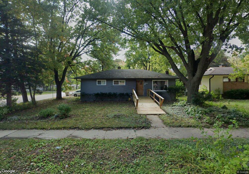
4901 Paul Ave Madison, WI 53711
Orchard Ridge NeighborhoodEstimated Value: $367,339 - $404,000
3
Beds
2
Baths
1,230
Sq Ft
$319/Sq Ft
Est. Value
About This Home
This home is located at 4901 Paul Ave, Madison, WI 53711 and is currently estimated at $391,835, approximately $318 per square foot. 4901 Paul Ave is a home located in Dane County with nearby schools including Orchard Ridge Elementary School, Toki Middle School, and Vel Phillips Memorial High School.
Ownership History
Date
Name
Owned For
Owner Type
Purchase Details
Closed on
Jun 30, 2006
Sold by
Burke Joseph A and Burke Melissa L
Bought by
Lance Fors And Charlotte H Selover 1986
Current Estimated Value
Home Financials for this Owner
Home Financials are based on the most recent Mortgage that was taken out on this home.
Original Mortgage
$153,900
Outstanding Balance
$91,434
Interest Rate
7.25%
Mortgage Type
Adjustable Rate Mortgage/ARM
Estimated Equity
$300,401
Purchase Details
Closed on
Jan 23, 2006
Sold by
Burke Daniel J and Burke Jeanne M
Bought by
Burke Joseph A and Burke Melissa L
Create a Home Valuation Report for This Property
The Home Valuation Report is an in-depth analysis detailing your home's value as well as a comparison with similar homes in the area
Home Values in the Area
Average Home Value in this Area
Purchase History
| Date | Buyer | Sale Price | Title Company |
|---|---|---|---|
| Lance Fors And Charlotte H Selover 1986 | $171,000 | None Available | |
| Burke Joseph A | -- | None Available |
Source: Public Records
Mortgage History
| Date | Status | Borrower | Loan Amount |
|---|---|---|---|
| Open | Lance Fors And Charlotte H Selover 1986 | $153,900 |
Source: Public Records
Tax History
| Year | Tax Paid | Tax Assessment Tax Assessment Total Assessment is a certain percentage of the fair market value that is determined by local assessors to be the total taxable value of land and additions on the property. | Land | Improvement |
|---|---|---|---|---|
| 2025 | $5,996 | $326,300 | $107,600 | $218,700 |
| 2024 | $10,919 | $313,100 | $107,600 | $205,500 |
| 2023 | $5,211 | $289,900 | $99,600 | $190,300 |
| 2022 | $9,909 | $254,300 | $87,400 | $166,900 |
| 2021 | $4,711 | $223,100 | $76,700 | $146,400 |
| 2020 | $4,718 | $213,500 | $73,400 | $140,100 |
| 2019 | $4,421 | $199,500 | $68,600 | $130,900 |
| 2018 | $4,044 | $183,000 | $62,900 | $120,100 |
| 2017 | $4,052 | $170,000 | $62,900 | $107,100 |
| 2016 | $3,552 | $151,500 | $57,200 | $94,300 |
| 2015 | $3,517 | $142,800 | $55,000 | $87,800 |
| 2014 | $3,382 | $142,800 | $55,000 | $87,800 |
| 2013 | $3,357 | $138,600 | $53,400 | $85,200 |
Source: Public Records
Map
Nearby Homes
- 30 Whitcomb Cir Unit 10 D
- 14 Whitcomb Cir
- 1401 Lewon Dr
- 4514 Hammersley Rd Unit 2
- 4421 Vale Cir
- 4233 Doncaster Dr
- 2309 Teal Dr
- 4402 Vale Cir
- 5602 Raymond Rd
- 5201 Fairway Dr
- 4215 Wanetah Trail
- 5314 Kroncke Dr
- 4206 Manitou Way
- 2102 Manor Green Dr
- 5710 Russett Rd
- 5017 Holiday Dr
- 4130 Manitou Way
- 609 Constitution Ln
- 4301 Odana Rd
- 4514 Wakefield St
Your Personal Tour Guide
Ask me questions while you tour the home.