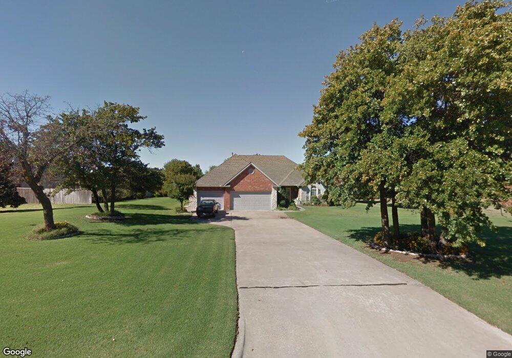
4901 Robin Hill Ln Oklahoma City, OK 73150
Estimated Value: $398,000 - $433,000
3
Beds
3
Baths
2,304
Sq Ft
$178/Sq Ft
Est. Value
About This Home
This home is located at 4901 Robin Hill Ln, Oklahoma City, OK 73150 and is currently estimated at $409,885, approximately $177 per square foot. 4901 Robin Hill Ln is a home located in Oklahoma County with nearby schools including Barnes Elementary School, Carl Albert Middle School, and Carl Albert High School.
Ownership History
Date
Name
Owned For
Owner Type
Purchase Details
Closed on
Jan 15, 2016
Sold by
Lorig Stanley A and Lorig Gwynn A
Bought by
Curtis Jeff
Current Estimated Value
Home Financials for this Owner
Home Financials are based on the most recent Mortgage that was taken out on this home.
Original Mortgage
$150,000
Outstanding Balance
$63,878
Interest Rate
4.01%
Mortgage Type
New Conventional
Estimated Equity
$346,007
Purchase Details
Closed on
Jun 27, 1997
Sold by
K & R Company
Bought by
Lorig Stanley A and Lorig Gwynn A
Home Financials for this Owner
Home Financials are based on the most recent Mortgage that was taken out on this home.
Original Mortgage
$120,000
Interest Rate
7.93%
Create a Home Valuation Report for This Property
The Home Valuation Report is an in-depth analysis detailing your home's value as well as a comparison with similar homes in the area
Home Values in the Area
Average Home Value in this Area
Purchase History
| Date | Buyer | Sale Price | Title Company |
|---|---|---|---|
| Curtis Jeff | $250,000 | American Eagle Title | |
| Lorig Stanley A | $163,000 | Stewart Escrow & Title |
Source: Public Records
Mortgage History
| Date | Status | Borrower | Loan Amount |
|---|---|---|---|
| Open | Curtis Jeff | $150,000 | |
| Previous Owner | Lorig Stanley A | $120,000 |
Source: Public Records
Tax History Compared to Growth
Tax History
| Year | Tax Paid | Tax Assessment Tax Assessment Total Assessment is a certain percentage of the fair market value that is determined by local assessors to be the total taxable value of land and additions on the property. | Land | Improvement |
|---|---|---|---|---|
| 2024 | $4,023 | $34,737 | $8,836 | $25,901 |
| 2023 | $4,023 | $33,726 | $5,491 | $28,235 |
| 2022 | $3,998 | $32,744 | $6,267 | $26,477 |
| 2021 | $3,890 | $31,185 | $6,767 | $24,418 |
| 2020 | $3,808 | $29,700 | $6,958 | $22,742 |
| 2019 | $3,687 | $29,535 | $5,170 | $24,365 |
| 2018 | $3,562 | $28,545 | $0 | $0 |
| 2017 | $3,577 | $28,324 | $5,170 | $23,154 |
| 2016 | $3,724 | $29,887 | $4,754 | $25,133 |
| 2015 | $3,649 | $29,016 | $4,770 | $24,246 |
| 2014 | $3,524 | $28,171 | $5,170 | $23,001 |
Source: Public Records
Map
Nearby Homes
- 4500 Mary Ann Cir
- 5501 Black Jack Ridge Rd
- 10829 SE 51st St
- 6401 Saddleback Dr
- 13985 SE 29th St
- 9400 Renny Rd
- 2708 Snapper Ln
- Carlisle Plan at Turtlewood
- Bella Plan at Turtlewood
- Lockard 22 Plan at Turtlewood
- Brea Plan at Turtlewood
- Andrew Plan at Turtlewood
- Newport Plan at Turtlewood
- Taylor Plan at Turtlewood
- Lynndale Plus Plan at Turtlewood
- Brooke Plan at Turtlewood
- Cooper Plan at Turtlewood
- 2553 Turtle Way
- 11532 SE 44th St
- 10730 Painted Turtle Way
- 4909 Robin Hill Ln
- 4825 Robin Hill Ln
- 4917 Robin Hill Ln
- 4817 Robin Hill Ln
- 4900 Robin Hill Ln
- 4908 Robin Hill Ln
- 4809 Robin Hill Ln
- 5001 Robin Hill Ln
- 4916 Robin Hill Ln
- 4712 S Post Rd
- 10108 SE 45th St
- 5000 Robin Hill Ln
- 5009 Robin Hill Ln
- 4801 Kennington Ln
- 10116 SE 45th St
- 4809 Kennington Ln
- 4901 Kennington Ln
- 10100 SE 45th St
- 4800 Robin Hill Ln
- 5008 Robin Hill Ln