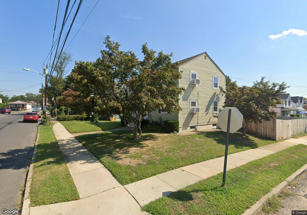
4902 Camden Ave Unit B Pennsauken, NJ 08110
Estimated Value: $284,041 - $350,000
2
Beds
1
Bath
--
Sq Ft
5,009
Sq Ft Lot
About This Home
This home is located at 4902 Camden Ave Unit B, Pennsauken, NJ 08110 and is currently estimated at $318,510. 4902 Camden Ave Unit B is a home located in Camden County with nearby schools including Pennsauken High School, St. Peter Elementary School, and St. Cecilia School.
Ownership History
Date
Name
Owned For
Owner Type
Purchase Details
Closed on
Aug 15, 2019
Sold by
Thai Bung T
Bought by
Johnson Malcolm S and Holloway Tiarra M
Current Estimated Value
Home Financials for this Owner
Home Financials are based on the most recent Mortgage that was taken out on this home.
Original Mortgage
$157,102
Outstanding Balance
$140,410
Interest Rate
4.75%
Mortgage Type
FHA
Estimated Equity
$178,100
Purchase Details
Closed on
Jun 1, 2018
Sold by
Wells Fargo Bank N A
Bought by
Thai Hung T
Purchase Details
Closed on
Aug 18, 2017
Sold by
Koutsouties Stephanos
Bought by
Wells Fargo Bank Na
Create a Home Valuation Report for This Property
The Home Valuation Report is an in-depth analysis detailing your home's value as well as a comparison with similar homes in the area
Home Values in the Area
Average Home Value in this Area
Purchase History
| Date | Buyer | Sale Price | Title Company |
|---|---|---|---|
| Johnson Malcolm S | $160,000 | Core Title | |
| Thai Hung T | $100,700 | Platinum Abstract Co Llc | |
| Wells Fargo Bank Na | -- | None Available |
Source: Public Records
Mortgage History
| Date | Status | Borrower | Loan Amount |
|---|---|---|---|
| Open | Johnson Malcolm S | $157,102 |
Source: Public Records
Tax History Compared to Growth
Tax History
| Year | Tax Paid | Tax Assessment Tax Assessment Total Assessment is a certain percentage of the fair market value that is determined by local assessors to be the total taxable value of land and additions on the property. | Land | Improvement |
|---|---|---|---|---|
| 2025 | $5,810 | $247,500 | $55,000 | $192,500 |
| 2024 | $5,698 | $133,500 | $38,500 | $95,000 |
| 2023 | $5,698 | $133,500 | $38,500 | $95,000 |
| 2022 | $5,152 | $133,500 | $38,500 | $95,000 |
| 2021 | $5,291 | $133,500 | $38,500 | $95,000 |
| 2020 | $4,118 | $116,000 | $38,500 | $77,500 |
| 2019 | $4,794 | $133,500 | $38,500 | $95,000 |
| 2018 | $4,819 | $133,500 | $38,500 | $95,000 |
| 2017 | $4,829 | $133,500 | $38,500 | $95,000 |
| 2016 | $4,742 | $133,500 | $38,500 | $95,000 |
| 2015 | $4,883 | $133,500 | $38,500 | $95,000 |
| 2014 | $4,611 | $82,900 | $19,500 | $63,400 |
Source: Public Records
Map
Nearby Homes
- 2154 Browning Rd
- 5507 Wayne Ave
- 4747 Westfield Ave
- 1938 W River Dr
- 1903 Tinsman Ave
- 2446 46th St
- 2146 44th St
- 2217 Hollinshed Ave
- 1828 47th St
- 2503 46th St
- 2254 Hollinshed Ave
- 3204 Merchantville Ave
- 3241 N 48th St
- 1666 Browning Rd
- 2232 42nd St
- 2404 42nd St
- 1824 44th St
- 6036 Washington Ave
- 1715 47th St
- 5532 Whitman Terrace
- 4902 Camden Ave
- 4902 Camden Ave Unit A
- 4908 Camden Ave
- 2216 49th St
- 4916 Camden Ave
- 2222 49th St
- 2215 49th St
- 2228 49th St
- 2217 Browning Rd
- 2211 Browning Rd Unit B
- 2211 Browning Rd
- 2205 Browning Rd Unit B
- 2205 Browning Rd
- 2223 49th St
- 2225 Browning Rd
- 2227 49th St
- 2234 49th St
- 2233 Browning Rd Unit 2
- 2233 Browning Rd Unit 1
- 2233 Browning Rd