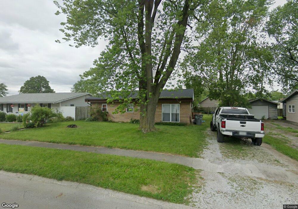
4905 Algonquin Trail Kokomo, IN 46902
Indian Heights NeighborhoodEstimated Value: $110,000 - $131,000
3
Beds
1
Bath
960
Sq Ft
$128/Sq Ft
Est. Value
About This Home
This home is located at 4905 Algonquin Trail, Kokomo, IN 46902 and is currently estimated at $123,343, approximately $128 per square foot. 4905 Algonquin Trail is a home located in Howard County with nearby schools including Taylor Elementary School, Taylor Middle School, and Taylor High School.
Ownership History
Date
Name
Owned For
Owner Type
Purchase Details
Closed on
Nov 9, 2021
Sold by
Strategic Land Development Llc
Bought by
Billie Dee Holdings Llc
Current Estimated Value
Home Financials for this Owner
Home Financials are based on the most recent Mortgage that was taken out on this home.
Original Mortgage
$314,000
Outstanding Balance
$264,657
Interest Rate
2.35%
Estimated Equity
-$141,314
Purchase Details
Closed on
Nov 8, 2021
Sold by
Strategic Land Development Llc
Bought by
Billie Dee Holdings Llc
Home Financials for this Owner
Home Financials are based on the most recent Mortgage that was taken out on this home.
Original Mortgage
$314,000
Outstanding Balance
$264,657
Interest Rate
2.35%
Estimated Equity
-$141,314
Purchase Details
Closed on
Feb 1, 2012
Sold by
Mochi Properties Llc
Bought by
Miko Development
Create a Home Valuation Report for This Property
The Home Valuation Report is an in-depth analysis detailing your home's value as well as a comparison with similar homes in the area
Home Values in the Area
Average Home Value in this Area
Purchase History
| Date | Buyer | Sale Price | Title Company |
|---|---|---|---|
| Billie Dee Holdings Llc | -- | None Listed On Document | |
| Strategic Land Development Llc | -- | None Listed On Document | |
| Miko Development | -- | None Listed On Document | |
| Billie Dee Holdings Llc | $68,000 | Maugans J Conrad | |
| Strategic Land Development Llc | $68,000 | Maugans J Conrad |
Source: Public Records
Mortgage History
| Date | Status | Borrower | Loan Amount |
|---|---|---|---|
| Open | Billie Dee Holdings Llc | $314,000 | |
| Closed | Billie Dee Holdings Llc | $314,000 |
Source: Public Records
Tax History Compared to Growth
Tax History
| Year | Tax Paid | Tax Assessment Tax Assessment Total Assessment is a certain percentage of the fair market value that is determined by local assessors to be the total taxable value of land and additions on the property. | Land | Improvement |
|---|---|---|---|---|
| 2024 | $1,491 | $85,700 | $13,300 | $72,400 |
| 2022 | $1,431 | $71,500 | $13,300 | $58,200 |
| 2021 | $1,189 | $59,400 | $10,400 | $49,000 |
| 2020 | $1,061 | $53,000 | $10,400 | $42,600 |
| 2019 | $951 | $47,500 | $10,400 | $37,100 |
| 2018 | $896 | $43,500 | $10,400 | $33,100 |
| 2017 | $830 | $41,200 | $11,800 | $29,400 |
| 2016 | $850 | $42,200 | $11,800 | $30,400 |
| 2014 | $779 | $38,900 | $11,800 | $27,100 |
| 2013 | $819 | $40,900 | $11,800 | $29,100 |
Source: Public Records
Map
Nearby Homes
- 5208 Algonquin Trail
- 5213 Wea Dr
- 726 Springwater Rd
- 1012 Chippewa Ln
- 5405 Wea Dr
- 5308 Arrowhead Blvd
- 1109 Peace Pipe Dr
- 3022 Highland Springs Dr
- 5234 Council Ring Blvd
- 718 Highland Springs Ct
- 5411 Long Bow Dr
- 5408 Arrowhead Blvd
- 846 Springwater Rd
- 5503 Arrowhead Blvd
- 806 Maumee Dr
- 1104 Wigwam Dr
- 230 Mackinaw Cir
- 126 Patricia Dr
- 1041 Spring Hill Dr
- 907 Wingra Ct
- 4907 Algonquin Trail
- 4903 Council Ring Blvd
- 4903 Algonquin Trail
- 4900 Arrowhead Blvd
- 4901 Algonquin Trail
- 4909 Algonquin Trail
- 4905 Council Ring Blvd
- 4901 Council Ring Blvd
- 4902 Algonquin Trail
- 4900 Algonquin Trail
- 4907 Council Ring Blvd
- 4904 Algonquin Trail
- 4911 Algonquin Trail
- 4906 Arrowhead Blvd
- 4904 Arrowhead Blvd
- 4909 Council Ring Blvd
- 4906 Algonquin Trail
- 5002 Mohawk Dr
- 4908 Arrowhead Blvd
- 5002 Wea Dr