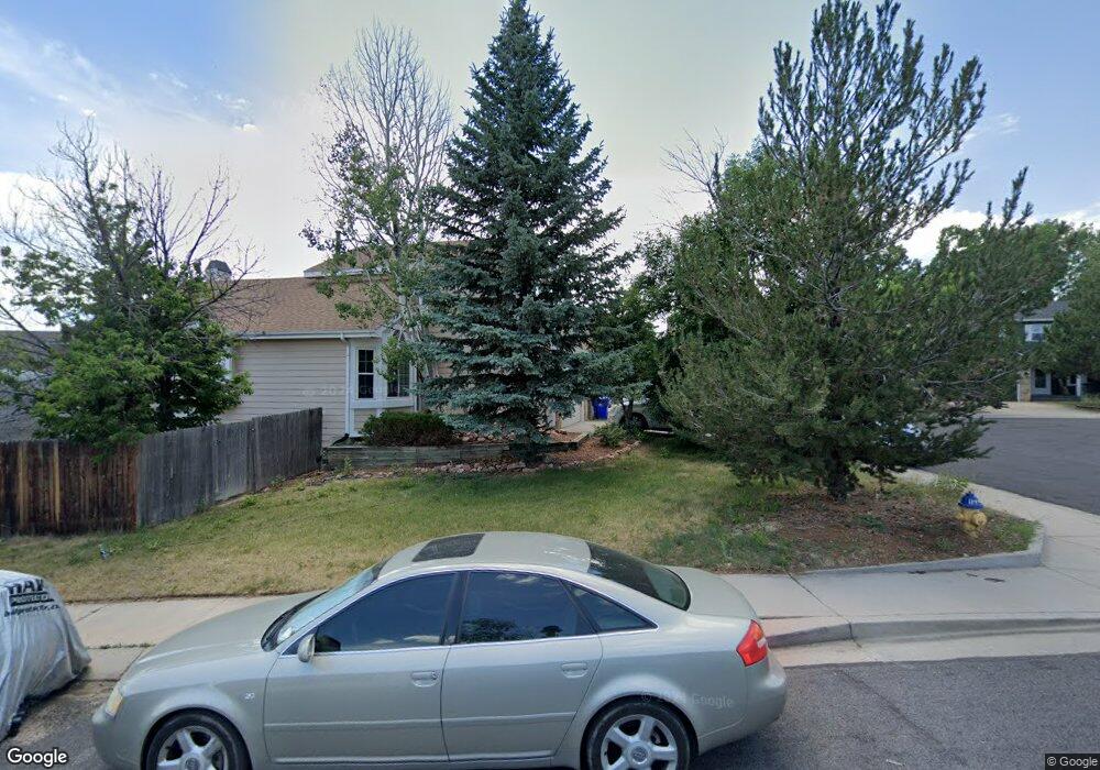
4906 Herndon Cir Colorado Springs, CO 80920
Briargate NeighborhoodEstimated Value: $477,000 - $515,000
3
Beds
3
Baths
1,738
Sq Ft
$282/Sq Ft
Est. Value
About This Home
This home is located at 4906 Herndon Cir, Colorado Springs, CO 80920 and is currently estimated at $489,293, approximately $281 per square foot. 4906 Herndon Cir is a home located in El Paso County with nearby schools including Prairie Hills Elementary School, Timberview Middle School, and Liberty High School.
Ownership History
Date
Name
Owned For
Owner Type
Purchase Details
Closed on
May 15, 2008
Sold by
Young Dennis A and Young Corinne C
Bought by
Fenske Richard and Fenske Melody
Current Estimated Value
Home Financials for this Owner
Home Financials are based on the most recent Mortgage that was taken out on this home.
Original Mortgage
$245,337
Outstanding Balance
$155,452
Interest Rate
5.89%
Mortgage Type
VA
Estimated Equity
$333,841
Purchase Details
Closed on
May 31, 1990
Bought by
Fenske Richard
Purchase Details
Closed on
Mar 20, 1990
Bought by
Fenske Richard
Create a Home Valuation Report for This Property
The Home Valuation Report is an in-depth analysis detailing your home's value as well as a comparison with similar homes in the area
Home Values in the Area
Average Home Value in this Area
Purchase History
| Date | Buyer | Sale Price | Title Company |
|---|---|---|---|
| Fenske Richard | $237,500 | Utc Colorado | |
| Fenske Richard | $97,700 | -- | |
| Fenske Richard | $19,400 | -- |
Source: Public Records
Mortgage History
| Date | Status | Borrower | Loan Amount |
|---|---|---|---|
| Open | Fenske Richard | $245,337 |
Source: Public Records
Tax History Compared to Growth
Tax History
| Year | Tax Paid | Tax Assessment Tax Assessment Total Assessment is a certain percentage of the fair market value that is determined by local assessors to be the total taxable value of land and additions on the property. | Land | Improvement |
|---|---|---|---|---|
| 2025 | $2,099 | $35,160 | -- | -- |
| 2024 | $2,062 | $36,460 | $5,360 | $31,100 |
| 2023 | $2,062 | $36,460 | $5,360 | $31,100 |
| 2022 | $1,669 | $23,650 | $4,340 | $19,310 |
| 2021 | $1,845 | $24,320 | $4,460 | $19,860 |
| 2020 | $1,757 | $21,590 | $3,720 | $17,870 |
| 2019 | $1,740 | $21,590 | $3,720 | $17,870 |
| 2018 | $1,406 | $17,160 | $2,880 | $14,280 |
| 2017 | $1,401 | $17,160 | $2,880 | $14,280 |
| 2016 | $1,370 | $16,760 | $2,930 | $13,830 |
| 2015 | $1,367 | $16,760 | $2,930 | $13,830 |
| 2014 | $1,255 | $15,370 | $2,930 | $12,440 |
Source: Public Records
Map
Nearby Homes
- 4940 Shirley Place
- 5002 Herndon Cir
- 8387 Snow Cap View
- 8372 Wilmington Dr
- 4865 Criswell Ct
- 8313 Scarborough Dr
- 8236 Telegraph Dr
- 8488 Grand Peak Vista Point
- 8030 Chancellor Dr
- 8138 Steadman Dr
- 8432 Artesian Springs Point
- 5033 Baseline View
- 5026 Plumstead Dr
- 7934 Vectra Dr
- 8482 Artesian Springs Point
- 7975 Manston Dr
- 4940 Deviation Point
- 5049 Construct Point
- 8230 Camfield Cir
- 5064 Construct Point
- 4902 Herndon Cir
- 4910 Herndon Cir
- 4960 Shirley Place
- 4980 Shirley Place
- 8259 Chancellor Dr
- 8251 Chancellor Dr
- 4862 Herndon Cir
- 8267 Chancellor Dr
- 4990 Shirley Place
- 8243 Chancellor Dr
- 8275 Chancellor Dr
- 8235 Chancellor Dr
- 4858 Herndon Cir
- 8283 Chancellor Dr
- 8227 Chancellor Dr
- 4907 Herndon Cir
- 4854 Herndon Cir
- 4911 Herndon Cir
- 4903 Herndon Cir
- 4915 Herndon Cir