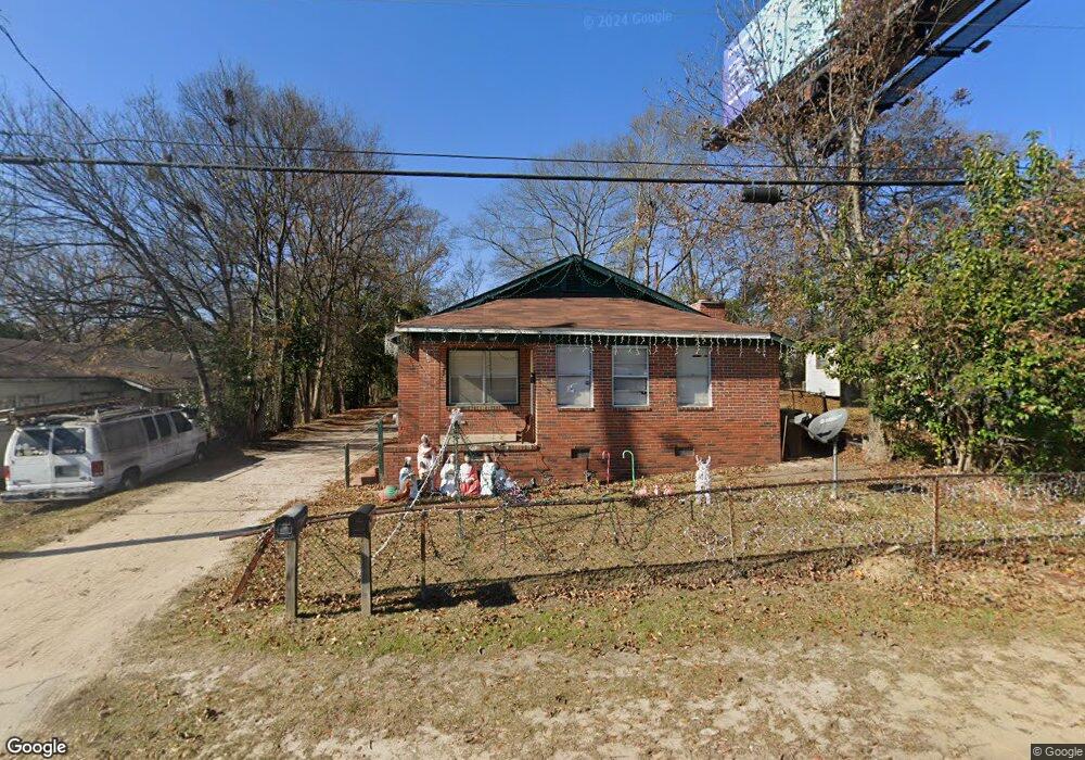
4909 14th Ave Columbus, GA 31904
Columbus Tech-Bealwood NeighborhoodEstimated Value: $118,000 - $165,000
3
Beds
1
Bath
1,250
Sq Ft
$116/Sq Ft
Est. Value
About This Home
This home is located at 4909 14th Ave, Columbus, GA 31904 and is currently estimated at $144,767, approximately $115 per square foot. 4909 14th Ave is a home located in Muscogee County with nearby schools including River Road Elementary School, Arnold Middle School, and Jordan Vocational High School.
Ownership History
Date
Name
Owned For
Owner Type
Purchase Details
Closed on
Aug 20, 2024
Sold by
Redmond Webb Otis
Bought by
Redmond Webb Otis and Redmond Anthony M
Current Estimated Value
Purchase Details
Closed on
Jul 23, 2024
Sold by
Redmond Josephine and Redmond Webb Otis
Bought by
Redmond Webb Otis
Purchase Details
Closed on
Mar 25, 2022
Sold by
Redmond Josephine R
Bought by
Redmond Web Otis
Purchase Details
Closed on
Mar 1, 2017
Sold by
Walton Aleane Walton
Bought by
Redmond Josephine R
Create a Home Valuation Report for This Property
The Home Valuation Report is an in-depth analysis detailing your home's value as well as a comparison with similar homes in the area
Home Values in the Area
Average Home Value in this Area
Purchase History
| Date | Buyer | Sale Price | Title Company |
|---|---|---|---|
| Redmond Webb Otis | -- | None Listed On Document | |
| Redmond Webb Otis | -- | None Listed On Document | |
| Redmond Web Otis | -- | None Listed On Document | |
| Redmond Josephine R | -- | -- |
Source: Public Records
Tax History Compared to Growth
Tax History
| Year | Tax Paid | Tax Assessment Tax Assessment Total Assessment is a certain percentage of the fair market value that is determined by local assessors to be the total taxable value of land and additions on the property. | Land | Improvement |
|---|---|---|---|---|
| 2025 | $3,644 | $41,968 | $9,304 | $32,664 |
| 2024 | $1,643 | $41,968 | $9,304 | $32,664 |
| 2023 | $1,653 | $41,968 | $9,304 | $32,664 |
| 2022 | $1,334 | $32,660 | $6,976 | $25,684 |
| 2021 | $1,289 | $31,448 | $6,976 | $24,472 |
| 2020 | $1,284 | $31,448 | $6,976 | $24,472 |
| 2019 | $1,288 | $31,448 | $6,976 | $24,472 |
| 2018 | $1,288 | $31,448 | $6,976 | $24,472 |
| 2017 | $960 | $23,368 | $6,976 | $16,392 |
| 2016 | $1,446 | $35,058 | $19,471 | $15,587 |
| 2015 | $579 | $35,058 | $19,471 | $15,587 |
| 2014 | $580 | $35,058 | $19,471 | $15,587 |
| 2013 | -- | $35,058 | $19,471 | $15,587 |
Source: Public Records
Map
Nearby Homes
- 5106 11th Ave
- 5110 11th Ave
- 5118 11th Ave
- 1103 52nd St
- 4830 17th Ave
- 4714 18th Ave
- 4814 20th Ave
- 5027 Abbott Ave
- 4213 16th Ave
- 2206 Devonshire Dr
- 2119 Lancaster Dr
- 2222 51st St
- 643 Lichfield Rd
- 4220 18th Ave
- 1717 42nd St
- 4109 Sherwood Ave
- 5239 23rd Ave
- 2014 Airport Thruway
- 2323 Devonshire Dr
- 2012 42nd St