4909 Andrew Rd Columbus, OH 43227
Shady Lane NeighborhoodEstimated Value: $215,927 - $244,000
About This Home
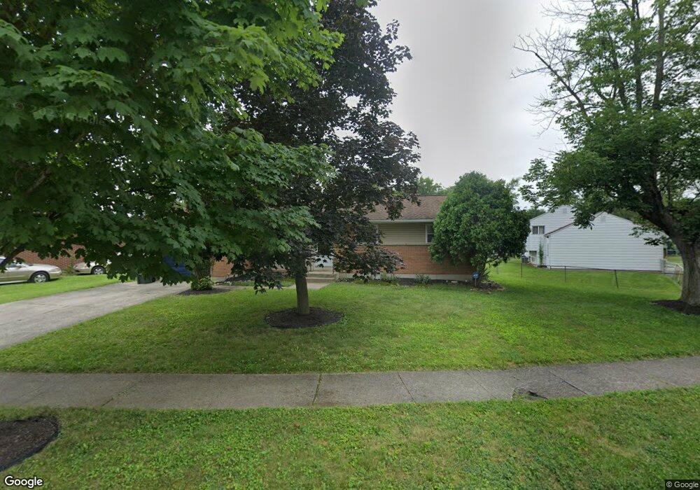
This home is located at 4909 Andrew Rd, Columbus, OH 43227 and is currently estimated at $230,732, approximately $188 per square foot. 4909 Andrew Rd is a home located in Franklin County with nearby schools including Shady Lane Elementary School, Sherwood Middle School, and Walnut Ridge High School.
Ownership History
We collect this data history from publicly available records. To have your information removed, we recommend requesting removal directly through your county’s website.
Purchase Details
Home Financials for this Owner
Home Financials are based on the most recent Mortgage that was taken out on this home.Purchase Details
Home Values in the Area
Average Home Value in this Area
Purchase History
We collect this data history from publicly available records. To have your information removed, we recommend requesting removal directly through your county’s website.
| Date | Buyer | Sale Price | Title Company |
|---|---|---|---|
| $101,500 | Advantage One Title Agency I | ||
| -- | -- |
Mortgage History
We collect this data history from publicly available records. To have your information removed, we recommend requesting removal directly through your county’s website.
| Date | Status | Borrower | Loan Amount |
|---|---|---|---|
| Open | $101,500 |
Tax History
We collect this data history from publicly available records. To have your information removed, we recommend requesting removal directly through your county’s website.
| Year | Tax Paid | Tax Assessment Tax Assessment Total Assessment is a certain percentage of the fair market value that is determined by local assessors to be the total taxable value of land and additions on the property. | Land | Improvement |
|---|---|---|---|---|
| 2025 | $3,214 | $71,610 | $16,170 | $55,440 |
| 2024 | $3,214 | $71,610 | $16,170 | $55,440 |
| 2023 | $3,173 | $71,610 | $16,170 | $55,440 |
| 2022 | $1,870 | $36,050 | $7,070 | $28,980 |
| 2021 | $1,873 | $36,050 | $7,070 | $28,980 |
| 2020 | $1,875 | $36,050 | $7,070 | $28,980 |
| 2019 | $1,728 | $28,490 | $5,670 | $22,820 |
| 2018 | $1,382 | $28,490 | $5,670 | $22,820 |
| 2017 | $1,727 | $28,490 | $5,670 | $22,820 |
| 2016 | $1,145 | $17,290 | $5,530 | $11,760 |
| 2015 | $1,040 | $17,290 | $5,530 | $11,760 |
| 2014 | $1,042 | $17,290 | $5,530 | $11,760 |
| 2013 | $605 | $20,335 | $6,510 | $13,825 |
Map
- 4956 Betsy Dr
- 1167 Manfeld Dr
- 4829 Mcallister Ave
- 4991 Justin Rd
- 5021 Betsy Dr
- 1264 Shady Lane Rd
- 1422 Benson Dr
- 4700 Ludington Rd
- 1085 Shady Lane Rd
- 1407 Simpson Dr
- 4530 Amesbury Rd
- 935 Duke Rd
- 1585 Shady Lane Rd
- 4706 Dundee Ave
- 4467 Grimsby Rd
- 4636 Dundee Ave
- 1567 Baxter Dr
- 1627 Coppertree Rd Unit 1627
- 5216 Bagley Rd
- 1417 Devonhurst Dr
- 4911 Andrew Rd
- 4899 Andrew Rd
- 1270 Manfeld Dr
- 4913 Andrew Rd
- 4918 Andrew Rd
- 1278 Manfeld Dr
- 4922 Andrew Rd
- 4914 Andrew Rd
- 4902 Andrew Rd
- 4924 Andrew Rd
- 4926 Andrew Rd
- 1286 Manfeld Dr
- 4928 Andrew Rd
- 4935 Teddy Dr
- 4927 Teddy Dr
- 1234 Manfeld Dr
- 4939 Teddy Dr
- 1294 Manfeld Dr
- 1263 Manfeld Dr
- 1249 Manfeld Dr
Ask me questions while you tour the home.