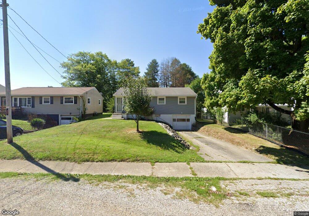
491 Allison Ave Mansfield, OH 44903
Estimated Value: $63,000 - $90,000
3
Beds
1
Bath
960
Sq Ft
$76/Sq Ft
Est. Value
About This Home
This home is located at 491 Allison Ave, Mansfield, OH 44903 and is currently estimated at $72,555, approximately $75 per square foot. 491 Allison Ave is a home located in Richland County with nearby schools including Foundation Academy, Mansfield Elective Academy, and Goal Digital Academy.
Ownership History
Date
Name
Owned For
Owner Type
Purchase Details
Closed on
Dec 14, 2004
Sold by
Pledged Property Ii Llc
Bought by
Mellott Lee and Mellott Sharon
Current Estimated Value
Home Financials for this Owner
Home Financials are based on the most recent Mortgage that was taken out on this home.
Original Mortgage
$17,600
Interest Rate
5.23%
Mortgage Type
Purchase Money Mortgage
Purchase Details
Closed on
Aug 5, 2004
Sold by
Jordan Frances
Bought by
Pledged Property Ii Llc
Purchase Details
Closed on
Mar 15, 1993
Sold by
Jordan Wilbur L
Bought by
Jordan Frances
Create a Home Valuation Report for This Property
The Home Valuation Report is an in-depth analysis detailing your home's value as well as a comparison with similar homes in the area
Home Values in the Area
Average Home Value in this Area
Purchase History
| Date | Buyer | Sale Price | Title Company |
|---|---|---|---|
| Mellott Lee | $22,000 | Magee Title Agency | |
| Pledged Property Ii Llc | $24,000 | Chicago Title | |
| Jordan Frances | -- | -- |
Source: Public Records
Mortgage History
| Date | Status | Borrower | Loan Amount |
|---|---|---|---|
| Closed | Mellott Lee | $17,600 |
Source: Public Records
Tax History Compared to Growth
Tax History
| Year | Tax Paid | Tax Assessment Tax Assessment Total Assessment is a certain percentage of the fair market value that is determined by local assessors to be the total taxable value of land and additions on the property. | Land | Improvement |
|---|---|---|---|---|
| 2024 | $214 | $14,360 | $3,390 | $10,970 |
| 2023 | $214 | $14,360 | $3,390 | $10,970 |
| 2022 | $111 | $10,740 | $2,800 | $7,940 |
| 2021 | $112 | $10,740 | $2,800 | $7,940 |
| 2020 | $114 | $10,740 | $2,800 | $7,940 |
| 2019 | $127 | $10,740 | $2,800 | $7,940 |
| 2018 | $125 | $10,740 | $2,800 | $7,940 |
| 2017 | $122 | $10,740 | $2,800 | $7,940 |
| 2016 | $98 | $10,310 | $2,660 | $7,650 |
| 2015 | $98 | $10,310 | $2,660 | $7,650 |
| 2014 | $93 | $10,310 | $2,660 | $7,650 |
| 2012 | $48 | $10,850 | $2,800 | $8,050 |
Source: Public Records
Map
Nearby Homes
- 0 State Route 314 Unit 9069650
- 0 State Route 314 Unit 9067316
- 0 State Route 314 Unit 225021979
- 641 Averill Ave
- 269 Parkway Dr
- 512 Burns St
- 741 Burger Ave
- 480 Mcpherson St
- 237 Helen Ave
- 340 Boston Ave
- 170 Western Ave
- 0 Highway 30
- 450 Tracy St
- 0 W Fourth St - Trimble Lenox
- 426 Mcpherson St
- 185 Rowland Ave
- 212 Penn Ave
- 1168 & 1171 Seminole Ave
- 1169 Seminole Ave
- 96 Helen Ave
- 497 Allison Ave
- 487 Allison Ave
- 481 Allison Ave
- 501 Allison Ave
- 482 Allison Ave
- 488 Allison Ave
- 775 Floral Ct
- 509 Allison Ave
- 785 Floral Ct
- 492 Allison Ave
- 765 Floral Ct
- 792 Mcpherson St
- 478 Allison Ave
- 790 Mcpherson St
- 472 Allison Ave
- 498 Allison Ave
- 791 Floral Ct
- 466 Allison Ave
- 768 Mcpherson St
- 766 Mcpherson St