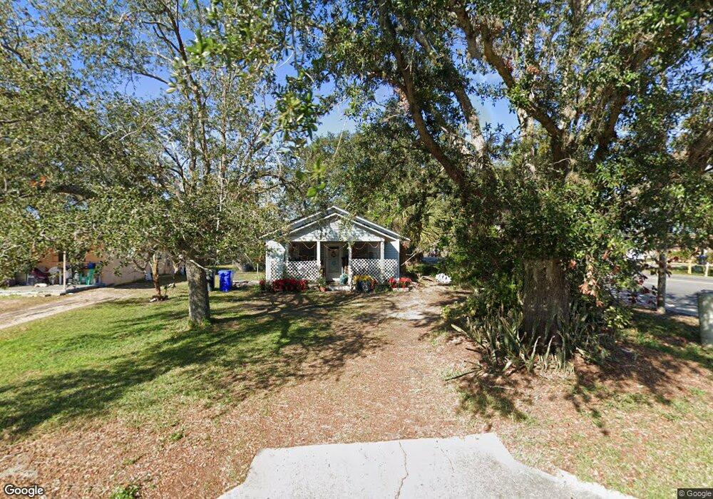
491 Charlotte St Winter Garden, FL 34787
Estimated Value: $265,077 - $307,000
3
Beds
1
Bath
1,056
Sq Ft
$272/Sq Ft
Est. Value
About This Home
This home is located at 491 Charlotte St, Winter Garden, FL 34787 and is currently estimated at $287,019, approximately $271 per square foot. 491 Charlotte St is a home located in Orange County with nearby schools including William S Maxey Elementary, Lakeview Middle, and West Orange High School.
Ownership History
Date
Name
Owned For
Owner Type
Purchase Details
Closed on
Jan 4, 1996
Sold by
West Orange Habitat For Humanity
Bought by
Scrivener Wayne and Holt Sheila
Current Estimated Value
Home Financials for this Owner
Home Financials are based on the most recent Mortgage that was taken out on this home.
Original Mortgage
$63,000
Outstanding Balance
$1,700
Interest Rate
7.29%
Estimated Equity
$285,319
Purchase Details
Closed on
Aug 29, 1995
Sold by
Crouch Robert and Crouch Betty
Bought by
W Orange Habitat For Humanity Inc
Create a Home Valuation Report for This Property
The Home Valuation Report is an in-depth analysis detailing your home's value as well as a comparison with similar homes in the area
Home Values in the Area
Average Home Value in this Area
Purchase History
| Date | Buyer | Sale Price | Title Company |
|---|---|---|---|
| Scrivener Wayne | $44,800 | -- | |
| W Orange Habitat For Humanity Inc | $7,500 | -- |
Source: Public Records
Mortgage History
| Date | Status | Borrower | Loan Amount |
|---|---|---|---|
| Open | Scrivener Wayne | $63,000 |
Source: Public Records
Tax History Compared to Growth
Tax History
| Year | Tax Paid | Tax Assessment Tax Assessment Total Assessment is a certain percentage of the fair market value that is determined by local assessors to be the total taxable value of land and additions on the property. | Land | Improvement |
|---|---|---|---|---|
| 2025 | $545 | $74,766 | -- | -- |
| 2024 | $530 | $74,766 | -- | -- |
| 2023 | $530 | $70,543 | $0 | $0 |
| 2022 | $519 | $68,488 | $0 | $0 |
| 2021 | $518 | $66,493 | $0 | $0 |
| 2020 | $496 | $65,575 | $0 | $0 |
| 2019 | $517 | $64,101 | $0 | $0 |
| 2018 | $516 | $62,906 | $0 | $0 |
| 2017 | $507 | $100,022 | $30,000 | $70,022 |
| 2016 | $510 | $68,824 | $21,000 | $47,824 |
| 2015 | $521 | $67,294 | $21,000 | $46,294 |
| 2014 | $526 | $61,442 | $17,100 | $44,342 |
Source: Public Records
Map
Nearby Homes
- 515 9th St
- 823 Magnolia Ave
- 402 E Maple St
- 851 9th St
- 764 Klondike Ave
- 1040 Maxey Dr
- 797 E Bay St
- 1500 E Bay St
- 1065 Lincoln Terrace
- 647 E Plant St
- 1125 Lincoln Terrace
- 282 E Newell St
- 205 S Woodland St
- 1211 E Maple St
- 716 Orange Belt Loop
- 410 S Main St
- 18 W Vining St
- 753 Orange Belt Loop
- 214 S Main St
- 215 S Boyd St
- 475 9th St
- 481 Charlotte St
- 471 Charlotte St
- 490 Pennsylvania Ave
- 501 9th St
- 482 Pennsylvania Ave
- 709 Magnolia Ave
- 469 Charlotte St
- 470 Pennsylvania Ave
- 531 9th St
- 451 9th St
- 715 Magnolia Ave
- 500 Pennsylvania Ave
- 482 Charlotte St
- 460 Pennsylvania Ave
- 470 Charlotte St
- 542 Magnolia Ave
- 451 Charlotte St
- 540 Oak St
- 462 Charlotte St