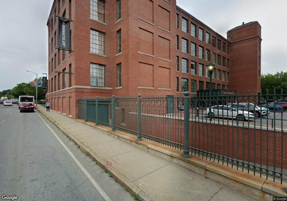
491 Dutton St Unit 408 Lowell, MA 01854
Acre NeighborhoodEstimated Value: $506,000 - $589,000
2
Beds
2
Baths
1,300
Sq Ft
$420/Sq Ft
Est. Value
About This Home
This home is located at 491 Dutton St Unit 408, Lowell, MA 01854 and is currently estimated at $545,602, approximately $419 per square foot. 491 Dutton St Unit 408 is a home located in Middlesex County with nearby schools including Charlotte M. Murkland Elementary School, Abraham Lincoln Elementary School, and Charles W. Morey Elementary School.
Ownership History
Date
Name
Owned For
Owner Type
Purchase Details
Closed on
Aug 10, 2022
Sold by
Fisher Peter F and Fisher Lori A
Bought by
491-408 Dutton Street Rt and Fisher
Current Estimated Value
Purchase Details
Closed on
Dec 6, 2012
Sold by
Loft Props Llc
Bought by
Fisher Peter F and Fisher Lori A
Home Financials for this Owner
Home Financials are based on the most recent Mortgage that was taken out on this home.
Original Mortgage
$95,000
Interest Rate
3.46%
Mortgage Type
New Conventional
Create a Home Valuation Report for This Property
The Home Valuation Report is an in-depth analysis detailing your home's value as well as a comparison with similar homes in the area
Home Values in the Area
Average Home Value in this Area
Purchase History
| Date | Buyer | Sale Price | Title Company |
|---|---|---|---|
| 491-408 Dutton Street Rt | -- | None Available | |
| Fisher Peter F | $400,000 | -- |
Source: Public Records
Mortgage History
| Date | Status | Borrower | Loan Amount |
|---|---|---|---|
| Previous Owner | Fisher Peter F | $95,000 |
Source: Public Records
Tax History
| Year | Tax Paid | Tax Assessment Tax Assessment Total Assessment is a certain percentage of the fair market value that is determined by local assessors to be the total taxable value of land and additions on the property. | Land | Improvement |
|---|---|---|---|---|
| 2025 | $6,019 | $524,300 | $0 | $524,300 |
| 2024 | $5,286 | $443,800 | $0 | $443,800 |
| 2023 | $6,083 | $489,800 | $0 | $489,800 |
| 2022 | $5,771 | $454,800 | $0 | $454,800 |
| 2021 | $6,400 | $475,500 | $0 | $475,500 |
| 2020 | $6,390 | $478,300 | $0 | $478,300 |
| 2019 | $6,300 | $448,700 | $0 | $448,700 |
| 2018 | $4,873 | $415,600 | $0 | $415,600 |
| 2017 | $4,967 | $332,900 | $0 | $332,900 |
| 2016 | $5,336 | $352,000 | $0 | $352,000 |
| 2015 | $5,633 | $363,900 | $0 | $363,900 |
| 2013 | $1,421 | $94,700 | $0 | $94,700 |
Source: Public Records
Map
Nearby Homes
- 491 Dutton St Unit 305
- 491 Dutton St Unit 409
- 491 Dutton St Unit 504
- 278-316 Middlesex St
- 45 Marshall St
- 200 Market St Unit 3010
- 200 Market St Unit 44B
- 200 Market St Unit 619
- 200 Market St Unit 3308
- 200 Market St Unit 115
- 200 Market St Unit 501
- 200 Market St Unit 103
- 42 Branch St
- 191 Thorndike St Unit 26
- 61 Market St Unit 2B
- 201 Thorndike St Unit 501
- 201 Thorndike St Unit 2-312
- 201 Thorndike St Unit 505
- 206 Cross St
- 15 Varney St
- 491 Dutton St Unit 414
- 491 Dutton St Unit 520
- 491 Dutton St Unit 416
- 491 Dutton St Unit 413
- 491 Dutton St Unit 517
- 491 Dutton St Unit 303
- 491 Dutton St Unit 521
- 491 Dutton St Unit 319
- 491 Dutton St Unit 318
- 491 Dutton St Unit 417
- 491 Dutton St Unit 316
- 491 Dutton St Unit 315
- 491 Dutton St Unit 412
- 491 Dutton St Unit 313
- 491 Dutton St Unit 314
- 491 Dutton St Unit 418
- 491 Dutton St Unit 410
- 491 Dutton St Unit 407
- 491 Dutton St Unit 406
- 491 Dutton St Unit 405
Your Personal Tour Guide
Ask me questions while you tour the home.