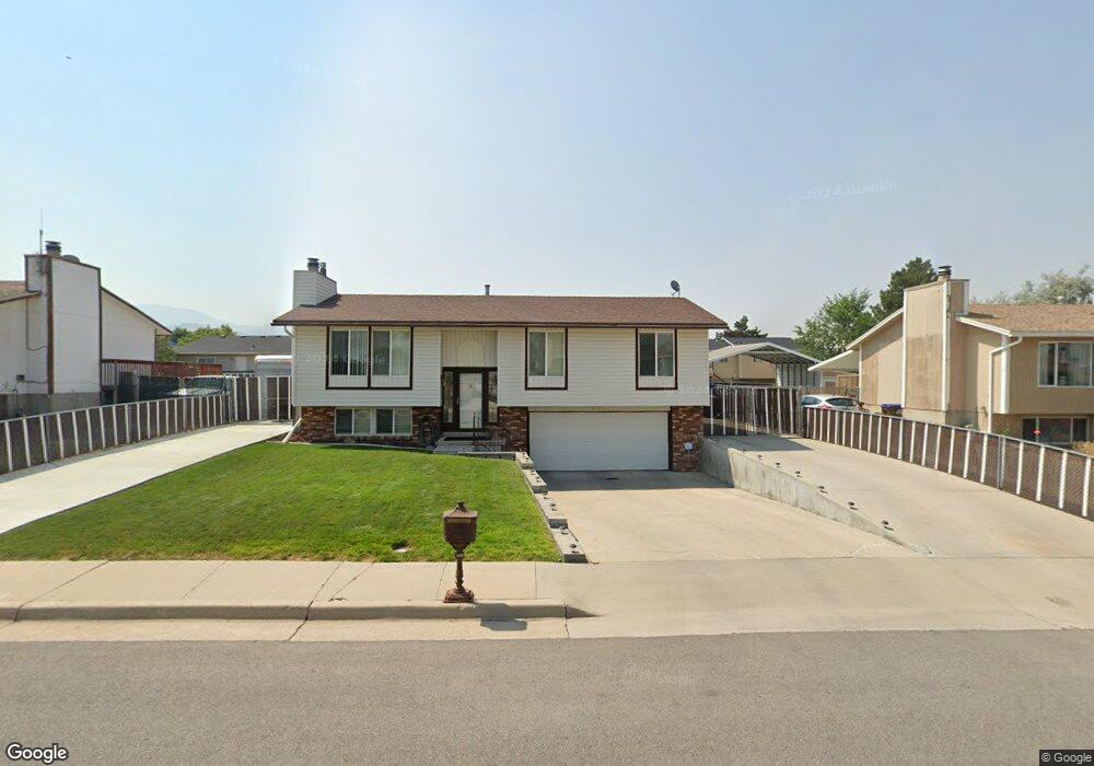
491 Havasu St Tooele, UT 84074
Estimated Value: $364,000 - $391,000
3
Beds
2
Baths
1,632
Sq Ft
$232/Sq Ft
Est. Value
About This Home
This home is located at 491 Havasu St, Tooele, UT 84074 and is currently estimated at $378,285, approximately $231 per square foot. 491 Havasu St is a home located in Tooele County with nearby schools including Northlake Elementary School, Tooele Junior High School, and Tooele High School.
Ownership History
Date
Name
Owned For
Owner Type
Purchase Details
Closed on
Dec 20, 2024
Sold by
Morgan Larry Kay and Morgan Cheryl Rae
Bought by
Morgan Family Revocable Living Trust and Morgan
Current Estimated Value
Purchase Details
Closed on
Mar 28, 2014
Sold by
Morgan Larry K and Morgan Cheryl R
Bought by
Morgan Larry K and Morgan Cheryl R
Create a Home Valuation Report for This Property
The Home Valuation Report is an in-depth analysis detailing your home's value as well as a comparison with similar homes in the area
Purchase History
| Date | Buyer | Sale Price | Title Company |
|---|---|---|---|
| Morgan Family Revocable Living Trust | -- | None Listed On Document | |
| Morgan Larry Kay | -- | None Listed On Document | |
| Morgan Larry K | -- | Tooele Title Co |
Source: Public Records
Tax History
| Year | Tax Paid | Tax Assessment Tax Assessment Total Assessment is a certain percentage of the fair market value that is determined by local assessors to be the total taxable value of land and additions on the property. | Land | Improvement |
|---|---|---|---|---|
| 2025 | $2,487 | $377,237 | $100,000 | $277,237 |
| 2024 | $2,733 | $208,637 | $55,000 | $153,637 |
| 2023 | $2,733 | $203,757 | $52,383 | $151,374 |
| 2022 | $2,366 | $203,528 | $66,110 | $137,418 |
| 2021 | $1,924 | $138,442 | $20,763 | $117,679 |
| 2020 | $1,819 | $227,097 | $37,750 | $189,347 |
| 2019 | $1,684 | $206,810 | $37,750 | $169,060 |
| 2018 | $1,468 | $170,883 | $30,000 | $140,883 |
| 2017 | $1,237 | $170,883 | $30,000 | $140,883 |
| 2016 | $930 | $76,309 | $15,125 | $61,184 |
| 2015 | $930 | $67,608 | $0 | $0 |
| 2014 | -- | $67,608 | $0 | $0 |
Source: Public Records
Map
Nearby Homes
- 591 W 400 N
- 832 N 250 W Unit C
- 848 N 250 W Unit C
- 387 N 200 W
- 225 230 N
- 307 N 200 W
- 342 W 600 N Unit 45
- 322 W 600 N Unit 47
- 322 W 600 N
- 454 W 2520 N
- 343 W 630 North St Unit 18
- 634 N 640 W
- 333 W 630 North St Unit 17
- 343 W 630 N
- 374 W 630 N
- 374 W 630 North St Unit 10
- 323 W 630 North St Unit 16
- 323 W 630 N
- 344 W 630 N Unit 13
- 334 W 630 North St Unit 14
Your Personal Tour Guide
Ask me questions while you tour the home.