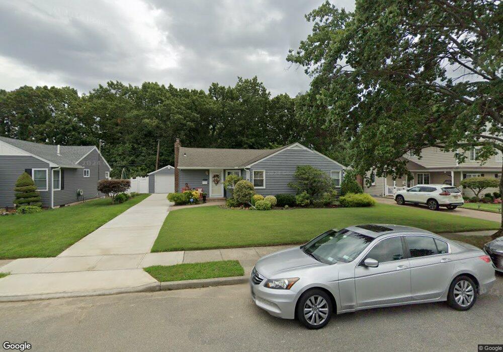
491 Lawrence Rd West Hempstead, NY 11552
Estimated Value: $793,108 - $847,000
3
Beds
2
Baths
1,184
Sq Ft
$693/Sq Ft
Est. Value
About This Home
This home is located at 491 Lawrence Rd, West Hempstead, NY 11552 and is currently estimated at $820,054, approximately $692 per square foot. 491 Lawrence Rd is a home located in Nassau County with nearby schools including Hebrew Academy of Nassau County (HANC).
Ownership History
Date
Name
Owned For
Owner Type
Purchase Details
Closed on
Aug 8, 2014
Sold by
Bonanno Frances
Bought by
Haye Italee
Current Estimated Value
Home Financials for this Owner
Home Financials are based on the most recent Mortgage that was taken out on this home.
Original Mortgage
$307,500
Outstanding Balance
$234,293
Interest Rate
4.09%
Mortgage Type
New Conventional
Estimated Equity
$585,761
Purchase Details
Closed on
Jan 23, 2008
Sold by
Covino Joseph
Bought by
Bonanno Frances
Purchase Details
Closed on
Dec 22, 2005
Sold by
Naidich James
Create a Home Valuation Report for This Property
The Home Valuation Report is an in-depth analysis detailing your home's value as well as a comparison with similar homes in the area
Home Values in the Area
Average Home Value in this Area
Purchase History
| Date | Buyer | Sale Price | Title Company |
|---|---|---|---|
| Haye Italee | $410,000 | Judicial Title | |
| Bonanno Frances | $435,000 | -- | |
| Bonanno Frances | $435,000 | -- | |
| -- | $458,000 | -- |
Source: Public Records
Mortgage History
| Date | Status | Borrower | Loan Amount |
|---|---|---|---|
| Open | Haye Italee | $307,500 |
Source: Public Records
Tax History Compared to Growth
Tax History
| Year | Tax Paid | Tax Assessment Tax Assessment Total Assessment is a certain percentage of the fair market value that is determined by local assessors to be the total taxable value of land and additions on the property. | Land | Improvement |
|---|---|---|---|---|
| 2025 | $11,437 | $511 | $291 | $220 |
| 2024 | $4,698 | $507 | $291 | $216 |
| 2023 | $11,135 | $479 | $273 | $206 |
| 2022 | $11,135 | $511 | $291 | $220 |
| 2021 | $16,362 | $502 | $286 | $216 |
| 2020 | $13,710 | $898 | $565 | $333 |
| 2019 | $14,212 | $898 | $565 | $333 |
| 2018 | $13,326 | $898 | $0 | $0 |
| 2017 | $7,474 | $898 | $565 | $333 |
| 2016 | $12,041 | $898 | $565 | $333 |
| 2015 | $3,728 | $898 | $565 | $333 |
| 2014 | $3,728 | $898 | $565 | $333 |
| 2013 | $3,472 | $898 | $565 | $333 |
Source: Public Records
Map
Nearby Homes
- 600 Dogwood Ave
- 576 Western Park Dr
- 757 Marion St
- 350 Paul Place
- 791 Caryl St
- 518 Nassau Blvd
- 708 Anderson Ave
- 582 Gaynor Place
- 19 Richard St
- 279 Semton Blvd
- 303 Nassau Blvd
- 613 Adams Ave
- 635 Hempstead Ave
- 590 Langley Ave
- 231 Dogwood Ave
- 850 First Ave
- 726 Meisser St
- 249 Grange St
- 537 Madison Ave
- 816 Anderson Ave
- 497 Lawrence Rd
- 485 Lawrence Rd
- 503 Lawrence Rd
- 479 Lawrence Rd
- 496 Lawrence Rd
- 490 Lawrence Rd
- 484 Lawrence Rd
- 502 Lawrence Rd
- 515 Lawrence Rd
- 591 Edward Terrace
- 585 Edward Terrace
- 508 Lawrence Rd
- 478 Lawrence Rd
- 465 Lawrence Rd
- 579 Edward Terrace
- 590 Buxton Ave
- 584 Buxton Ave
- 596 Buxton Ave
- 493 Dogwood Ave
- 499 Dogwood Ave