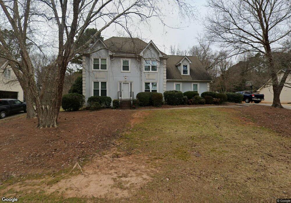
491 Shore Dr Unit 1 Suwanee, GA 30024
Estimated Value: $459,375 - $497,000
3
Beds
3
Baths
2,930
Sq Ft
$162/Sq Ft
Est. Value
About This Home
This home is located at 491 Shore Dr Unit 1, Suwanee, GA 30024 and is currently estimated at $475,094, approximately $162 per square foot. 491 Shore Dr Unit 1 is a home located in Gwinnett County with nearby schools including Walnut Grove Elementary School, Creekland Middle School, and Collins Hill High School.
Ownership History
Date
Name
Owned For
Owner Type
Purchase Details
Closed on
Apr 15, 1999
Sold by
Hogan Libby E
Bought by
Horridge Steven M and Horridge Julie
Current Estimated Value
Home Financials for this Owner
Home Financials are based on the most recent Mortgage that was taken out on this home.
Original Mortgage
$139,150
Outstanding Balance
$34,041
Interest Rate
7.13%
Mortgage Type
New Conventional
Estimated Equity
$441,053
Create a Home Valuation Report for This Property
The Home Valuation Report is an in-depth analysis detailing your home's value as well as a comparison with similar homes in the area
Home Values in the Area
Average Home Value in this Area
Purchase History
| Date | Buyer | Sale Price | Title Company |
|---|---|---|---|
| Horridge Steven M | $146,500 | -- |
Source: Public Records
Mortgage History
| Date | Status | Borrower | Loan Amount |
|---|---|---|---|
| Open | Horridge Steven M | $139,150 |
Source: Public Records
Tax History Compared to Growth
Tax History
| Year | Tax Paid | Tax Assessment Tax Assessment Total Assessment is a certain percentage of the fair market value that is determined by local assessors to be the total taxable value of land and additions on the property. | Land | Improvement |
|---|---|---|---|---|
| 2025 | $4,714 | $185,840 | $28,000 | $157,840 |
| 2024 | $4,243 | $156,200 | $31,600 | $124,600 |
| 2023 | $4,243 | $156,200 | $31,600 | $124,600 |
| 2022 | $3,964 | $144,360 | $26,000 | $118,360 |
| 2021 | $3,664 | $126,720 | $26,000 | $100,720 |
| 2020 | $3,536 | $119,440 | $26,000 | $93,440 |
| 2019 | $3,304 | $112,000 | $19,600 | $92,400 |
| 2018 | $3,036 | $99,440 | $19,600 | $79,840 |
| 2016 | $3,062 | $99,440 | $19,600 | $79,840 |
| 2015 | $2,839 | $88,320 | $19,600 | $68,720 |
| 2014 | -- | $88,320 | $19,600 | $68,720 |
Source: Public Records
Map
Nearby Homes
- 2315 Prosperity Way Unit 2
- 318 Arbour Way Unit 4
- 327 Lee Miller Dr
- 318 Lee Miller Dr
- 267 Arbour Way
- 1953 Frisco Way
- 619 Kenridge Way
- 2305 Compton Place
- 2538 Brynfield Cove
- 2140 Deer Trail
- 2372 Merrymount Dr Unit 2
- 487 Danville Ave
- 2265 Wildwood Lake Dr
- 620 Telfair Ct
- 2470 Jakin Way
- 2689 Richmond Row Dr
- 2538 Brentmoor Ct
- 481 Shore Dr
- 501 Shore Dr
- 471 Shore Dr
- 500 Shore Dr
- 511 Shore Dr
- 418 Arbour Run
- 408 Arbour Run
- 470 Shore Dr
- 461 Shore Dr Unit 1
- 520 Shore Dr
- 521 Shore Dr
- 385 Wesfork Way Unit 2
- 398 Arbour Run
- 460 Shore Dr
- 395 Wesfork Way Unit 2
- 451 Shore Dr
- 375 Wesfork Way
- 541 Richland Pkwy
- 388 Arbour Run
- 458 Arbour Run