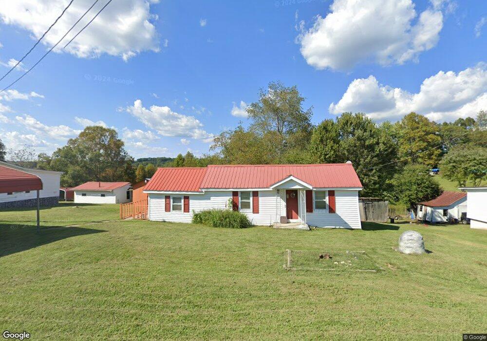
491 Slate Rd Mount Airy, NC 27030
Estimated Value: $110,882 - $174,000
2
Beds
1
Bath
984
Sq Ft
$151/Sq Ft
Est. Value
About This Home
This home is located at 491 Slate Rd, Mount Airy, NC 27030 and is currently estimated at $148,971, approximately $151 per square foot. 491 Slate Rd is a home with nearby schools including Flat Rock Elementary School, Meadowview Magnet Middle School, and North Surry High School.
Ownership History
Date
Name
Owned For
Owner Type
Purchase Details
Closed on
May 6, 2025
Sold by
King Kermit R and King Brenda Honeycutt
Bought by
King Kermit Roland and Honeycutt King Brenda
Current Estimated Value
Purchase Details
Closed on
Nov 1, 1969
Create a Home Valuation Report for This Property
The Home Valuation Report is an in-depth analysis detailing your home's value as well as a comparison with similar homes in the area
Home Values in the Area
Average Home Value in this Area
Purchase History
| Date | Buyer | Sale Price | Title Company |
|---|---|---|---|
| King Kermit Roland | $10,000 | None Listed On Document | |
| King Kermit Roland | $10,000 | None Listed On Document | |
| -- | -- | -- |
Source: Public Records
Tax History Compared to Growth
Tax History
| Year | Tax Paid | Tax Assessment Tax Assessment Total Assessment is a certain percentage of the fair market value that is determined by local assessors to be the total taxable value of land and additions on the property. | Land | Improvement |
|---|---|---|---|---|
| 2025 | $371 | $67,130 | $6,000 | $61,130 |
| 2024 | $306 | $38,680 | $6,000 | $32,680 |
| 2023 | $302 | $38,680 | $6,000 | $32,680 |
| 2022 | $302 | $38,680 | $6,000 | $32,680 |
| 2021 | $306 | $38,680 | $6,000 | $32,680 |
| 2020 | $299 | $36,380 | $6,000 | $30,380 |
| 2019 | $296 | $36,380 | $0 | $0 |
| 2018 | $291 | $36,380 | $0 | $0 |
| 2017 | $288 | $36,380 | $0 | $0 |
| 2016 | $285 | $36,380 | $0 | $0 |
| 2013 | -- | $34,810 | $0 | $0 |
Source: Public Records
Map
Nearby Homes
- 845 Linville Rd
- 663 Mcbride Rd
- 1769 Inglebrook Trail
- 00 Jackson Rd Unit 8.64 Ac
- 1694 Woodbury Ln
- 335 Badgett Ave
- 1816 Gwyn St
- 607 Riverside Dr
- 234 Hylton St
- 280 Burke Rd
- 0 Jackson Rd
- 00 Paynetown Rd
- 2638 Riverside Dr
- 344 Linville Rd
- 1709 N Main St
- 1709 N Main St Unit A-1
- 316 Linville Rd
- 0 Woodruff St
- 105 Grace St
- 2029 N Main St