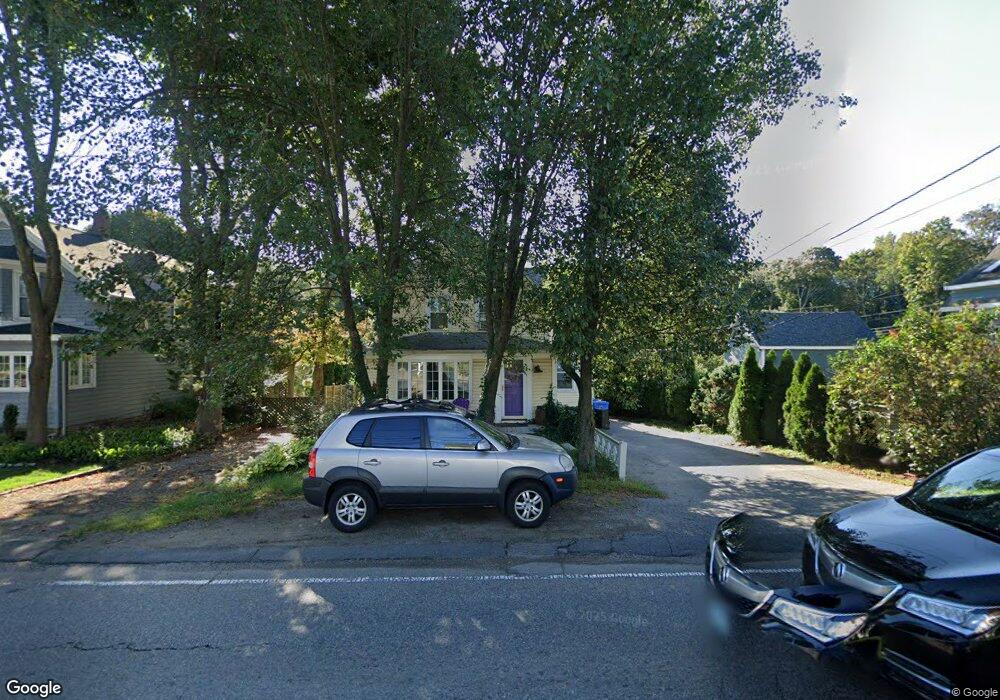
491 South St Wrentham, MA 02093
Estimated Value: $502,000 - $582,000
3
Beds
2
Baths
1,103
Sq Ft
$487/Sq Ft
Est. Value
About This Home
This home is located at 491 South St, Wrentham, MA 02093 and is currently estimated at $536,815, approximately $486 per square foot. 491 South St is a home located in Norfolk County with nearby schools including Delaney Elementary School and Charles E Roderick.
Ownership History
Date
Name
Owned For
Owner Type
Purchase Details
Closed on
Sep 5, 1990
Sold by
Sylvia K Est Hoyle
Bought by
Wilson John M
Current Estimated Value
Create a Home Valuation Report for This Property
The Home Valuation Report is an in-depth analysis detailing your home's value as well as a comparison with similar homes in the area
Home Values in the Area
Average Home Value in this Area
Purchase History
| Date | Buyer | Sale Price | Title Company |
|---|---|---|---|
| Wilson John M | $145,000 | -- |
Source: Public Records
Mortgage History
| Date | Status | Borrower | Loan Amount |
|---|---|---|---|
| Open | Wilson John M | $294,000 | |
| Closed | Wilson John M | $22,235 | |
| Closed | Wilson John M | $17,000 |
Source: Public Records
Tax History Compared to Growth
Tax History
| Year | Tax Paid | Tax Assessment Tax Assessment Total Assessment is a certain percentage of the fair market value that is determined by local assessors to be the total taxable value of land and additions on the property. | Land | Improvement |
|---|---|---|---|---|
| 2025 | $5,610 | $484,000 | $235,800 | $248,200 |
| 2024 | $5,042 | $420,200 | $235,800 | $184,400 |
| 2023 | $4,835 | $383,100 | $214,300 | $168,800 |
| 2022 | $4,739 | $346,700 | $208,500 | $138,200 |
| 2021 | $4,643 | $330,000 | $194,900 | $135,100 |
| 2020 | $4,238 | $297,400 | $148,700 | $148,700 |
| 2019 | $4,144 | $293,500 | $148,700 | $144,800 |
| 2018 | $3,569 | $250,600 | $148,800 | $101,800 |
| 2017 | $3,427 | $240,500 | $145,900 | $94,600 |
| 2016 | $3,352 | $234,700 | $141,700 | $93,000 |
| 2015 | $3,348 | $223,500 | $136,200 | $87,300 |
| 2014 | $3,338 | $218,000 | $131,000 | $87,000 |
Source: Public Records
Map
Nearby Homes
- Lot 1 - Blueberry 2 Car Plan at King Philip Estates
- Lot 8 - Blueberry 2 Car Plan at King Philip Estates
- Lot 5 - Hughes 2 car Plan at King Philip Estates
- Lot 6 - Blueberry 3 Car Plan at King Philip Estates
- Lot 2 - Camden 2 Car Plan at King Philip Estates
- Lot 7 - Cedar Plan at King Philip Estates
- Lot 4 - Hemingway 2 Car Plan at King Philip Estates
- Lot 3 - Blueberry 2 Car Plan at King Philip Estates
- Lot 3 - 14 Earle Stewart Ln
- 11 Earle Stewart Ln
- 131 Creek St Unit 7
- 791 South St Unit 5
- 319 Taunton St
- 10 Nature View Dr
- 15 Nature View Dr
- 570 Franklin St
- 1204 South St
- 1222 South St
- 362 East St
- 1 Lorraine Metcalf Dr
- 485 South St
- 499 South St
- 13 Beach St
- 483 South St
- 490 South St Unit 2
- 490 South St
- 490 South St Unit 1
- 490 South St Unit 3
- 479 South St
- 513 South St
- 513 South St Unit 201
- 513 South St Unit 202
- 513 South St Unit 205
- 513 South St Unit 203
- 513 South St Unit 204
- LOT 2 Gibbons Ln
- 2 Gibbons Ln
- 1 Gibbons Ln
- 4 Gibbons Ln
- 25 Beach St