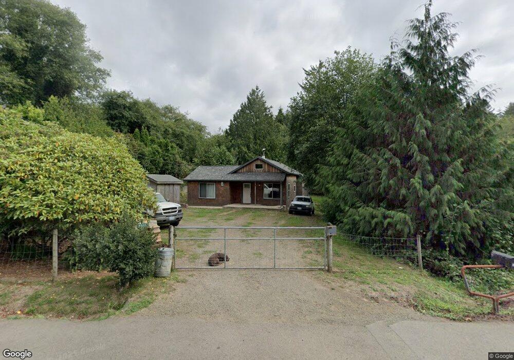
4910 Netarts Hwy W Tillamook, OR 97141
Estimated Value: $360,291 - $404,000
2
Beds
1
Bath
928
Sq Ft
$419/Sq Ft
Est. Value
About This Home
This home is located at 4910 Netarts Hwy W, Tillamook, OR 97141 and is currently estimated at $388,573, approximately $418 per square foot. 4910 Netarts Hwy W is a home located in Tillamook County with nearby schools including Tillamook High School.
Ownership History
Date
Name
Owned For
Owner Type
Purchase Details
Closed on
Nov 21, 2025
Sold by
Winslow Justin E
Bought by
Winslow Kristin V
Current Estimated Value
Home Financials for this Owner
Home Financials are based on the most recent Mortgage that was taken out on this home.
Original Mortgage
$230,000
Outstanding Balance
$230,000
Interest Rate
6.19%
Mortgage Type
New Conventional
Estimated Equity
$158,573
Purchase Details
Closed on
Jul 8, 2005
Sold by
Sullivan Joel M and Sullivan Jeanette
Bought by
Winslow Justin E and Winslow Kristin
Home Financials for this Owner
Home Financials are based on the most recent Mortgage that was taken out on this home.
Original Mortgage
$31,000
Interest Rate
5.58%
Mortgage Type
Stand Alone Second
Create a Home Valuation Report for This Property
The Home Valuation Report is an in-depth analysis detailing your home's value as well as a comparison with similar homes in the area
Home Values in the Area
Average Home Value in this Area
Purchase History
| Date | Buyer | Sale Price | Title Company |
|---|---|---|---|
| Winslow Kristin V | -- | Wfg Title | |
| Winslow Justin E | $155,000 | Ticor Title Ins Co |
Source: Public Records
Mortgage History
| Date | Status | Borrower | Loan Amount |
|---|---|---|---|
| Open | Winslow Kristin V | $230,000 | |
| Previous Owner | Winslow Justin E | $31,000 | |
| Previous Owner | Winslow Justin E | $124,000 |
Source: Public Records
Tax History Compared to Growth
Tax History
| Year | Tax Paid | Tax Assessment Tax Assessment Total Assessment is a certain percentage of the fair market value that is determined by local assessors to be the total taxable value of land and additions on the property. | Land | Improvement |
|---|---|---|---|---|
| 2024 | $1,542 | $121,690 | $64,400 | $57,290 |
| 2023 | $1,536 | $118,150 | $62,530 | $55,620 |
| 2022 | $1,493 | $114,710 | $60,710 | $54,000 |
| 2021 | $1,459 | $111,370 | $58,940 | $52,430 |
| 2020 | $1,427 | $108,130 | $57,230 | $50,900 |
| 2019 | $1,465 | $104,990 | $55,570 | $49,420 |
| 2018 | $1,437 | $101,940 | $53,960 | $47,980 |
| 2017 | $1,411 | $98,980 | $52,400 | $46,580 |
| 2016 | $1,369 | $96,100 | $50,880 | $45,220 |
| 2015 | $1,349 | $93,310 | $49,410 | $43,900 |
| 2014 | $1,334 | $90,600 | $47,980 | $42,620 |
| 2013 | -- | $87,970 | $46,590 | $41,380 |
Source: Public Records
Map
Nearby Homes
- 1540 Vista View Dr W
- 218 Holly Heights Ave
- 223 Holly Heights Ave
- 224 Holly Heights Ave
- 0 Tl 3800 Unit 479246395
- TL 3800 Vista View Dr W
- 4803 Holly Heights Ave
- 4900 Clam Way
- 4850 Netarts Hwy W Unit 6
- 4805 Leonard St W
- 4830 Netarts Hwy W
- 925 Happy Camp Rd W
- 4745 Netarts Hwy W
- 0 Moondancer Ln Unit 25-198
- 0 Moondancer Ln Unit 62
- 0 Netarts Oceanside Hwy W Unit 2Lots 24315118
- 0 Netarts Oceanside Hwy W Unit 2500&2600 23-95
- 4380 Sequoia Loop
- 1960 Alder Cove Rd W
- 1480 Emerald Ln
- 4900 Netarts Hwy W
- 2085 Pearl St W
- 4924 Netarts Hwy W
- 1295 Pearl St W
- 4890 Netarts Hwy W
- VL Pearl St
- 4896 Holly Heights Ave
- 1400 Vista View Dr W
- 4430 Netarts Hwy W
- 4930 Netarts Hwy W Unit B
- 4930 Netarts Hwy W Unit Netarts
- 1290 5th Street Loop W
- 1355 Phelps Ave W
- 0 Pearl Parcel 3 St Unit 20-832
- 0 Pearl Parcel 3 St Unit 20-478
- 4835 Phelps St
- 1275 Phelps Ave W
- 4773 Holly Heights Ave Unit 18
- 1510 Vista View Dr W
- 000 Three Capes Scenic Route