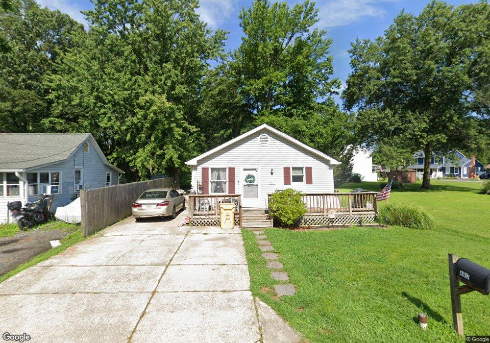
4912 Olive St Shady Side, MD 20764
Estimated Value: $318,000 - $385,000
3
Beds
2
Baths
960
Sq Ft
$363/Sq Ft
Est. Value
About This Home
This home is located at 4912 Olive St, Shady Side, MD 20764 and is currently estimated at $348,440, approximately $362 per square foot. 4912 Olive St is a home located in Anne Arundel County with nearby schools including Shady Side Elementary School, Southern Middle School, and Southern High School.
Ownership History
Date
Name
Owned For
Owner Type
Purchase Details
Closed on
Apr 21, 2006
Sold by
Furman Irving M
Bought by
Knee Ivan J and Knee Beverly S
Current Estimated Value
Home Financials for this Owner
Home Financials are based on the most recent Mortgage that was taken out on this home.
Original Mortgage
$212,000
Outstanding Balance
$123,649
Interest Rate
6.62%
Mortgage Type
Purchase Money Mortgage
Estimated Equity
$224,791
Purchase Details
Closed on
Sep 16, 2003
Sold by
Eskew Paula M
Bought by
Furman Irving M
Purchase Details
Closed on
Mar 31, 1998
Sold by
Layne Nancy M
Bought by
Eskew Paula M
Create a Home Valuation Report for This Property
The Home Valuation Report is an in-depth analysis detailing your home's value as well as a comparison with similar homes in the area
Home Values in the Area
Average Home Value in this Area
Purchase History
| Date | Buyer | Sale Price | Title Company |
|---|---|---|---|
| Knee Ivan J | $265,000 | -- | |
| Furman Irving M | $165,000 | -- | |
| Eskew Paula M | $113,000 | -- |
Source: Public Records
Mortgage History
| Date | Status | Borrower | Loan Amount |
|---|---|---|---|
| Open | Knee Ivan J | $212,000 | |
| Closed | Furman Irving M | -- |
Source: Public Records
Tax History
| Year | Tax Paid | Tax Assessment Tax Assessment Total Assessment is a certain percentage of the fair market value that is determined by local assessors to be the total taxable value of land and additions on the property. | Land | Improvement |
|---|---|---|---|---|
| 2025 | $3,238 | $264,767 | -- | -- |
| 2024 | $3,238 | $249,833 | $0 | $0 |
| 2023 | $3,039 | $234,900 | $136,100 | $98,800 |
| 2022 | $2,850 | $231,567 | $0 | $0 |
| 2020 | $2,740 | $224,900 | $136,100 | $88,800 |
| 2019 | $2,637 | $214,833 | $0 | $0 |
| 2018 | $132 | $204,767 | $0 | $0 |
| 2017 | $2,367 | $194,700 | $0 | $0 |
| 2016 | $132 | $190,767 | $0 | $0 |
| 2015 | $132 | $186,833 | $0 | $0 |
| 2014 | -- | $182,900 | $0 | $0 |
Source: Public Records
Map
Nearby Homes
- 1209 Johnson Dr
- 1161 Steamboat Rd
- 4907 Quince St
- 1205 Avalon Blvd
- 4908 Aspen St
- 1241 Steamboat Rd
- 1225 Juniper St
- 4951 Dogwood St
- 1306 Spruce St
- 1330 Jordan Dr
- 0 Riverside Dr Unit C4 MDAA2119968
- 1340 E West Shady Side Rd
- 1419 Shady Rest Rd
- 4846 Woods Wharf Rd
- 1462 Snug Harbor Rd
- 1379 McDonald Rd
- 1006 Henry Ave
- 1451 Shady Rest Rd
- 1006 Allen Ave
- Lot 2 Benning Rd
Your Personal Tour Guide
Ask me questions while you tour the home.