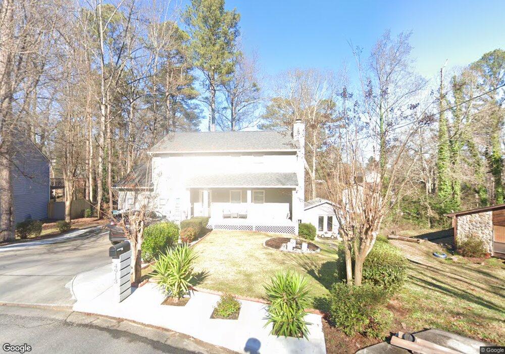
4913 Brookside Way Unit 1 Duluth, GA 30096
Estimated Value: $445,000 - $467,000
3
Beds
3
Baths
2,132
Sq Ft
$214/Sq Ft
Est. Value
About This Home
This home is located at 4913 Brookside Way Unit 1, Duluth, GA 30096 and is currently estimated at $455,250, approximately $213 per square foot. 4913 Brookside Way Unit 1 is a home located in Gwinnett County with nearby schools including Norcross Elementary School, Summerour Middle School, and Norcross High School.
Ownership History
Date
Name
Owned For
Owner Type
Purchase Details
Closed on
Dec 11, 2025
Sold by
Santana Israel
Bought by
Golden Coast Properties Inc
Current Estimated Value
Home Financials for this Owner
Home Financials are based on the most recent Mortgage that was taken out on this home.
Original Mortgage
$307,500
Outstanding Balance
$307,208
Interest Rate
6.24%
Mortgage Type
Purchase Money Mortgage
Estimated Equity
$148,042
Purchase Details
Closed on
Aug 5, 2003
Sold by
Santana Israel and Santana Guillermo
Bought by
Santana Israel
Purchase Details
Closed on
Jul 13, 1999
Sold by
Wilson James A
Bought by
Santana Brael
Home Financials for this Owner
Home Financials are based on the most recent Mortgage that was taken out on this home.
Original Mortgage
$131,813
Interest Rate
7.43%
Mortgage Type
FHA
Create a Home Valuation Report for This Property
The Home Valuation Report is an in-depth analysis detailing your home's value as well as a comparison with similar homes in the area
Home Values in the Area
Average Home Value in this Area
Purchase History
| Date | Buyer | Sale Price | Title Company |
|---|---|---|---|
| Golden Coast Properties Inc | -- | -- | |
| Santana Israel | -- | -- | |
| Santana Brael | $132,900 | -- |
Source: Public Records
Mortgage History
| Date | Status | Borrower | Loan Amount |
|---|---|---|---|
| Open | Golden Coast Properties Inc | $307,500 | |
| Previous Owner | Santana Brael | $131,813 |
Source: Public Records
Tax History
| Year | Tax Paid | Tax Assessment Tax Assessment Total Assessment is a certain percentage of the fair market value that is determined by local assessors to be the total taxable value of land and additions on the property. | Land | Improvement |
|---|---|---|---|---|
| 2025 | $4,822 | $192,480 | $25,840 | $166,640 |
| 2024 | $5,134 | $200,480 | $24,000 | $176,480 |
| 2023 | $5,134 | $182,920 | $24,000 | $158,920 |
| 2022 | $3,964 | $145,640 | $24,000 | $121,640 |
| 2021 | $2,745 | $84,720 | $12,000 | $72,720 |
| 2020 | $2,763 | $84,720 | $12,000 | $72,720 |
| 2019 | $2,692 | $84,720 | $12,000 | $72,720 |
| 2018 | $2,693 | $84,720 | $12,000 | $72,720 |
| 2016 | $2,551 | $77,080 | $10,000 | $67,080 |
| 2015 | $1,844 | $49,200 | $5,600 | $43,600 |
| 2014 | $1,853 | $49,200 | $5,600 | $43,600 |
Source: Public Records
Map
Nearby Homes
- 2605 Silver Cliff Dr Unit I
- 4979 Old Norcross Rd
- 5063 Micaela Way
- 2621 Village Chase Dr
- 5143 Micaela Way
- 2638 Lake Manor Cir
- 4947 Holbrook Cir
- 4767 Glenwhite Dr
- 2569 Ingram Rd
- 2621 Bailey Dr
- 2504 Havasu Trace
- 4633 Elsinore Cir
- 2755 Greenbridge Dr
- 2775 Greenbridge Dr
- 2496 Redfield Dr
- 4849 Chaucery Ln
- 2431 Player Ct
- 2655 Cambridge Mews Dr
- 5045 Racquet Ct
- 2468 Whistle Stop Dr
- 4923 Brookside Way
- 2594 Silver Cliff Dr Unit LL: DIST:1 SECT:A BL
- 2594 Silver Cliff Dr
- 4903 Brookside Way
- 2585 Silver Cliff Dr
- 4933 Brookside Way
- 2587 Sandy Creek Trail Unit 1
- 4902 Brookside Way
- 2604 Silver Cliff Dr Unit 1
- 4912 Brookside Way
- 4922 Brookside Way
- 2597 Sandy Creek Trail
- 2595 Silver Cliff Dr
- 4932 Brookside Way Unit 1
- 2607 Sandy Creek Trail
- 2471 Chaffin Ridge
- 4942 Brookside Way Unit 1
- 4947 Montford Ct Unit 3
- 2481 Chaffin Ridge Unit 1
- 4926 Old Norcross Rd
Your Personal Tour Guide
Ask me questions while you tour the home.