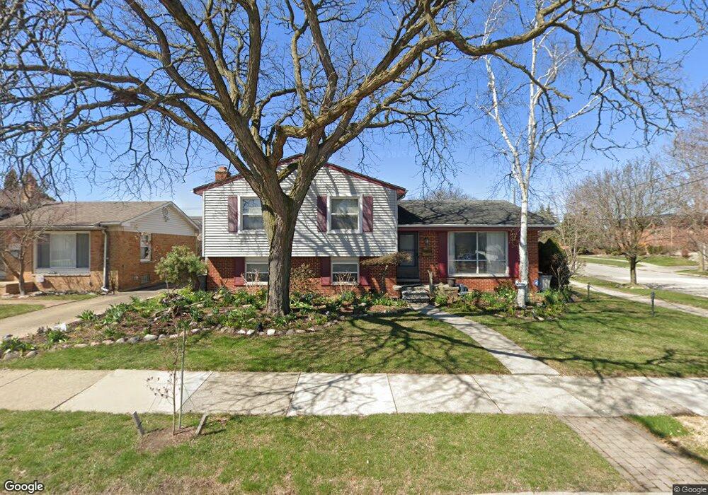
4913 Elmhurst Ave Royal Oak, MI 48073
Estimated Value: $436,107 - $491,000
5
Beds
2
Baths
1,927
Sq Ft
$240/Sq Ft
Est. Value
About This Home
This home is located at 4913 Elmhurst Ave, Royal Oak, MI 48073 and is currently estimated at $463,277, approximately $240 per square foot. 4913 Elmhurst Ave is a home located in Oakland County with nearby schools including Alfred E. Upton Elementary School, Royal Oak Middle School, and Royal Oak High School.
Ownership History
Date
Name
Owned For
Owner Type
Purchase Details
Closed on
May 14, 2004
Sold by
Adams John and Adams Carmen
Bought by
Gesquiere James P
Current Estimated Value
Home Financials for this Owner
Home Financials are based on the most recent Mortgage that was taken out on this home.
Original Mortgage
$200,450
Outstanding Balance
$95,971
Interest Rate
5.91%
Mortgage Type
Purchase Money Mortgage
Estimated Equity
$367,306
Purchase Details
Closed on
Feb 27, 1998
Sold by
Ogurek J Patrick
Bought by
Adams John
Home Financials for this Owner
Home Financials are based on the most recent Mortgage that was taken out on this home.
Original Mortgage
$146,000
Interest Rate
7.23%
Create a Home Valuation Report for This Property
The Home Valuation Report is an in-depth analysis detailing your home's value as well as a comparison with similar homes in the area
Home Values in the Area
Average Home Value in this Area
Purchase History
| Date | Buyer | Sale Price | Title Company |
|---|---|---|---|
| Gesquiere James P | $211,000 | Parks Title | |
| Adams John | $166,000 | -- |
Source: Public Records
Mortgage History
| Date | Status | Borrower | Loan Amount |
|---|---|---|---|
| Open | Gesquiere James P | $200,450 | |
| Previous Owner | Adams John | $146,000 |
Source: Public Records
Tax History Compared to Growth
Tax History
| Year | Tax Paid | Tax Assessment Tax Assessment Total Assessment is a certain percentage of the fair market value that is determined by local assessors to be the total taxable value of land and additions on the property. | Land | Improvement |
|---|---|---|---|---|
| 2024 | $3,146 | $177,560 | $0 | $0 |
| 2022 | $3,717 | $160,450 | $0 | $0 |
| 2020 | $3,057 | $139,260 | $0 | $0 |
| 2018 | $3,717 | $113,300 | $0 | $0 |
| 2017 | $3,573 | $113,300 | $0 | $0 |
| 2015 | -- | $106,650 | $0 | $0 |
| 2014 | -- | $94,980 | $0 | $0 |
| 2011 | -- | $83,880 | $0 | $0 |
Source: Public Records
Map
Nearby Homes
- 4830 Briarwood Ave Unit 2
- 4859 Mansfield Ave Unit H5
- 4820 Briarwood Ave Unit 4
- 4840 Briarwood Ave Unit 8
- 2306 W 14 Mile Rd Unit 14
- 2356 W 14 Mile Rd Unit 1
- 2420 Parmenter Blvd Unit 101
- 2440 Parmenter Blvd Unit 112
- 2425 Torquay Ave Unit 101A
- 4625 Leafdale Ave
- 4921 Crooks Rd Unit M-10
- 4909 Crooks Rd Unit C7
- 4909 Crooks Rd Unit E8
- 4909 Crooks Rd Unit 4
- 4921 N Crooks Rd Unit N-10
- 1823 Torquay Ave
- 2134 Wickham St
- 1936 Torquay Ave Unit 205
- 1807 Samoset Rd
- 496 Langley Blvd
- 4905 Elmhurst Ave
- 4839 Elmhurst Ave
- 5003 Elmhurst Ave
- 4834 Mansfield Ave Unit 9
- 4834 Mansfield Ave Unit 2L 9
- 4833 Elmhurst Ave
- 4912 Elmhurst Ave
- 5009 Elmhurst Ave
- 4904 Elmhurst Ave
- 4838 Elmhurst Ave
- 5002 Elmhurst Ave
- 4827 Elmhurst Ave
- 5015 Elmhurst Ave
- 4832 Elmhurst Ave
- 5008 Elmhurst Ave
- 4859 Mansfield #6
- 4904 Mansfield Ave Unit 14
- 4816 Mansfield Ave Unit Bldg-Unit
- 4821 Mansfield Ave Unit 25
- 4819 Mansfield Ave Unit 24