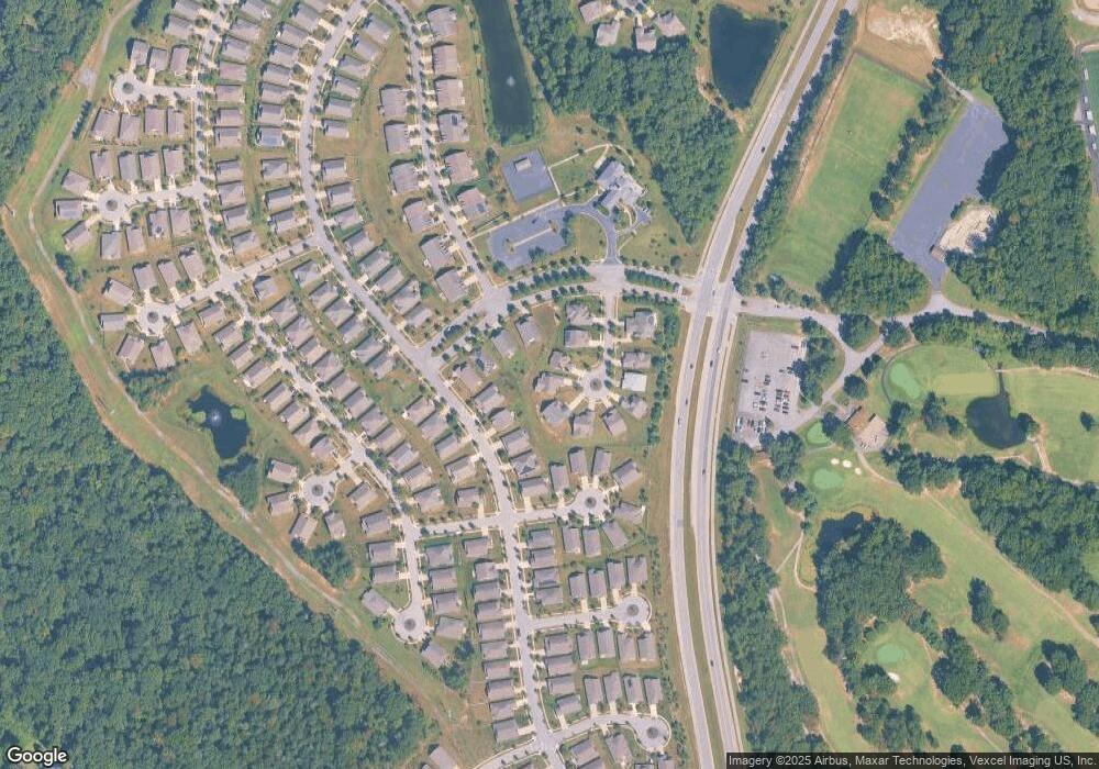
4913 Keswick Ct White Plains, MD 20695
Estimated Value: $507,000 - $527,340
3
Beds
3
Baths
2,772
Sq Ft
$187/Sq Ft
Est. Value
About This Home
This home is located at 4913 Keswick Ct, White Plains, MD 20695 and is currently estimated at $517,085, approximately $186 per square foot. 4913 Keswick Ct is a home located in Charles County with nearby schools including Mary B. Neal Elementary School, Milton M. Somers Middle School, and St. Charles High School.
Ownership History
Date
Name
Owned For
Owner Type
Purchase Details
Closed on
Oct 15, 2007
Sold by
Us Home Corporation
Bought by
Linville Darrell D and Linville Nannie J
Current Estimated Value
Home Financials for this Owner
Home Financials are based on the most recent Mortgage that was taken out on this home.
Original Mortgage
$335,950
Outstanding Balance
$213,016
Interest Rate
6.51%
Mortgage Type
Purchase Money Mortgage
Estimated Equity
$304,069
Purchase Details
Closed on
Oct 5, 2007
Sold by
Us Home Corporation
Bought by
Linville Darrell D and Linville Nannie J
Home Financials for this Owner
Home Financials are based on the most recent Mortgage that was taken out on this home.
Original Mortgage
$335,950
Outstanding Balance
$213,016
Interest Rate
6.51%
Mortgage Type
Purchase Money Mortgage
Estimated Equity
$304,069
Create a Home Valuation Report for This Property
The Home Valuation Report is an in-depth analysis detailing your home's value as well as a comparison with similar homes in the area
Home Values in the Area
Average Home Value in this Area
Purchase History
| Date | Buyer | Sale Price | Title Company |
|---|---|---|---|
| Linville Darrell D | $419,990 | -- | |
| Linville Darrell D | $419,990 | -- |
Source: Public Records
Mortgage History
| Date | Status | Borrower | Loan Amount |
|---|---|---|---|
| Open | Linville Darrell D | $335,950 | |
| Closed | Linville Darrell D | $335,950 |
Source: Public Records
Tax History Compared to Growth
Tax History
| Year | Tax Paid | Tax Assessment Tax Assessment Total Assessment is a certain percentage of the fair market value that is determined by local assessors to be the total taxable value of land and additions on the property. | Land | Improvement |
|---|---|---|---|---|
| 2025 | -- | $429,100 | -- | -- |
| 2024 | $5,146 | $366,300 | $126,100 | $240,200 |
| 2023 | $5,168 | $361,667 | $0 | $0 |
| 2022 | $4,474 | $357,033 | $0 | $0 |
| 2021 | $4,725 | $352,400 | $96,100 | $256,300 |
| 2020 | $4,725 | $341,600 | $0 | $0 |
| 2019 | $4,568 | $330,800 | $0 | $0 |
| 2018 | $4,383 | $320,000 | $90,100 | $229,900 |
| 2017 | $4,375 | $320,000 | $0 | $0 |
| 2016 | -- | $320,000 | $0 | $0 |
| 2015 | $3,470 | $350,600 | $0 | $0 |
| 2014 | $3,470 | $329,800 | $0 | $0 |
Source: Public Records
Map
Nearby Homes
- 4909 Keswick Ct
- 4930 Shoal Creek Ln
- 10701 Millport St
- 11117 Commanders Ln
- 11257 Yellowstone Ct
- 5096 Atlantis Ln
- 4683 Diamond Ridge Ln
- 5149 Atlantis Ln
- 5165 Atlantis Ln
- 11150 Saint Christopher Dr
- 11324 Sandestin Place
- 10631 Roundstone Ln
- 10635 Roundstone Ln
- 10636 Roundstone Ln
- 11009 Barnard Place
- 11007 Barnard Place
- 11287 Saint Christopher Dr
- 10918 Timothy Ct
- 10627 Roundstone Ln
- 10748 Millport St
- 4917 Keswick Ct
- 11219 Saint Edwins Dr
- 11186 Commanders Ln
- 4905 Keswick Ct
- 4921 Keswick Ct
- 11182 Commanders Ln
- 11223 Saint Edwins Dr
- 11190 Commanders Ln
- 11215 Saint Edwins Dr
- 4901 Keswick Ct
- 4920 Keswick Ct
- 11211 Saint Edwins Dr
- 11178 Commanders Ln
- 11189 Commanders Ln
- 11194 Commanders Ln
- 4942 Stonehedge Ct
- 4942 Stonehedge Ct
- 4912 Keswick Ct
- 4916 Keswick Ct
- 4908 Keswick Ct
