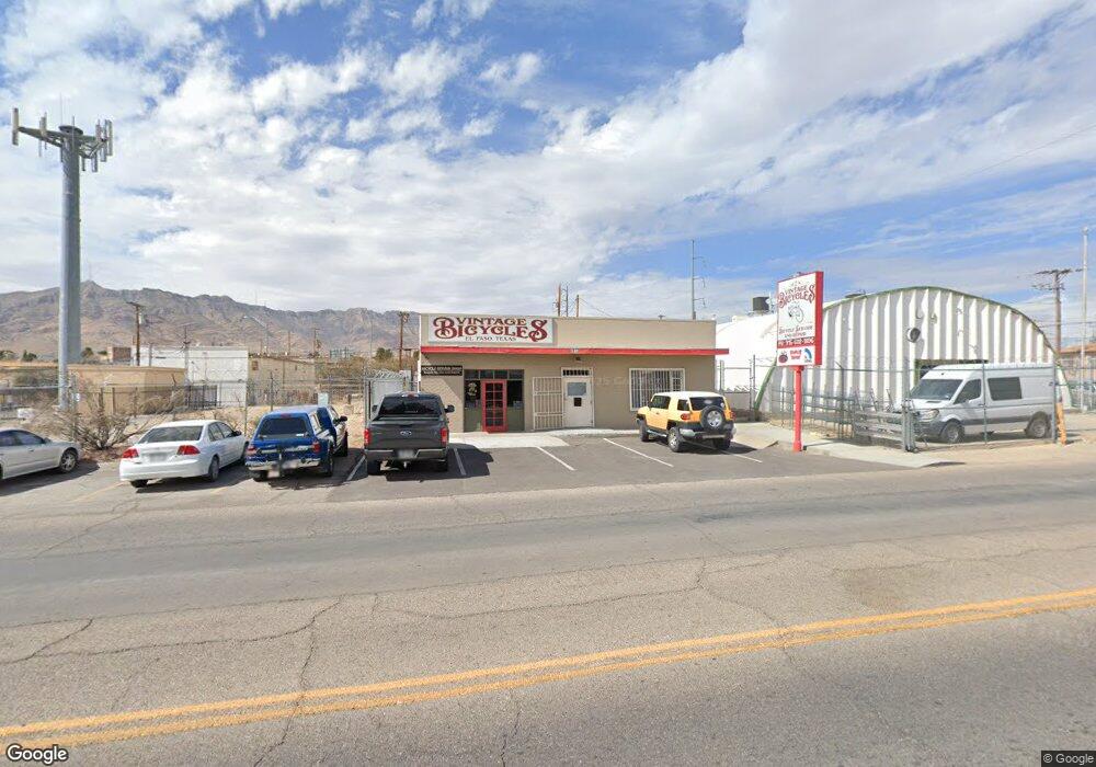
4913 Pershing Dr El Paso, TX 79903
Grandview Neighborhood
--
Bed
--
Bath
2,800
Sq Ft
6,098
Sq Ft Lot
About This Home
This home is located at 4913 Pershing Dr, El Paso, TX 79903. 4913 Pershing Dr is a home located in El Paso County with nearby schools including Coldwell Elementary School, Armendariz Middle School, and Middle School-5 NW Middle.
Ownership History
Date
Name
Owned For
Owner Type
Purchase Details
Closed on
Sep 27, 2013
Sold by
Ep Nevada Partners Llc
Bought by
Southwest First Aid And Safety Supply In
Home Financials for this Owner
Home Financials are based on the most recent Mortgage that was taken out on this home.
Original Mortgage
$128,000
Outstanding Balance
$96,033
Interest Rate
4.46%
Mortgage Type
Purchase Money Mortgage
Purchase Details
Closed on
Sep 13, 2006
Sold by
Malooly Ronald Christopher
Bought by
Ep Nevada Partners Llc
Purchase Details
Closed on
Apr 5, 2006
Sold by
Davis Charles W
Bought by
Malooly Ronald Christopher
Create a Home Valuation Report for This Property
The Home Valuation Report is an in-depth analysis detailing your home's value as well as a comparison with similar homes in the area
Home Values in the Area
Average Home Value in this Area
Purchase History
| Date | Buyer | Sale Price | Title Company |
|---|---|---|---|
| Southwest First Aid And Safety Supply In | -- | None Available | |
| Ep Nevada Partners Llc | -- | None Available | |
| Malooly Ronald Christopher | $95,793 | None Available |
Source: Public Records
Mortgage History
| Date | Status | Borrower | Loan Amount |
|---|---|---|---|
| Open | Southwest First Aid And Safety Supply In | $128,000 |
Source: Public Records
Tax History Compared to Growth
Tax History
| Year | Tax Paid | Tax Assessment Tax Assessment Total Assessment is a certain percentage of the fair market value that is determined by local assessors to be the total taxable value of land and additions on the property. | Land | Improvement |
|---|---|---|---|---|
| 2025 | $4,992 | $192,300 | $21,900 | $170,400 |
| 2024 | $4,992 | $192,300 | $21,900 | $170,400 |
| 2023 | $5,128 | $185,377 | $21,900 | $163,477 |
| 2022 | $5,487 | $185,377 | $21,900 | $163,477 |
| 2021 | $5,788 | $185,377 | $21,900 | $163,477 |
| 2020 | $5,814 | $189,160 | $21,900 | $167,260 |
| 2018 | $3,881 | $131,116 | $21,900 | $109,216 |
| 2017 | $3,595 | $127,637 | $21,900 | $105,737 |
| 2016 | $3,595 | $127,637 | $21,900 | $105,737 |
| 2015 | $2,505 | $127,637 | $21,900 | $105,737 |
| 2014 | $2,505 | $91,549 | $21,900 | $69,649 |
Source: Public Records
Map
Nearby Homes
- 2518 Partello St
- 3905 Nashville Ave
- 3921 Mobile Ave
- 3817 Frankfort Ave
- 4504 Nashville Ave
- 3827 Idalia Ave
- 3816 Hastings Dr
- 3625 Richmond Ave
- 3524 Mobile Ave
- 4620 Frankfort Ave
- 3919 Cumberland Ave
- 4122 Cumberland Ave
- 19 Cumberland Cir
- 4405 Cumberland Ave
- 3921 Nations Ave
- 3427 Hamilton Ave
- 3510 Porter Ave
- 4327 Chester Ave
- 3606 Morehead Ave
- 3327 Mobile Ave
- 2418 Dyer St
- 4912 Pershing Dr
- 4908 Pershing Dr
- 4916 Pershing Dr
- 4904 Pershing Dr
- 5001 Pershing Dr Unit 5005
- 4918 Pershing Dr
- 4111 Memphis Ave
- 4113 Memphis Ave
- 4810 Pershing Dr
- 4110 Memphis Ave
- 4112 Memphis Ave
- 2405 Dyer St
- 4114 Memphis Ave
- 4116 Memphis Ave
- 2700 Corte Del Sol St
- 4105 Frankfort Ave
- 2702 Corte Del Sol St
- 4118 Memphis Ave
- 5023 Pershing Dr