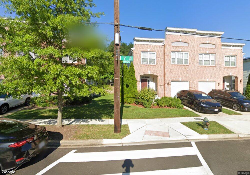
4914 7th St NE Washington, DC 20017
Michigan Park NeighborhoodEstimated Value: $710,605 - $808,000
3
Beds
3
Baths
1,982
Sq Ft
$381/Sq Ft
Est. Value
About This Home
This home is located at 4914 7th St NE, Washington, DC 20017 and is currently estimated at $754,535, approximately $380 per square foot. 4914 7th St NE is a home located in District of Columbia with nearby schools including Bunker Hill Elementary School, Brookland Middle School, and Dunbar High School.
Ownership History
Date
Name
Owned For
Owner Type
Purchase Details
Closed on
Nov 27, 2006
Sold by
K Hovnanian Homes Of Dc
Bought by
Davis Dwight
Current Estimated Value
Home Financials for this Owner
Home Financials are based on the most recent Mortgage that was taken out on this home.
Original Mortgage
$394,300
Outstanding Balance
$234,505
Interest Rate
6.4%
Mortgage Type
New Conventional
Estimated Equity
$520,030
Create a Home Valuation Report for This Property
The Home Valuation Report is an in-depth analysis detailing your home's value as well as a comparison with similar homes in the area
Home Values in the Area
Average Home Value in this Area
Purchase History
| Date | Buyer | Sale Price | Title Company |
|---|---|---|---|
| Davis Dwight | $492,888 | -- |
Source: Public Records
Mortgage History
| Date | Status | Borrower | Loan Amount |
|---|---|---|---|
| Open | Davis Dwight | $394,300 |
Source: Public Records
Tax History
| Year | Tax Paid | Tax Assessment Tax Assessment Total Assessment is a certain percentage of the fair market value that is determined by local assessors to be the total taxable value of land and additions on the property. | Land | Improvement |
|---|---|---|---|---|
| 2025 | $6,248 | $735,110 | $332,070 | $403,040 |
| 2024 | $6,124 | $720,420 | $330,420 | $390,000 |
| 2023 | $5,854 | $688,760 | $321,390 | $367,370 |
| 2022 | $5,507 | $647,860 | $300,330 | $347,530 |
| 2021 | $5,286 | $621,880 | $292,860 | $329,020 |
| 2020 | $5,167 | $607,880 | $287,580 | $320,300 |
| 2019 | $4,853 | $570,940 | $263,070 | $307,870 |
| 2018 | $4,595 | $540,600 | $0 | $0 |
| 2017 | $4,291 | $504,780 | $0 | $0 |
| 2016 | $4,100 | $482,310 | $0 | $0 |
| 2015 | $3,743 | $440,390 | $0 | $0 |
| 2014 | $3,349 | $393,990 | $0 | $0 |
Source: Public Records
Map
Nearby Homes
- 647 Emerson St NE
- 720 Decatur St NE
- 4928 8th St NE
- 724 Crittenden St NE
- 735 Emerson St NE
- 404 Ava Way NE
- 832 Delafield St NE
- 4710 8th St NE
- 5031 S Dakota Ave NE
- 5051 8th St NE
- 838 Buchanan St NE
- 314 Farragut St NW
- 4803 10th St NE
- 500 Hamilton St NE
- 4822 S Dakota Ave NE
- 4911 Sargent Rd NE
- 227 Hawaii Ave NE
- 215 Hawaii Ave NE
- 5035 Sargent Rd NE
- 4306 Varnum Place NE
- 4912 7th St NE
- 4916 7th St NE
- 4910 7th St NE
- 4918 7th St NE
- 4908 7th St NE
- 4920 7th St NE
- 700 Decatur Place NE
- 701 Decatur Place NE
- 4922 7th St NE
- 4906 7th St NE
- 636 Totten Mews NE
- 619 Ava Cir NE
- 702 Decatur Place NE
- 703 Decatur Place NE
- 621 Ava Cir NE
- 634 Totten Mews NE
- 4924 7th St NE
- 4904 7th St NE
- 632 Totten Mews NE
- 623 Ava Cir NE
Your Personal Tour Guide
Ask me questions while you tour the home.