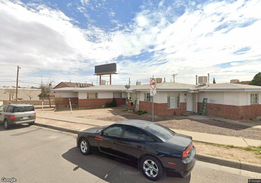
4918 Pershing Dr El Paso, TX 79903
Five Points NeighborhoodEstimated Value: $267,000 - $365,000
--
Bed
4
Baths
3,139
Sq Ft
$101/Sq Ft
Est. Value
About This Home
This home is located at 4918 Pershing Dr, El Paso, TX 79903 and is currently estimated at $316,000, approximately $100 per square foot. 4918 Pershing Dr is a home located in El Paso County with nearby schools including Coldwell Elementary School, Armendariz Middle School, and Middle School-5 NW Middle.
Ownership History
Date
Name
Owned For
Owner Type
Purchase Details
Closed on
Aug 31, 2017
Sold by
Megan Light Enterprises Inc
Bought by
Zimmerman Howard W and Zimmerman Emily B
Current Estimated Value
Purchase Details
Closed on
Nov 7, 2001
Sold by
Baca Jose J
Bought by
Lopez Manuel Ismael Moreno and Moreno Romana Yvette
Purchase Details
Closed on
Feb 16, 1996
Sold by
Baca Rebecca E
Bought by
Baca Jose J
Home Financials for this Owner
Home Financials are based on the most recent Mortgage that was taken out on this home.
Original Mortgage
$34,935
Interest Rate
7.09%
Create a Home Valuation Report for This Property
The Home Valuation Report is an in-depth analysis detailing your home's value as well as a comparison with similar homes in the area
Home Values in the Area
Average Home Value in this Area
Purchase History
| Date | Buyer | Sale Price | Title Company |
|---|---|---|---|
| Zimmerman Howard W | -- | None Available | |
| Lopez Manuel Ismael Moreno | -- | -- | |
| Baca Jose J | -- | -- |
Source: Public Records
Mortgage History
| Date | Status | Borrower | Loan Amount |
|---|---|---|---|
| Previous Owner | Baca Jose J | $34,935 |
Source: Public Records
Tax History Compared to Growth
Tax History
| Year | Tax Paid | Tax Assessment Tax Assessment Total Assessment is a certain percentage of the fair market value that is determined by local assessors to be the total taxable value of land and additions on the property. | Land | Improvement |
|---|---|---|---|---|
| 2025 | $5,932 | $233,415 | $31,880 | $201,535 |
| 2024 | $5,932 | $233,415 | $31,880 | $201,535 |
| 2023 | $5,268 | $190,442 | $19,801 | $170,641 |
| 2022 | $5,207 | $175,917 | $19,801 | $156,116 |
| 2021 | $4,661 | $149,299 | $19,801 | $129,498 |
| 2020 | $3,830 | $124,603 | $19,801 | $104,802 |
| 2018 | $3,688 | $124,603 | $19,801 | $104,802 |
| 2017 | $3,452 | $122,547 | $19,801 | $102,746 |
| 2016 | $3,452 | $122,547 | $19,801 | $102,746 |
| 2015 | $3,353 | $122,547 | $19,801 | $102,746 |
| 2014 | $3,353 | $122,547 | $19,801 | $102,746 |
Source: Public Records
Map
Nearby Homes
- 2518 Partello St
- 3905 Nashville Ave
- 3921 Mobile Ave
- 3817 Frankfort Ave
- 4504 Nashville Ave
- 3827 Idalia Ave
- 3816 Hastings Dr
- 4620 Frankfort Ave
- 3625 Richmond Ave
- 3524 Mobile Ave
- 3919 Cumberland Ave
- 4122 Cumberland Ave
- 19 Cumberland Cir
- 4405 Cumberland Ave
- 4327 Chester Ave
- 3921 Nations Ave
- 3427 Hamilton Ave
- 3510 Porter Ave
- 4325 Oxford Ave
- 4711 Chesterfield Ave
- 4916 Pershing Dr
- 4912 Pershing Dr
- 4908 Pershing Dr
- 4113 Memphis Ave
- 4111 Memphis Ave
- 5001 Pershing Dr Unit 5005
- 4904 Pershing Dr
- 4913 Pershing Dr
- 4114 Memphis Ave
- 4112 Memphis Ave
- 4116 Memphis Ave
- 4118 Memphis Ave
- 4110 Memphis Ave
- 5023 Pershing Dr
- 2418 Dyer St
- 4810 Pershing Dr
- 4117 Frankfort Ave
- 4115 Frankfort Ave
- 4121 Frankfort Ave
- 4111 Frankfort Ave