Estimated Value: $189,000 - $304,000
3
Beds
2
Baths
2,280
Sq Ft
$116/Sq Ft
Est. Value
About This Home
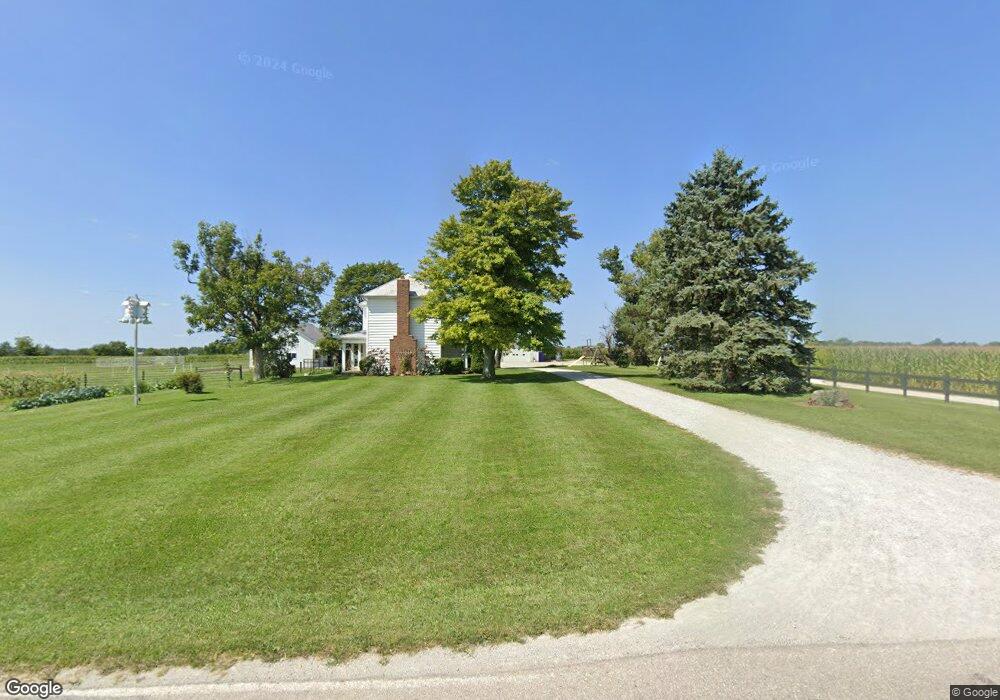
This home is located at 4919 Wolverton Rd, Eaton, OH 45320 and is currently estimated at $265,544, approximately $116 per square foot. 4919 Wolverton Rd is a home located in Preble County with nearby schools including National Trail Elementary School, National Trail Middle School, and National Trail High School.
Ownership History
Date
Name
Owned For
Owner Type
Purchase Details
Closed on
Sep 9, 2025
Sold by
Yoder Paul and Yoder Emma
Bought by
Yoder Allen P and Yoder Verna E
Current Estimated Value
Home Financials for this Owner
Home Financials are based on the most recent Mortgage that was taken out on this home.
Original Mortgage
$14,000
Outstanding Balance
$14,000
Interest Rate
7.5%
Mortgage Type
New Conventional
Estimated Equity
$251,544
Purchase Details
Closed on
Apr 3, 2020
Sold by
Shaneyfelt Paul H
Bought by
Yoder Paul and Yoder Emma
Purchase Details
Closed on
Mar 15, 2007
Sold by
King Betty Anne and King James
Bought by
Hake Nathaniel W and Hake Amy Lynn
Home Financials for this Owner
Home Financials are based on the most recent Mortgage that was taken out on this home.
Original Mortgage
$150,000
Interest Rate
7.75%
Mortgage Type
Unknown
Create a Home Valuation Report for This Property
The Home Valuation Report is an in-depth analysis detailing your home's value as well as a comparison with similar homes in the area
Home Values in the Area
Average Home Value in this Area
Purchase History
| Date | Buyer | Sale Price | Title Company |
|---|---|---|---|
| Yoder Allen P | -- | None Listed On Document | |
| Yoder Paul | $130,300 | Ctc | |
| Hake Nathaniel W | $150,000 | Freedom Title Co Inc |
Source: Public Records
Mortgage History
| Date | Status | Borrower | Loan Amount |
|---|---|---|---|
| Open | Yoder Allen P | $14,000 | |
| Open | Yoder Allen P | $256,000 | |
| Previous Owner | Hake Nathaniel W | $150,000 |
Source: Public Records
Tax History Compared to Growth
Tax History
| Year | Tax Paid | Tax Assessment Tax Assessment Total Assessment is a certain percentage of the fair market value that is determined by local assessors to be the total taxable value of land and additions on the property. | Land | Improvement |
|---|---|---|---|---|
| 2024 | $2,552 | $74,490 | $18,590 | $55,900 |
| 2023 | $2,552 | $75,220 | $18,590 | $56,630 |
| 2022 | $2,511 | $67,030 | $17,120 | $49,910 |
| 2021 | $2,655 | $67,030 | $17,120 | $49,910 |
| 2020 | $2,480 | $67,030 | $17,120 | $49,910 |
| 2019 | $2,501 | $55,760 | $14,630 | $41,130 |
| 2018 | $1,901 | $54,810 | $13,680 | $41,130 |
| 2017 | $1,769 | $54,810 | $13,680 | $41,130 |
| 2016 | $1,576 | $46,770 | $12,220 | $34,550 |
| 2014 | $2,297 | $46,770 | $12,220 | $34,550 |
| 2013 | $2,297 | $45,395 | $10,850 | $34,545 |
Source: Public Records
Map
Nearby Homes
- 4741 Wolverton Rd
- 10051 State Route 320
- 10263 Cr 335
- 6670 Murray Rd
- 6007 Murray Rd
- 6100 Hodgin Rd Unit LotWP002
- 6100 Hodgin Rd
- 443 S Spring St
- 0 Hodgin Rd Unit LotWP003 23959386
- 0 Hodgin Rd
- 5.71A Greenmount Pike
- 0 Industrial Pkwy Unit 10048533
- 0 Industrial Pkwy Unit 202406115
- 5695 New Paris Gettysburg Rd
- 700 W Cherry St
- 200 Pearl St
- 307 E Cherry St
- 5835 Crawfordsville Campbellstown Rd
- 202 Nelson St
- 8458 Hawley Mills Rd
- 9255 Us Route 35
- 8923 Us Route 35 W
- 8875 Us Route 35
- 9763 State Route 320
- 78 Sauer Dr Unit 320
- 5236 Elkhorn Rd
- 5342 Elkhorn Rd
- 102 Eaton Fort Nesbit Rd
- 5230 New Westville Rd
- 5230 N Westville Rd
- 9977 State Route 320
- 9997 State Route 320
- 10038 State Route 320
- 10036 State Route 320
- 10042 State Route 320
- 10035 State Route 320
- 5316 New Westville Rd
- 5316 New Westville Rd
- 9988 Ken Ln
- 10118 State Route 320