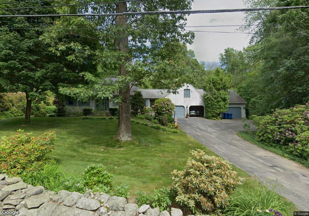
492 Forest St Dunstable, MA 01827
Estimated Value: $579,815 - $761,000
3
Beds
2
Baths
1,608
Sq Ft
$420/Sq Ft
Est. Value
About This Home
This home is located at 492 Forest St, Dunstable, MA 01827 and is currently estimated at $675,204, approximately $419 per square foot. 492 Forest St is a home located in Middlesex County with nearby schools including Groton Dunstable Regional High School, Innovation Academy Charter School, and 2nd Nature Academy.
Ownership History
Date
Name
Owned For
Owner Type
Purchase Details
Closed on
Feb 4, 1986
Bought by
Cronstrom Peter and Cronstrom Janice
Current Estimated Value
Create a Home Valuation Report for This Property
The Home Valuation Report is an in-depth analysis detailing your home's value as well as a comparison with similar homes in the area
Home Values in the Area
Average Home Value in this Area
Purchase History
| Date | Buyer | Sale Price | Title Company |
|---|---|---|---|
| Cronstrom Peter | $70,500 | -- |
Source: Public Records
Mortgage History
| Date | Status | Borrower | Loan Amount |
|---|---|---|---|
| Closed | Cronstrom Peter | $85,000 |
Source: Public Records
Tax History
| Year | Tax Paid | Tax Assessment Tax Assessment Total Assessment is a certain percentage of the fair market value that is determined by local assessors to be the total taxable value of land and additions on the property. | Land | Improvement |
|---|---|---|---|---|
| 2025 | $7,003 | $509,300 | $212,300 | $297,000 |
| 2024 | $6,684 | $478,800 | $195,900 | $282,900 |
| 2023 | $6,578 | $439,400 | $195,900 | $243,500 |
| 2022 | $6,428 | $421,500 | $195,900 | $225,600 |
| 2021 | $5,254 | $374,300 | $179,600 | $194,700 |
| 2020 | $6,187 | $367,400 | $179,600 | $187,800 |
| 2019 | $6,118 | $358,600 | $179,600 | $179,000 |
| 2018 | $5,930 | $338,100 | $179,600 | $158,500 |
| 2017 | $5,732 | $336,800 | $179,600 | $157,200 |
| 2016 | $5,314 | $321,100 | $171,400 | $149,700 |
| 2015 | $5,108 | $305,300 | $143,700 | $161,600 |
| 2014 | $4,753 | $301,400 | $143,700 | $157,700 |
Source: Public Records
Map
Nearby Homes
- 0 Lowell St
- 16 Cannongate Rd Unit 16
- 160 Westford Rd
- 153 Off Pond St
- 0 Dunstable Rd
- 22 Highland Rd
- 319 Pleasant St
- 14 Centercrest Dr Unit 14
- 62 Brook St
- 103 Pondview Place Unit 103
- 34 Shakespeare St
- 660 Old Dunstable Rd
- 24 Old Tyng Rd
- 56 Frost Rd
- 21 Merrimac Way Unit D
- 2 Strawberry Bank Rd Unit 17
- 2 Wildflower Ln
- 1 Appian Way
- 4 Heritage Village Dr
- 28 Juniper Ln Unit 65
Your Personal Tour Guide
Ask me questions while you tour the home.