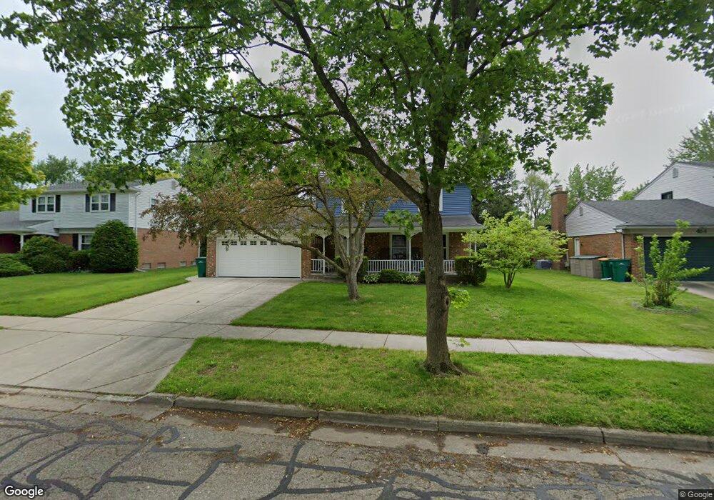
492 Marlpool Dr Saline, MI 48176
South Side NeighborhoodEstimated Value: $378,571 - $406,000
3
Beds
2
Baths
1,640
Sq Ft
$242/Sq Ft
Est. Value
About This Home
This home is located at 492 Marlpool Dr, Saline, MI 48176 and is currently estimated at $396,143, approximately $241 per square foot. 492 Marlpool Dr is a home located in Washtenaw County with nearby schools including Pleasant Ridge Elementary School, Heritage School, and Saline Middle School.
Ownership History
Date
Name
Owned For
Owner Type
Purchase Details
Closed on
Sep 27, 2002
Sold by
Gimesky James H
Bought by
English Stephen
Current Estimated Value
Home Financials for this Owner
Home Financials are based on the most recent Mortgage that was taken out on this home.
Original Mortgage
$180,800
Outstanding Balance
$77,072
Interest Rate
6.39%
Mortgage Type
Purchase Money Mortgage
Estimated Equity
$319,071
Create a Home Valuation Report for This Property
The Home Valuation Report is an in-depth analysis detailing your home's value as well as a comparison with similar homes in the area
Home Values in the Area
Average Home Value in this Area
Purchase History
| Date | Buyer | Sale Price | Title Company |
|---|---|---|---|
| English Stephen | $226,000 | -- |
Source: Public Records
Mortgage History
| Date | Status | Borrower | Loan Amount |
|---|---|---|---|
| Open | English Stephen | $180,800 |
Source: Public Records
Tax History
| Year | Tax Paid | Tax Assessment Tax Assessment Total Assessment is a certain percentage of the fair market value that is determined by local assessors to be the total taxable value of land and additions on the property. | Land | Improvement |
|---|---|---|---|---|
| 2025 | $5,329 | $177,100 | $0 | $0 |
| 2024 | $5,175 | $156,300 | $0 | $0 |
| 2023 | $4,979 | $145,700 | $0 | $0 |
| 2022 | $5,136 | $134,200 | $0 | $0 |
| 2021 | $4,931 | $129,200 | $0 | $0 |
| 2020 | $4,882 | $103,200 | $0 | $0 |
| 2019 | $4,770 | $123,300 | $123,300 | $0 |
| 2018 | $4,573 | $116,500 | $0 | $0 |
| 2017 | $269 | $115,300 | $0 | $0 |
| 2016 | $4,386 | $91,176 | $0 | $0 |
| 2015 | -- | $90,904 | $0 | $0 |
| 2014 | -- | $88,064 | $0 | $0 |
| 2013 | -- | $88,064 | $0 | $0 |
Source: Public Records
Map
Nearby Homes
- 500 Old Creek Dr
- 29 Black Cherry Ln
- 110 Parsons Ln
- 1450 W Bemis Rd
- 100 Parsons Ln
- 126 Parsons Ln
- 106 Parsons Ln
- 124 Parsons Ln
- 112 Parsons Ln
- 112 Burwyck Park Dr
- 109 Burwyck Park Dr Unit 3
- 2204 Mill Ln
- 548 Park Place
- 350 Huntington Dr Unit 30
- 404 Mills Rd
- 514 Mills Rd
- 676 W Michigan Ave
- 7608 E Michigan Ave
- 7663 Ann Arbor-Saline Rd
- 165 Harper Dr
- 500 Marlpool Dr
- 484 Marlpool Dr
- 519 Eastlook Dr
- 478 Marlpool Dr
- 508 Marlpool Dr
- 505 Eastlook Dr Unit Bldg-Unit
- 505 Eastlook Dr
- 529 Eastlook Dr
- 491 Eastlook Dr
- 489 Marlpool Dr
- 516 Marlpool Dr
- 483 Marlpool Dr
- 477 Eastlook Dr
- 466 Marlpool Dr
- 539 Eastlook Dr
- 477 Marlpool Dr
- 519 Marlpool Dr
- 444 Marlpool Dr
- 527 Marlpool Dr
- 471 Marlpool Dr
Your Personal Tour Guide
Ask me questions while you tour the home.