Estimated Value: $145,106 - $180,000
--
Bed
--
Bath
1,208
Sq Ft
$136/Sq Ft
Est. Value
About This Home
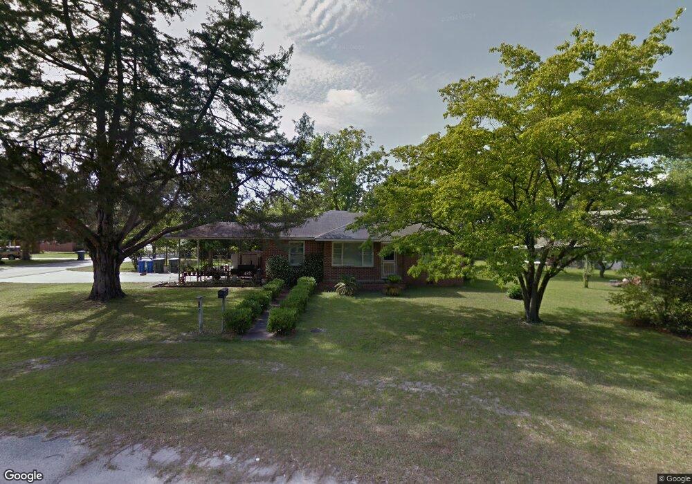
This home is located at 492 Rogers St, Jesup, GA 31545 and is currently estimated at $164,777, approximately $136 per square foot. 492 Rogers St is a home located in Wayne County with nearby schools including Martha Rawls Smith Elementary School, Arthur Williams Middle School, and Wayne County High School.
Ownership History
Date
Name
Owned For
Owner Type
Purchase Details
Closed on
Feb 1, 1999
Sold by
Rothfeldt Willie W
Bought by
Rothfeldt Morris W
Current Estimated Value
Purchase Details
Closed on
Mar 1, 1991
Bought by
Rothfeldt Willie W
Purchase Details
Closed on
Nov 1, 1984
Purchase Details
Closed on
May 1, 1984
Purchase Details
Closed on
Mar 1, 1981
Purchase Details
Closed on
Apr 1, 1977
Purchase Details
Closed on
Aug 1, 1972
Create a Home Valuation Report for This Property
The Home Valuation Report is an in-depth analysis detailing your home's value as well as a comparison with similar homes in the area
Home Values in the Area
Average Home Value in this Area
Purchase History
| Date | Buyer | Sale Price | Title Company |
|---|---|---|---|
| Rothfeldt Morris W | -- | -- | |
| Rothfeldt Willie W | -- | -- | |
| -- | $18,500 | -- | |
| -- | $32,800 | -- | |
| -- | -- | -- | |
| -- | -- | -- | |
| -- | -- | -- |
Source: Public Records
Tax History Compared to Growth
Tax History
| Year | Tax Paid | Tax Assessment Tax Assessment Total Assessment is a certain percentage of the fair market value that is determined by local assessors to be the total taxable value of land and additions on the property. | Land | Improvement |
|---|---|---|---|---|
| 2024 | $940 | $61,379 | $4,181 | $57,198 |
| 2023 | $420 | $54,277 | $4,122 | $50,155 |
| 2022 | $588 | $44,418 | $4,122 | $40,296 |
| 2021 | $535 | $37,928 | $4,122 | $33,806 |
| 2020 | $557 | $37,928 | $4,122 | $33,806 |
| 2019 | $590 | $37,928 | $4,122 | $33,806 |
| 2018 | $313 | $34,280 | $4,122 | $30,158 |
| 2017 | $378 | $34,280 | $4,122 | $30,158 |
| 2016 | $876 | $34,280 | $4,122 | $30,158 |
| 2014 | $879 | $34,280 | $4,122 | $30,158 |
| 2013 | -- | $34,279 | $4,121 | $30,158 |
Source: Public Records
Map
Nearby Homes
- 486 Rogers St
- 520 Brannen St
- 183 Hollywood Ave
- 462 Rogers St
- 179 Hollywood Ave
- 505 Brannen St
- 189 Hollywood Ave
- 517 Brannen St
- 474 Brannen St
- 527 Brannen St
- 493 Brannen St
- 173 Hollywood Ave
- 456 Rogers St
- 442 Brannen St
- 190 Hollywood Ave
- 197 Hollywood Ave
- 180 Hollywood Ave
- 442 Rogers St
- 467 Brannen St
- 198 Hollywood Ave