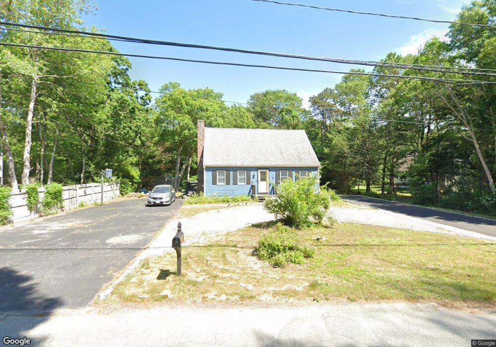
492 Skunknet Rd Centerville, MA 02632
Centerville NeighborhoodEstimated Value: $593,481 - $632,000
4
Beds
2
Baths
1,501
Sq Ft
$410/Sq Ft
Est. Value
About This Home
This home is located at 492 Skunknet Rd, Centerville, MA 02632 and is currently estimated at $614,870, approximately $409 per square foot. 492 Skunknet Rd is a home located in Barnstable County with nearby schools including Barnstable United Elementary School, Centerville Elementary School, and Barnstable Intermediate School.
Ownership History
Date
Name
Owned For
Owner Type
Purchase Details
Closed on
Oct 5, 2015
Sold by
Pagano Kathy
Bought by
Pagano Ryan
Current Estimated Value
Purchase Details
Closed on
Jan 9, 2009
Sold by
Martin Daniel J
Bought by
Pagano Kathy
Purchase Details
Closed on
Jan 30, 1995
Sold by
Goulart David A
Bought by
Martin Daniel J
Purchase Details
Closed on
Jun 26, 1990
Sold by
Mullen Thomas J
Bought by
Goulart David A
Create a Home Valuation Report for This Property
The Home Valuation Report is an in-depth analysis detailing your home's value as well as a comparison with similar homes in the area
Home Values in the Area
Average Home Value in this Area
Purchase History
| Date | Buyer | Sale Price | Title Company |
|---|---|---|---|
| Pagano Ryan | -- | -- | |
| Pagano Kathy | -- | -- | |
| Martin Daniel J | $105,000 | -- | |
| Goulart David A | $128,900 | -- |
Source: Public Records
Mortgage History
| Date | Status | Borrower | Loan Amount |
|---|---|---|---|
| Previous Owner | Goulart David A | $75,000 | |
| Previous Owner | Goulart David A | $92,400 | |
| Previous Owner | Goulart David A | $27,600 |
Source: Public Records
Tax History
| Year | Tax Paid | Tax Assessment Tax Assessment Total Assessment is a certain percentage of the fair market value that is determined by local assessors to be the total taxable value of land and additions on the property. | Land | Improvement |
|---|---|---|---|---|
| 2025 | $3,926 | $485,300 | $152,200 | $333,100 |
| 2024 | $3,648 | $467,100 | $152,200 | $314,900 |
| 2023 | $3,505 | $420,300 | $138,400 | $281,900 |
| 2022 | $3,259 | $338,100 | $102,500 | $235,600 |
| 2021 | $3,174 | $302,600 | $102,500 | $200,100 |
| 2020 | $3,268 | $298,200 | $102,500 | $195,700 |
| 2019 | $3,135 | $277,900 | $102,500 | $175,400 |
| 2018 | $2,897 | $258,200 | $107,900 | $150,300 |
| 2017 | $2,702 | $251,100 | $107,900 | $143,200 |
| 2016 | $2,746 | $251,900 | $108,700 | $143,200 |
| 2015 | $2,670 | $246,100 | $105,100 | $141,000 |
Source: Public Records
Map
Nearby Homes
- 51 Larch Ln
- 200 Lumbert Mill Rd
- 315 Prince Hinckley Rd
- 296 Buckskin Path
- 53 Meadow Farm Rd
- 52 Meadow Farm Rd
- 103 Pine Tree Dr
- 7 Ebenezer
- 82 Yacht Club Rd
- 19 Marrick Ct
- 900 Old Stage Rd
- 87 Foxglove Rd
- 1028 Old Falmouth Rd
- 351 Swift Ave
- 40 Sachem Dr
- 66 Tern Ln
- 62 Three Ponds Dr
- 156 S Main St
- 12 S Cedar Rd
- 369 Bumps River Rd
- 480 Skunknet Rd
- 502 Skunknet Rd
- 499 Skunknet Rd
- 499 Skunknet Rd
- 472 Skunknet Rd
- 249 Ames Way
- 498 Skunknet Rd
- 516 Skunknet Rd
- 8 Bridgets Path
- 261 Ames Way
- 201 Taramac Rd
- 25 Bridget's Path
- 254 Ames Way
- 220 Ames Way
- 271 Ames Way
- 532 Skunknet Rd
- 7 Bridgets Path
- 191 Taramac Rd
- 264 Ames Way
- 24 Bridgets Path
Your Personal Tour Guide
Ask me questions while you tour the home.