Estimated Value: $301,321 - $671,000
--
Bed
--
Bath
1,487
Sq Ft
$387/Sq Ft
Est. Value
About This Home
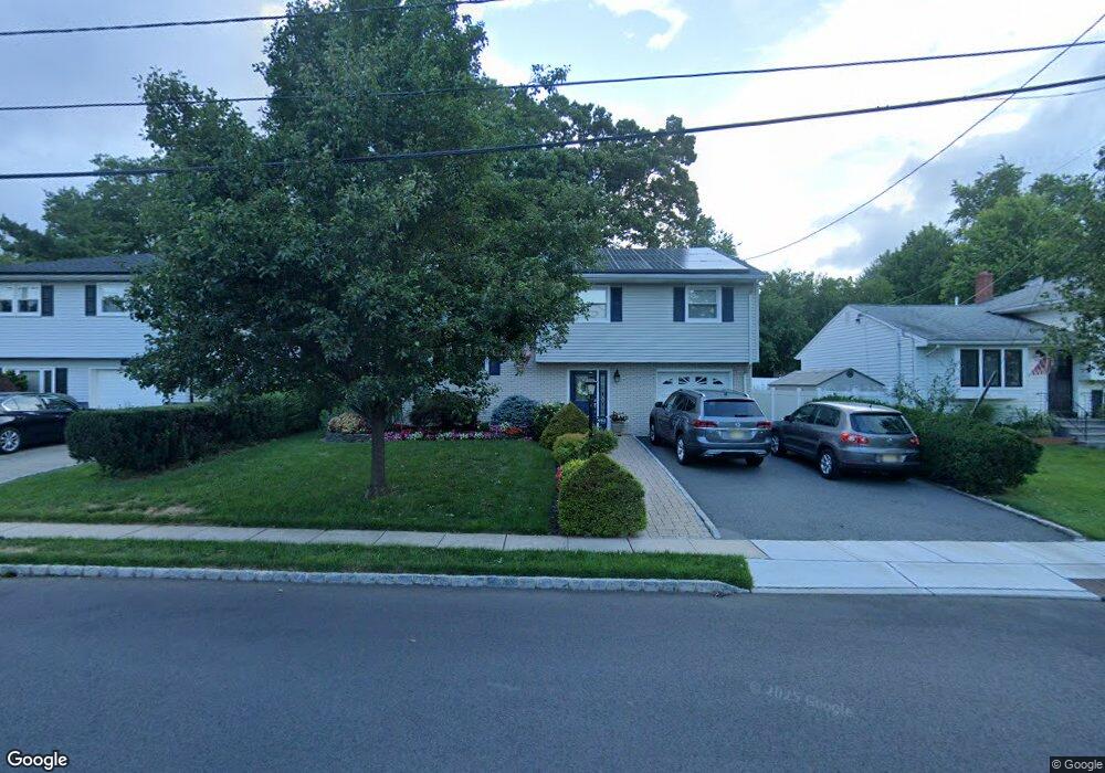
This home is located at 492 Winchester Ave, Union, NJ 07083 and is currently estimated at $575,830, approximately $387 per square foot. 492 Winchester Ave is a home located in Union County with nearby schools including Washington Elementary School and Union High School.
Ownership History
Date
Name
Owned For
Owner Type
Purchase Details
Closed on
May 28, 1999
Sold by
Genova Peter J
Bought by
Pereira Antonio M and Pereira Maria E
Current Estimated Value
Home Financials for this Owner
Home Financials are based on the most recent Mortgage that was taken out on this home.
Original Mortgage
$110,000
Interest Rate
6.85%
Mortgage Type
Stand Alone First
Purchase Details
Closed on
Sep 18, 1995
Sold by
Genova Peter J and Genova Agnes M
Bought by
Genova Peter J
Create a Home Valuation Report for This Property
The Home Valuation Report is an in-depth analysis detailing your home's value as well as a comparison with similar homes in the area
Home Values in the Area
Average Home Value in this Area
Purchase History
| Date | Buyer | Sale Price | Title Company |
|---|---|---|---|
| Pereira Antonio M | $190,000 | Commonwealth Land Title Ins | |
| Genova Peter J | -- | -- |
Source: Public Records
Mortgage History
| Date | Status | Borrower | Loan Amount |
|---|---|---|---|
| Closed | Pereira Antonio M | $110,000 |
Source: Public Records
Tax History Compared to Growth
Tax History
| Year | Tax Paid | Tax Assessment Tax Assessment Total Assessment is a certain percentage of the fair market value that is determined by local assessors to be the total taxable value of land and additions on the property. | Land | Improvement |
|---|---|---|---|---|
| 2025 | $11,980 | $53,600 | $21,100 | $32,500 |
| 2024 | $11,615 | $53,600 | $21,100 | $32,500 |
| 2023 | $11,615 | $53,600 | $21,100 | $32,500 |
| 2022 | $11,211 | $53,600 | $21,100 | $32,500 |
| 2021 | $10,939 | $53,600 | $21,100 | $32,500 |
| 2020 | $10,721 | $53,600 | $21,100 | $32,500 |
| 2019 | $10,577 | $53,600 | $21,100 | $32,500 |
| 2018 | $10,397 | $53,600 | $21,100 | $32,500 |
| 2017 | $10,243 | $53,600 | $21,100 | $32,500 |
| 2016 | $9,993 | $53,600 | $21,100 | $32,500 |
| 2015 | $9,828 | $53,600 | $21,100 | $32,500 |
| 2014 | $9,607 | $53,600 | $21,100 | $32,500 |
Source: Public Records
Map
Nearby Homes
- 403 Foxwood Rd
- 394 Martin Rd
- 536 Lehigh Ave
- 819 Greenwich Ln
- 578 Winchester Ave
- 321 Salem Rd
- 341 Trotting Rd
- 277 Newark Ave
- 686 Gates Terrace
- 275 Clermont Terrace
- 233 Monticello St
- 619 Spruce St
- 201 E Lincoln Ave
- 494 Whitewood Rd
- 214 Washington Ave
- 1134-1138 Kipling Rd
- 328 Minute Arms Rd
- 255 Tucker Ave Unit 233
- 255 Tucker Ave Unit 204
- 173 E Webster Ave
- 488 Winchester Ave
- 500 Winchester Ave
- 484 Winchester Ave
- 504 Winchester Ave
- 445 Huntington Rd
- 441 Huntington Rd
- 485 Winchester Ave
- 449 Huntington Rd
- 897 Greenwich Ln
- 437 Huntington Rd
- 453 Huntington Rd
- 480 Winchester Ave
- 479 Winchester Ave
- 508 Winchester Ave
- 433 Huntington Rd
- 891 Greenwich Ln
- 457 Huntington Rd
- 891 Randolph Place
- 505 Winchester Ave
- 890 Greenwich Ln