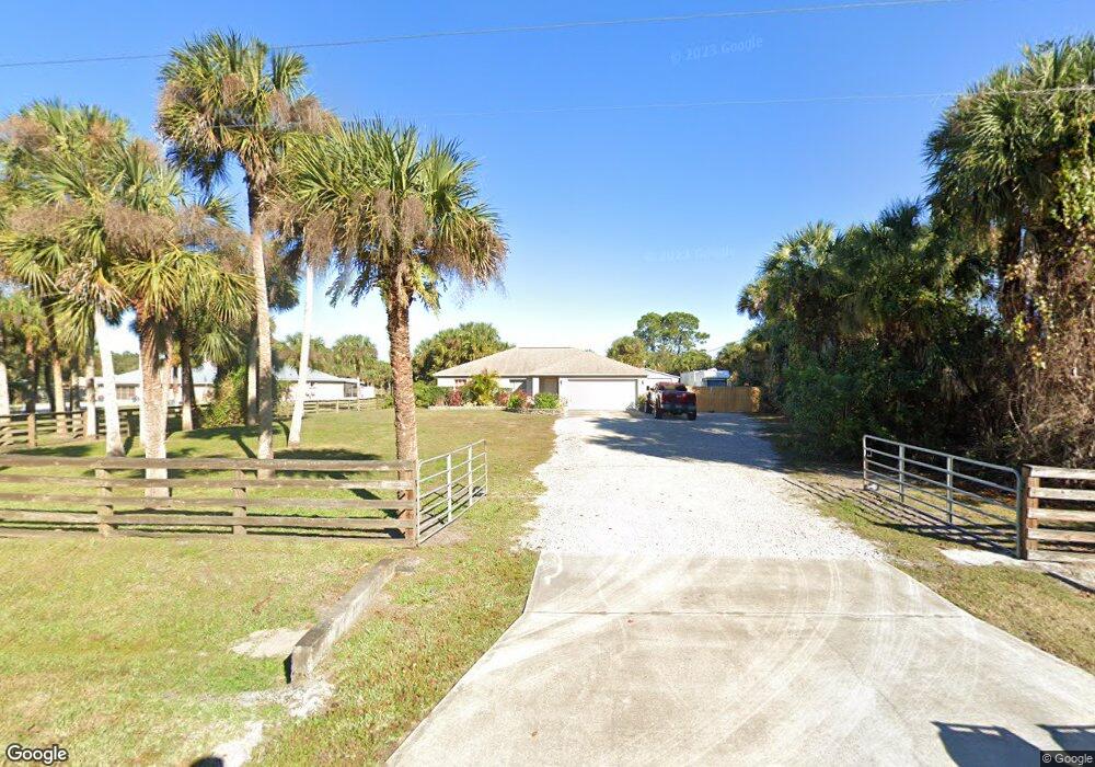
4920 Date Palm St Cocoa, FL 32927
Canaveral Groves NeighborhoodEstimated Value: $349,000 - $512,000
3
Beds
2
Baths
1,332
Sq Ft
$312/Sq Ft
Est. Value
About This Home
This home is located at 4920 Date Palm St, Cocoa, FL 32927 and is currently estimated at $415,859, approximately $312 per square foot. 4920 Date Palm St is a home located in Brevard County with nearby schools including Fairglen Elementary School and Cocoa High School.
Ownership History
Date
Name
Owned For
Owner Type
Purchase Details
Closed on
Mar 7, 2003
Sold by
Holiday Bldr Inc
Bought by
Allison Delia R and Allison Jared K
Current Estimated Value
Home Financials for this Owner
Home Financials are based on the most recent Mortgage that was taken out on this home.
Original Mortgage
$114,574
Outstanding Balance
$49,255
Interest Rate
5.88%
Mortgage Type
Purchase Money Mortgage
Estimated Equity
$366,604
Purchase Details
Closed on
Sep 5, 2002
Sold by
Rule Richard W
Bought by
Holiday Bldr Inc
Purchase Details
Closed on
Jan 27, 1997
Sold by
Util Contracts and Util Contracts C
Bought by
Rule Richard W
Create a Home Valuation Report for This Property
The Home Valuation Report is an in-depth analysis detailing your home's value as well as a comparison with similar homes in the area
Home Values in the Area
Average Home Value in this Area
Purchase History
| Date | Buyer | Sale Price | Title Company |
|---|---|---|---|
| Allison Delia R | $116,400 | -- | |
| Holiday Bldr Inc | $27,000 | -- | |
| Rule Richard W | $5,000 | -- |
Source: Public Records
Mortgage History
| Date | Status | Borrower | Loan Amount |
|---|---|---|---|
| Open | Allison Delia R | $114,574 |
Source: Public Records
Tax History Compared to Growth
Tax History
| Year | Tax Paid | Tax Assessment Tax Assessment Total Assessment is a certain percentage of the fair market value that is determined by local assessors to be the total taxable value of land and additions on the property. | Land | Improvement |
|---|---|---|---|---|
| 2025 | $1,929 | $150,290 | -- | -- |
| 2024 | $1,891 | $146,060 | -- | -- |
| 2023 | $1,891 | $141,810 | $0 | $0 |
| 2022 | $1,765 | $137,680 | $0 | $0 |
| 2021 | $1,788 | $133,670 | $0 | $0 |
| 2020 | $1,744 | $131,830 | $0 | $0 |
| 2019 | $1,685 | $128,870 | $0 | $0 |
| 2018 | $1,685 | $126,470 | $0 | $0 |
| 2017 | $1,694 | $123,870 | $0 | $0 |
| 2016 | $1,708 | $121,330 | $44,000 | $77,330 |
| 2015 | $1,741 | $120,490 | $44,000 | $76,490 |
| 2014 | $1,747 | $119,540 | $44,000 | $75,540 |
Source: Public Records
Map
Nearby Homes
- 5495 Pine St
- 000 Port Saint John Pkwy
- 0 Cangro St
- 6180 Balboa St
- 5940 Fisherman Ln
- 5955 Keystone Ave
- 00000 No Access West of Date Palm St
- 5490 Cangro St
- 0000 No Access West of Date Palm St
- 4725 Papaya St
- 0 Port St John Pkwy Unit 1043150
- 0 Unknown St Unit 1060164
- 0 Unknown St Unit 1058024
- 0 Unknown St Unit 1038247
- 0 Golfview Ave
- 6070 Baltimore Ave
- 6118 Dees Rd
- 6003 Gilson
- 6010 Fay Blvd
- 4118 Canaveral Groves Blvd
- 4940 Date Palm St
- 4945 Date Palm St
- 4880 Date Palm St
- 4960 Date Palm St
- 4855 Date Palm St
- 4840 Date Palm St
- 5595 Pine St
- 5020 Date Palm St
- 5545 Pine St
- 5560 Fan Palm Ave
- 4788 Date Palm St
- 5525 Pine St
- 5040 Date Palm St
- 5540 Fan Palm Ave
- 5520 Fan Palm Ave
- 0 Fan Palm Ave Unit 525637
- 0 Fan Palm Ave Unit 525634
- 0 Fan Palm Ave Unit 525627
- 0 Fan Palm Ave Unit 1039412
- 0 Fan Palm Ave Unit 763260
