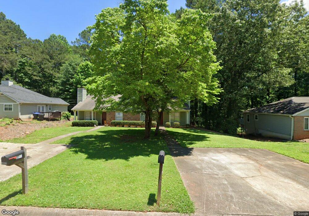
4920 Farmstead Ct NE Woodstock, GA 30188
Sandy Plains NeighborhoodEstimated Value: $195,000 - $270,000
2
Beds
2
Baths
1,054
Sq Ft
$224/Sq Ft
Est. Value
About This Home
This home is located at 4920 Farmstead Ct NE, Woodstock, GA 30188 and is currently estimated at $236,399, approximately $224 per square foot. 4920 Farmstead Ct NE is a home located in Cobb County with nearby schools including Nicholson Elementary School, McCleskey Middle School, and Kell High School.
Ownership History
Date
Name
Owned For
Owner Type
Purchase Details
Closed on
Jul 7, 2022
Sold by
Barnes Kimberly T
Bought by
K & D Rentals Two Llc
Current Estimated Value
Purchase Details
Closed on
Sep 17, 2019
Sold by
Barnes Kimberly Tucker
Bought by
Barnes Kimberly T and Barnes Daniel W
Purchase Details
Closed on
Mar 14, 2014
Sold by
Richards James C
Bought by
Barnes Kimberly Tucker
Create a Home Valuation Report for This Property
The Home Valuation Report is an in-depth analysis detailing your home's value as well as a comparison with similar homes in the area
Home Values in the Area
Average Home Value in this Area
Purchase History
| Date | Buyer | Sale Price | Title Company |
|---|---|---|---|
| K & D Rentals Two Llc | -- | Dyer & Rusbridge Pc | |
| Barnes Kimberly T | -- | -- | |
| Barnes Kimberly Tucker | $90,000 | -- |
Source: Public Records
Tax History Compared to Growth
Tax History
| Year | Tax Paid | Tax Assessment Tax Assessment Total Assessment is a certain percentage of the fair market value that is determined by local assessors to be the total taxable value of land and additions on the property. | Land | Improvement |
|---|---|---|---|---|
| 2024 | $2,386 | $79,132 | $24,000 | $55,132 |
| 2023 | $2,082 | $69,048 | $18,000 | $51,048 |
| 2022 | $1,932 | $63,648 | $16,000 | $47,648 |
| 2021 | $1,360 | $44,808 | $12,000 | $32,808 |
| 2020 | $1,244 | $40,992 | $8,000 | $32,992 |
| 2019 | $1,244 | $40,992 | $8,000 | $32,992 |
| 2018 | $1,000 | $32,936 | $8,000 | $24,936 |
| 2017 | $894 | $31,088 | $8,000 | $23,088 |
| 2016 | $659 | $22,916 | $4,800 | $18,116 |
| 2015 | $530 | $18,000 | $4,800 | $13,200 |
| 2014 | $625 | $21,020 | $0 | $0 |
Source: Public Records
Map
Nearby Homes
- 5142 Farm Place Dr NE
- 4793 Moonstone Trace
- 639 Tigers Eye Terrace
- 4785 Moonstone Trace
- 4778 Moonstone Trace
- 4669 Blue Topaz Trail
- The Gavin E Plan at The Village at Shallowford - Signature Series
- The Marion A Plan at The Village at Shallowford - Classic Series
- The Cary A Plan at The Village at Shallowford - Classic Series
- 4778 Moonstone NE
- 707 Smokey Quartz Way
- 710 Smokey Quartz Way
- 694 Smokey Quartz Way
- 4785 Moonstone NE
- 703 Smokey Quartz Way
- 706 Smokey Quartz Way
- 702 Smokey Quartz Way
- 4922 Farmstead Ct NE
- 4918 Farmstead Ct NE
- 4916 Farmstead Ct NE
- 4924 Farmstead Ct NE Unit 4926
- 4924 Farmstead Ct NE
- 4928 Farmstead Ct NE
- 795 Farm Creek Rd NE Unit 797
- 4930 Farmstead Ct NE
- 4923 Farmstead Ct NE
- 4921 Farmstead Ct NE Unit 4921 AND 4919
- 4921 Farmstead Ct NE
- 799 Farm Creek Rd NE Unit 801
- 4919 Farmstead Ct NE
- 4919 Farmstead Ct NE Unit 4921 AND 4919
- 791 Farm Creek Rd NE
- 791 Farm Creek Rd NE Unit 791, 793
- 4925 Farmstead Ct NE
- 4915 Farmstead Ct NE
- 4927 Farmstead Ct NE
- 4917 Farmstead Ct NE