Estimated Value: $434,000 - $617,000
3
Beds
3
Baths
3,196
Sq Ft
$168/Sq Ft
Est. Value
About This Home
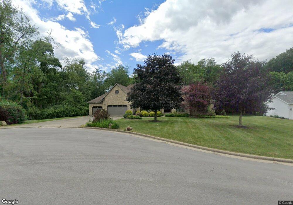
This home is located at 4920 Fireside Dr, Akron, OH 44319 and is currently estimated at $537,770, approximately $168 per square foot. 4920 Fireside Dr is a home located in Summit County with nearby schools including Greenwood Elementary School, Green Intermediate Elementary School, and Green Primary School.
Ownership History
Date
Name
Owned For
Owner Type
Purchase Details
Closed on
Dec 11, 2018
Sold by
Sensius Josef and Sensius Theresa
Bought by
Sensius Sensius David J David J and Josef Sensius And Theresa Sensius Family
Current Estimated Value
Purchase Details
Closed on
Jul 31, 2013
Sold by
Sensius Theresa
Bought by
Sensius Josef and Sensius Theresa
Create a Home Valuation Report for This Property
The Home Valuation Report is an in-depth analysis detailing your home's value as well as a comparison with similar homes in the area
Home Values in the Area
Average Home Value in this Area
Purchase History
| Date | Buyer | Sale Price | Title Company |
|---|---|---|---|
| Sensius Sensius David J David J | -- | None Available | |
| Sensius Josef | -- | None Available | |
| Sensius Josef | -- | None Available |
Source: Public Records
Tax History Compared to Growth
Tax History
| Year | Tax Paid | Tax Assessment Tax Assessment Total Assessment is a certain percentage of the fair market value that is determined by local assessors to be the total taxable value of land and additions on the property. | Land | Improvement |
|---|---|---|---|---|
| 2025 | $7,719 | $173,839 | $30,188 | $143,651 |
| 2024 | $7,719 | $173,839 | $30,188 | $143,651 |
| 2023 | $7,719 | $173,839 | $30,188 | $143,651 |
| 2022 | $6,202 | $127,705 | $22,033 | $105,672 |
| 2021 | $5,813 | $127,705 | $22,033 | $105,672 |
| 2020 | $5,701 | $127,700 | $22,030 | $105,670 |
| 2019 | $5,490 | $116,090 | $26,120 | $89,970 |
| 2018 | $5,613 | $116,090 | $26,120 | $89,970 |
| 2017 | $5,014 | $116,090 | $26,120 | $89,970 |
| 2016 | $4,989 | $98,740 | $26,120 | $72,620 |
| 2015 | $5,014 | $98,740 | $26,120 | $72,620 |
| 2014 | $4,981 | $98,740 | $26,120 | $72,620 |
| 2013 | $4,816 | $95,240 | $26,120 | $69,120 |
Source: Public Records
Map
Nearby Homes
- 683 Chilham Cir
- 4881 S Main St
- 4529-4533 Camelot Cir
- 4 Shrakes Hotel Dr
- 4710 Pinecrest Dr
- 6 Shrakes Hotel Dr
- 3 Shrakes Hotel Dr
- 5 Shrakes Hotel Dr
- 7 Shrakes Hotel Dr
- 4441 Merlin Dr
- S/L 14,15 Shakes Hotel Dr
- lot 8 Whyem Dr
- 4674 S Main St
- 4259 Arlington Rd
- 5052 Arlington Rd
- 4298 S Main St Unit 4302
- 860 Killinger Rd
- 0 S Arlington Rd Unit 4494606
- 4394 Ridge View Dr
- 3943 Crest View Dr
- 4908 Fireside Dr
- 4931 Fireside Dr
- 4923 Fireside Dr
- 4900 Fireside Dr
- 4905 Fireside Dr
- 15 Fireside Dr
- 4892 Fireside Dr
- 4887 Fireside Dr
- 4884 Fireside Dr
- 4879 Fireside Dr
- 4910 Provens Dr
- 4869 Fireside Dr
- 4900 Provens Dr
- 507 Saturn Dr
- 4935 Provens Dr
- 510 Saturn Dr
- 513 Saturn Dr
- 4894 Provens Dr
- 4911 Provens Dr
- 0 4 Saturn